Routing

Routing services (in some countries called navigation services) help people get from one place to another. OpenStreetMap data includes information for routing by many modes including car, foot, bicycle and horse. There are many offline, embedded and web-based routing services using OpenStreetMap data.
For developers this page provides advice on software available for creating new routing applications/deployments and details key OpenStreetMap data that can be used to create better routing engines. A number of mailing lists are also available.
End users: routing software
- See also: List of OSM based Services#Routing
- simply on the OSM homepage (blog post with description)
- Routing/online routers – There are many websites that use OpenStreetMap data to provide online route planners; those with global support are featured below.
- Routing/offline routers – Furthermore several options exist for installing offline navigation software on your handheld device or laptop.
- Navigation apps are available for Android, Apple iOS and Java ME (J2ME). For other mobile platforms see Software#Mobile Devices.
| Name, link | Genre | Covered region | Language | Description | Free materials | Image |
|---|---|---|---|---|---|---|
| A Better Routeplanner | Routing, car | English | A route planner for planning trips and charging with a Electric Vehicle. | No | ||
| Agilogik GmbH | Routing, maps, tile server, geocoding, geo reverse coding | Worldwide | English, German | Worldwide tile server and services for commercial use | No | |
| BBBike [1] | Routing | English, Chinese, Danish, Spanish, French, German, Croatian, Dutch, Polish, Portuguese, Russian | Routing focused on bikes (no. of traffic lights, height profile, lit, road surface, …) | ?
|

| |
| Bike Citizens [2] | Routing | English, Spanish, French, German | Bike Citizens is a navigation app designed for and by cyclists, offers offline routing, predefined tours and various routing profiles | ?
|

| |
| BRouter [3] | Routing | English, Hungarian | BRouter: Let's get serious about bike routing. BRouter offers routing for trekking and cycling with predefined profiles and the ability to modify and upload custom profiles | ?
|
||
| Curvature | Routing | English | Curvature generates a map highlighting the most twisty roads, all across the world. | Yes | ||
| CycleStreets [4] | Routing | English | Bicycle routing and planning and photo map based on OpenStreetMap data and the OpenCycleMap for the British Isles. API available. | Yes | 
| |
| FacilMap [5] | General, routing, share, social, interaction | English | Different OSM renderings, search and draggable routes, create custom maps with live collaboration where markers, lines, routes and GPX/KML/GeoJSON/OSM files can be added. | Yes | ||
| GraphHopper [6] | Routing, car, bike, walking, public transport, wheelchair | Worldwide | multiple languages | Fast routing for bikes, pedestrians and cars with worldwide coverage. Using the open source routing engine GraphHopper. | Yes | 
|
| GraphHopper Direction Api | Road Routing, car, bike, walking | Worldwide | multiple languages | Fast routing service including a powerful Matrix and Route Optimization API based on the open source routing engine GraphHopper | No commercial |
|
| KOMOOT Routing | Routing, hiking, bike | German, English | Calculate routes for mountain bikes, touring bikes and hiking taking your fitness level and elevation into account | Yes, see GraphHopper | 
| |
| Kurviger | Routing, motorcycle | English, French, Italian, Spanish, Dutch, German | Routing and navigation specialised for motorcycles. Kurviger calculates curvy routes that are fun to ride on bike. Curves and slopes are preferred, while cities and highways are avoided. Generate loop trips with one click. Personalise the routing to your own riding style. | Yes, see GraphHopper | 
| |
| Mapzen Turn-by-Turn (Valhalla) | Routing | Worldwide | English | Worldwide routing by automobile, bus, foot, and bicycle. | Yes | 
|
| Naviki | Routing | multiple languages | Planning bicycle trips and routing and collecting GPS traces | ?
|

| |
| Nop's Reit- und Wanderkarte [7] | Routing | German, English, Italian | Dedicated routing for hiking and horseback riding with multiple targets. Dynamic route options e.g. for following marked hiking routes or weather conditions. Options to modify caculated route manually, download or print it. | No | 
| |
| OpenRouteService [8] | Routing, wheelchair routing | Czech, Danish, German, English, Spanish, French, Croatian, Hungarian, Italian, Dutch, Polish, Portuguese, Russian, Ukrainian, Chinese | Route navigation based on osm data and TMC for car, bike and pedestrian | Yes | 
| |
| RouteYou | Routing, walk, bike, horse riding, motorcycle,... | Dutch, English, French, German, Italian, Spanish, Catalan, Danish | Routing based on osm data for several recreational modes walking, hiking, cycling, horse riding, motorcycle,... | Yes, freemium | 
| |
| routing.osm.ch | Routing | Europe, Switzerland | German, English, French, Italian | Routing with Leaflet slippy map for pedestrians (two types), cyclists (two types) and cars in Switzerland only (based on OSRM) | Yes, free | |
| OpenTripPlanner | Routing | English | A multimodal router combining OSM and Public transport tables | Yes | 
| |
| Ride the City | Routing | English, French, Spanish, Icelandic | Bicycle routing based on OSM data. Coverage: Selected big cities (currently 42) in U.S., Canada, Australia, France, Spain, few cities in other countries. | No | 
| |
| TargomoAPI | Routing, car, walk, bike, public transport, network analysis, isochrone | English, German | Targomo offers routing-based analysis tools - isochrone polygons, points-of-interest, routing, reachability, fleet management, statistics reachability. | No | ||
| Open Source Routing Machine (OSRM) | Routing | Worldwide | Bulgarian, Czech, German, Danish, Greek, English, Spanish, Finnish, French, Italian, Irish, Georgian, Latvian, Norwegian Bokmål, Polish, Portuguese, Romanian, Russian, Swedish, Turkish | A new fast routing service for car covering the world |
Yes. | 
|
| Sputnik | General, render, routing | Russian | Russian website that provides search of state services, POIs and routing to them | Partial | 
| |
| StreetCritic | Routing, bike | Worldwide | English | Routing for cyclists that uses both user and algorithmic ratings to calculate routes and visualise streets | Yes | |
| uNav | General, routing | multiple languages | Map viewer and GPS navigator for Ubuntu Phone | Yes | 
| |
| VROOM [9] | Routing | English | Vehicle Routing Open-source Optimization Machine It's aim at providing good solutions to various real-life vehicle routing problems (VRP) within a small computing time. |
Yes | ||
| brouter.grade.de [10] | Waterway routing | Europe | English | Inland waterway routing (Europe) taking size of vessel into account. Based on Brouter router-software | Yes | 
|
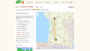
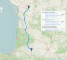
Gallery
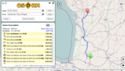
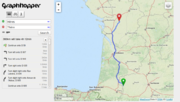
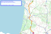
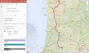
- Example: Routing from Hères to Thère, France
-
-
-
-
-
-


Mappers: improving the map data
For routing software to work well, the underlying map data must be of good quality. Essentially this means that ways that should be connected are in fact connected, one-way roads are tagged, turn restrictions are mapped, and so on. You should be familiar with the map features used, in particular see OSM tags for routing to understand the tags specific to routing.
Fixing bugs with notes

Some issues reported in Notes are specifically about one-way roads or turn restrictions, and are marked as such.
Speed data
In order to better calculate the fastest route, please consider helping by adding speed data using the maxspeed=* tag. This is especially important where the speed limit differs from the assumed maximum permitted speed for the road type per country and vehicle-type.
- Note: There are some services to help identify missing speed limits.
Often maxspeed is meaningless - see #Average speed.
Checking your fix
After you have fixed an error on the map you will need to wait until the revised version of the map propagates into the routing engine you are using. This delay will depend for each engine on:
- how often it get updates from the database
- how long it needs to update its internal database.
In the case of OSRM used on the map front page it usually gets updates twice a day and then spends 10-12 hours processing the updates. This gives a total delay of anything from 10 to 24 hours from your fix being saved to the map, to working in OSRM.
Other useful data
surface=*- especially useful for cyclistscycleway:left=*/cycleway:right=*/cycleway:both=*- marking presence of cycleway infrastructuretracktype=*andsurface=*onhighway=trackmaxweight=*- for trucks, including more complex tags required in some cases
Developers

Open source desktop and server software
Java:
- OpenRouteService - free, open source library and API with many options and an ecosystem of further tools and libs for Javascript, R, Python, QGIS etc. Has website at openrouteservice.org.
- GraphHopper is an open source routing engine for road networks written in Java. Fast and memory efficient (for Android, iOS, desktop and server)
- OpenTripPlanner site is a multi-modal trip planner supporting OSM data. OTP Deployer makes it easy to deploy your own routing instance.
- BRouter focuses on bike routing and features elevation awareness, alternatives, fully configurable routing profiles and offline routing initially written for Android, but has also a web api. BRouter can also run in QMapShack.
- OptaPlanner is a lightweight, embeddable planning engine which optimizes the Vehicle Routing Problem, the Travelling Salesman Problem and variants. It is based on GraphHopper and Google Maps APIs.
- JGraphT (jgrapht.org) - "class library that provides mathematical graph-theory objects and algorithms." Used by JOSM/Plugins/Routing
- pgrServer is a routing service that uses pgRouting topologies in PostGIS and is loaded to a JGraphT graph for fast searches even with very dense networks.
C/C++:
- Open Source Routing Machine
- Valhalla ([11])
- Routino Flexible router with user selectable routing preferences.
- Navit
- RoutingKit (BSD license, C++)
C#:
- Itinero – (.Net) libraries for routing and transportation optimization problems; formerly part of OsmSharp library
R:
- opentripplanner - R interface to OpenTripPlanner
- r5r - R implementation of Conveyal's R5 routing engine
- dodgr - Many-to-many routing and flow aggregation engine, including routing profiles and elevation effects
Ruby:
- Mormon ruby version of pyroutelib
Python:
- PyrouteLib routing engine behind Pyroute
- SimpleOsmRouter simplest possible router
Mobile device software
C/Java:
- Guru Maps online & offline routing for iOS & Android
- OsmAnd OSM Map, POI and Routing (car/bike/foot, online&offline) for Android and iOS
- Navit Linux, Windows and portable devices
- GraphHopper Open Source routing library for Desktop, Android and iOS
- BRouter focuses on bike routing and features elevation awareness, alternatives, fully configurable routing profiles and offline routing for Android
- OpenTripPlanner (Android) is an Android app for multi-modal trip planning using any OpenTripPlanner server
- MapFactor Navigator Free for Android and iOS
- MAPS.ME for Android and iOS
Libraries/development tools
- Main article: Frameworks#Navigation
Libraries focused on OSM Routing can be found at Develop/Frameworks. Here some general libs:
- openrouteservice, free, open source library and API with many options and an ecosystem of further tools and libs for Javascript, R, Python, QGIS etc.
- DGLib Directed Graph Library used by Grass's vector network tools (shortest path, traveling salesman, isodistances, Steiner trees; also Addons)
- Graphserver is a webservice providing shortest-path itineraries on TIGER/line road maps, and public transport data in the General Transit Feed Specification format
- osm4routing is a command-line tool for parsing OSM data into a routing graph.
- pgRouting - PostGIS-based routing engine. Special tool osm2pgrouting for importing OSM data to internal graph structure. Works directly on top of SQL database tables.
- Libosmscout offers simple, high-level interfaces to offline rendering and routing functionalities based on OpenStreetMap data
- Spatialite Spatialite has its own routing engine VirtualNetwork and a spatialite_osm_net tool for building a routable network directly from OSM data. Routing can use either Dijkstra or A* algorithm.
- GraphHopper routing engine with Java API.
- ffwdme.js is a JavaScript toolkit that aims to bring interactive GPS driving directions to the mobile browser.
- Valhalla is a free, open-source routing service that lets you integrate routing and navigation into a web or mobile application.
Protocols:
- The default-protocol is the API v0.6 spoken by the main servers. If can contain all data there is in OSM. Get Planet.osm dump.
Routing considerations
Highway-type
The order of values for the highway-tag ordered by assumed speed is:
| Type | Description (mainly valid in Western Europe) |
|---|---|
| motorway | Usually the maxspeed can be kept for long distances, but these roads can be sensitive to long traffic jams. Usually forbidden for slow traffic (pedestrians, cyclists, agricultural, ...) |
| trunk | Similar to motorways, but these roads can have level crossings, so the stretches where the maximum speed can be reached are shorter. Best avoided when using slow vehicles (sometimes forbidden, depending on the local legislation). |
| primary | Connecting roads between cities, towns and villages. The classification depends mostly on the importance of the areas they connect. This is often also reflected in the number of lanes and the general traffic throughput, but the speed for these classifications is mostly comparable. Usually around 90-100 km/h in the countryside, and 50 (or even 30) km/h when crossing a residential center. |
| secondary | |
| tertiary | |
| motorway_link | Used for on- and off-ramps or complete motorway junctions. Reachable speed depends a lot on curvature, usually around 60-90 km/h |
| trunk_link | In contrast to motorway junctions, these link roads are often very short pieces (e.g., allowing one to turn right without stopping at a traffic light). The speed on these road pieces is very slow, as these often need to give way to the other traffic. |
| primary_link | |
| secondary_link | |
| tertiary_link | |
| unclassified | These roads usually connect farms, isolated houses and small hamlets through the countryside to bigger residential areas. Due to lack of traffic signs, they often have a speed limit way faster than can be driven safely. Speed on a well-maintained but unfamiliar unclassified road will rarely exceed 50 km/h. |
| residential | Residential roads are found in a residential area, so usually have a speed limit of 50 km/h to 30 km/h, with a lot of traffic calming features. |
| living_street | Living streets are streets where slow traffic has absolute right-of-way. The speed limit is normally around 20 km/h. Through-going traffic is absolutely discouraged (and often impossible). |
| service | Service roads are usually found on private property or parking lots. The driver has to pay attention to manoeuvring vehicles, and must wait often. |
| track | Tracks are roads of agricultural purpose. They usually connect fields to farms. The surface sometimes makes them inaccessible for regular cars, or at least limits the speeds to a very slow pace. Tracks should always be avoided for through-going traffic. |
| pedestrian | Pedestrian roads are normally forbidden for motorised vehicles, but can be allowed on certain hours (f.e. early in the morning), or for certain purposes (like delivering goods to shops). Even when allowed, only pedestrian speed is advisable. Cycling can also be forbidden on pedestrian highways. |
This is highly country specific and rather useless without country specific values. For example in Germany primary roads allow 100km/h both legally and as a realistic speed while minor motorway_link(s) are built to allow a recommended speed of 60 km/h, only major motorway_links allow a realistic speed of 80 or 100. For more information see OSM tags for routing/Maxspeed#Additional information for selected countries
Lanes
The number of lanes of a highway is directly tagged in OSM and has a major influence on the average speed (fastest route) and fuel-consumption (most efficient route). There is no simple mapping to speed unfortunately, in many cases more lanes only indicate more congestion.
Highway condition
Other factors, in our case more difficult to measure, which determine the average speed are the width of pavement, condition of the network (roadworks, surface type and surface smoothness - especially in ex-USSR), Levels of Service (LOS), minimal radius curve, banked turns, visibility based on curves and gradients, etc.
In OpenStreetMap this model can be interesting for those routes where there are no data on speeds (for example: highway=road).
Inclines
Same as curves, inclines may decrease the speed of traffic. In winter of when lots of hgv is present the hindrance is also on the descending way. While some inclines are explicitly tagged, in some cases utilization of additional informations such as ele=* and height elevation profile from DEM data could prove useful.
Sinuosity
- See also
turning radius=*
In some studies about the accessibility [12] develop models that assume a certain speed of travel depending on the degree of sinuosity of the track and certain characteristics of this one. By means of the sinuosity index (observed line distance/expected line distance ) for every section it is possible to obtain a speed estimated according to the degree of winding of the road and type of route. This needs to take into account the visibility around corners (determined by vegetation, embankments, cuttings, cliffs,...) and road width. The model is more precise if the excessively large arcs are avoided provided that a long curve can be equal to many small curves along a way, giving similar values of sinuosity for both routes. Some countries use these values to divide sections of roads and put speed limits (but this is not usual).
On the other hand, geographical approaches like that of the space syntax presuppose that, in urban environments, pedestrians and drivers are influenced at the moment of choosing theirs paths for the visibility of the route. In this respect a pedestrian who moves, for example, from the point A to the point B will select principally wide and rectilinear streets, squares or avenues with a wide visual field, avoiding crossed by winding and narrow streets, even when the latter route is somewhat shorter.
Crossings, junctions and lane changes
Certain cost should be assumed for:
- crossing higher-class roads
- changing to and from lower-class roads
- u-turns
- lane changes
- traffic-signals, see also
traffic_signals:direction=*
Average speed
OpenStreetMap data will need average/realistic speed values for routing.
maxspeed:practical=*is a rejected but nevertheless used proposal to tag estimated average speed values (with the possibility to specify day/night/rush hour values) in areas where official speed limits are largely meaningless and road/track type information insufficient to derive meaningful travel speed estimates.- Speedcollector is a currently defunct service to collect real-world measurements, while it might be possible to derive average speed per way from stored tracks.
- Global Statistical Speed Matrix is a proposed concept (no current signs of life?) to extract speed information from NMEA/GPX tracks and store them efficiently in a database to make collected data useful for routing purposes.
- For an upper limit, see
maxspeed=*
List of other tags giving routing hints
Bicycle
bicycle=*for bicycle specificaccess=*route=bicyclehighway=cyclewayfor separated cycle-wayscycleway=*for on-street cycle facilitiessurface=*mtb:scale=*- See also Hiking
Hiking
Routing obstacles and other conditions requiring special consideration
crossing=*- pedestrian or other crossing, slowdown
Discontinued routing engines
- Main article: Discontinued Routing Engines
Mailing lists
The following mailing lists are relevant to routing
- osm-routing 'Discussion about Routing with vector Data. Especially concerning OSM Data' Note that it is nearly inactive, it is likely that osm-talk or osm-dev will be preferable for most topics.
- osm-accessibility For all kinds of disabilities this concerns the proposal and use of tags that are of special interest for disabled persons. Special maps shall be created with this data.
See also
- OSM tags for routing, what data is stored in OpenStreetMap that you can use when routing?
- CartoType, cartotype.com
- Rollstuhlfahrer-Routing - German project for wheelchair routing (now wheelchair routing has been improved and integrated into openrouteservice.org)
- Routing problems, are there any problems that can't be solved using least-cost routing? Do we have any suggestions for solving those problems?
- Routing profiles, which categories of people want to generate routes, and what are their specific needs? What weights should we use when a 'horse who's scared of traffic lights but likes walking in the forest' asks for a route? How do we choose the best route for a cyclist with slick tires and no lights at night?
- Sample driving instructions
- TIGER fixup, fixing routing in the U.S. Starting with basic interstate routes: TIGER fixup/250 cities
- Train routing, how can we do routing on public transport networks, and other scheduled services?
- Guidelines for pedestrian navigation, how to map roads, footways etc. so that accurate and realistic pedestrian routes can be produced
- LoroDux, pedestrian routing for mobile devices for the blind
- Video: Google Tech Talk - Peter Sanders - Fast Route Planning
- Leaflet Routing Machine
Videos
- SotM 2020: OSM Routing Evaluation, Yantisa Akhadi
- SotM 2019: Pedestrian routing in complex areas : the case of Paris railway stations, Adrien Defarge Antoine Riche
- SotM 2019: Routing for Humans, Sebastian Ritterbusch
- SotM 2018: Routing on rails with OpenStreetMap, Michael Reichert