List of OSM-based services
Alphabetically sorted complete list of ready and free to use projects using especially data from OpenStreetMap.
Screenshot
- For any page using just the OSM Map see OSM Internet Links. For smaller user favourites lists see:
- For a full list of all OSM Apps described in this wiki see:
- Osm Software Catalog — Desktop Windows application. Supports sorting, filtering and comparison. Based on Software template entries.
- OSM Apps Catalog — A WebApp. Supports filtering and comparison. Based on Software, Service item and Layer template entries. Enriched with data from the Taginfo Project list.
The term free materials is what you would colloquially refer to as "open". A project which makes its building blocks - be that software, algorithms, works of art - available to a degree that allows everyone to duplicate it should be labelled "yes", and a project where relevant bits - data processing scripts, rendering stylesheets, or CSS files - are hidden in a black box should be labelled "no".
See also Free and Open License. For commercial see Commercial OSM Software and Services.
General
| Name, link | Genre | Covered region | Languages | Description | Free materials | Image |
|---|---|---|---|---|---|---|
| OsmAPP | general | WorldWide | English, አማርኛ, Deutsch, čeština, italiano, français and more | Universal app for OpenStreetMap | GitHub | 
|
| AddisMap | POI | Addis Ababa | English, Amharic, German | Addis Ababa (Ethiopia) city map with POI locator | ?
|

|
| Ateliers de co_réparation de France | Sustainable, repair | France | French | Co-repair workshops in France: map and calendar based on OpenStreetMap. | ?
|
|
| Atlas.co | Data visualization, spatial analysis, interactive web maps | English | Browser-based GIS platform with OSM basemaps and OSM integration. | Yes | ||
| atownsend | Maps, tile server | British Isles | English | UK and Ireland - shows features useful to walkers, including England and Wales public rights of way. | Yes | 
|
| Baidu Maps | Routing | Chinese | World map outcome of OSM for the part outside China. See citation license footer. | ?
|

| |
| Bexhill-OSM | POI, routing | Bexhill, England | English | A developed fork from 'POIs on a Map' below. Show POIs in the current area of the map using OverpassAPI, plot walking directions, address search, reverse lookups. | Yes. | 
|
| BuioMetria Partecipativa | Crowd, weather | Italy | Italian | Displays darkness of the sky measured with Sky Quality Meter. | ?
|

|
| Carto | Data visualization, cartography, tool | English | Online datavisualization tool built on a FLOSS stack, also providing free OSM tiles. | No | 
| |
| Cartogiraffe | Transport, biking, hiking and standard maps. | English | Mobile friendly online map with standard, transport, bicycle and hiking maps. | Map embedding | 
| |
| CartoVrac | Sustainable, zero waste, food | France | French | Map of shops without packaging | ?
|
|
| Cartes.app | Web | France | French | French open source alternative to Google/Apple Maps | GitHub | |
| delta.map delta.map-github | Maps, tile server | English | Webapp for KaiOS using OSM Tile Server and other OSM-Based Tiles with other utilities such as Weather, Geolocation, GeoJSON, and more! | Yes. | ||
| Disaster Ninja | Disaster analytics, map analytics, map quality visualisation | Worldwide | English | Service for emergency cartographers, helps to prepare mapping tasks in minutes instead of hours. | Yes | |
| Distance Calculator | Tool | English | Create paths, measure length and export to .GPX or .KMZ | ?
|

| |
| Esri OpenStreetMap Vector Basemap | OpenStreetMap Vector Basemap - high map details - zoom 19, 20, ... | ?
|
||||
| EqualStreetNames | Roads | English, French, German, Dutch | A map visualizing the streetnames by gender. | Yes | 
| |
| Fahrkartenautomaten in OSM | Ticket machines | WorldWide | German | This map shows ticket machines in Openstreetmap. Operators, payment options, refs, notes and fixmes are shown. | Yes | |
| FacilMap [1] | General, routing, share, social, interaction | English | Different OSM renderings, search and draggable routes, create custom maps with live collaboration where markers, lines, routes and GPX/KML/GeoJSON/OSM files can be added. | Yes | 
| |
| Freemap [2] | England | English | Project to create free and annotatable maps of the UK countryside. Users can add countryside-specific data on top of the maps. Mobile Java Client is worked on (see wiki-page). | Yes. | 
| |
| Freemap Slovakia | POI, routing | Central and south Europe | English, Slovak, Czech, Hungarian, Italian | Feature-rich map including distance and area measurement, fullscreen mode, bicycle and hiking routes, POIs, elevation details, downloadable maps for multiple devices, diverse export options, routing, and search functionalities. While some features focus on the Slovak region, there are more to explore. | Yes | 
|
| FreieTonne | Seamap navigation | German | Slippy Map with POI Overlay representing Seamap Information like Ports, Buoys and other seamarks even for whitewater. Apache-based offline Navigation and mapping-tools. Support for making your own maps for Ozi, BitMap (iPhone), Seaclear... | Yes | 
| |
| Freizeitkarte | POI | Switzerland | Deutsch | Map with different overlays to help people planning their outdoor activities and find interesting spots in Switzerland. | No | 
|
| Ghost bikes (witte fietsen) | Memorial | English | This mapcontrib shows ghost-bikes | Yes | 
| |
| GPX-Tool | Maps, search, POI, import, export, geocoding, reverse geocoding. | English, German | Tool for managing POIs by clicking on map (slippy map with several TMS providers) with Geocoding (forward & reverse) and Google Maps & OpenRouteService integration (import & export). | ?
|
||
| Geofabrik Map | Tool | English | A full-screen Slippy Map with several different map views. | Yes (JS) | 
| |
| Gmaps Pedometer | Planning, routing, share, export, GPS | English | A Slippy Map that allows drawing of routes and calculates the distance travelled and shows elevations nicely. | ?
|

| |
| Hitchwiki Maps | Tracking, tracing, geofence alarms, location based reminders, GPS pictures, POI, track recording. | English, Chinese, Dutch, Finnish, French, German, Hungarian, Italian, Lithuanian, Polish, Portuguese, Romanian, Russian, Spanish | Worldmap for hitchhikers, showing hitching places with rating and description. Editable by everybody. | CC-BY-SA | ||
| KartaView [3] | Photo. | English | Shows geotagged street photos (formerly OpenStreetCam) | Yes. | 
| |
| Karta GPS [4] | For mobile. | English, German, Russian, Spanish | Karta is a free of charge navigation app combining open map data with relevant content from Yelp and Foursquare, as well as additional non-crowdsourced information like traffic and speed camera data, without needing to be connected to the internet. | Yes | 
| |
| KeplerJs [5] | Social, OSM tool | English, Italian, German, Spanish, French ,Swedish | The open source Geosocial network platform. Documentation. | Yes. | ||
| Las calles de las mujeres | Roads | Spanish | Map of streets named after women in Latin American and Spanish cities, to make visible the gap that exists in the representation of female figures in cities. | Yes | ||
| Lombardo Geosystems | Render, POI | Italy | Italian | Maps of Italy with city streets search and POI locator. | ?
|
|
| Longdo Map | Asia, Thailand | Thai | ?
|
|||
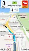
| Magic Earth [6] | Maps & navigation app | Worldwide | multiple languages | A completely free of charge navigation app with worldwide maps | ?
|
|
| Map of Belarus detailed - Карта Беларуси подробная | Belarus | English Russian | Map of the Republic of Belarus | ?
|
||
| Mapa OpenStreetMap Polska | Topographic | Poland | polski (Polish) | Style: OSMapa-Topo with hiking trails | Yes | |
| Maps.me | APP | English, German, Spanish, Russian | Very popular app, now property of the Russian Mail.Ru Group. Ads can be found, but plenty of POI gathered from different sources. Even hotel bookings available through the app. | No. | ||
| netzwolf.info OSM | German | Service of various maps. | Yes | 
| ||
| Open Camping Map [7] | Camping | Worldwide | German, English, French, Spanish, Russian | Global map of campgrounds | Yes [8][9]] | |
| OpenMapTiles OpenMapTiles | Vector, Tile server | English | Vector tile maps | Yes | ||
| OpenPoiMap [10] | POI | Worldwide | Show different types of POIs by user's choice. | Yes | 
| |
| OpenTopoMap [11] | Topography | Worldwide | English, German | Topographical maps | CC-BY-SA | 
|
| OpenTrafficCamMap | CCTV, interaction, realtime | United States | English | An open database of live traffic cameras and their streaming links. | Yes | |
| OpenTouchMap | For mobile | Slippy map with basic IPhone gesture-capabilities using iol.js for mobile devices. | Yes TouchMapLight#how can you use it. | 
| ||
| Organic Maps | For mobile | Worldwide | English, Russian, Dutch | Open source MAPS.ME fork and mobile app for iOS and Android that provides worldwide based on OpenStreetMap data. | Yes | 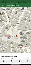
|
| OSMbot for Telegram | Social, search, share | English | OpenStreetMap bot finds any location in the world from the Nominatim OSM database. | GPLv3. | 
| |
| OSM Unterkunftkarte | tourism, hotel, camping | German | Hotels, campsites, flats and pensions on one accommodation map | ?
|
||
| Postcodes | Administrative | England | English | Showing postcodes of the UK of different projects (see Related Projects) | Yes. | 
|
| Show Your Places [12] | Tool | English, German, French | Images gallery with pictures displayed on map. | Yes. | 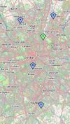
| |
| Running Reality | World history, analysis, editing, data transformation | English | Explore the history of human civilization from 3000BC to today. Running Reality is a world history model with free web and app versions. | Yes | ||
| TerpNav Pedestrian Map System | Maryland | English | Very detailed map of the Campus at Hyattsville with event- and locationfinder and detailed (pedestrian-) routing. | ?
|

| |
| The New Cloud Atlas | Internet | English | This is a global effort to map each data place that makes up the cloud in an open and accountable way. | ?
|
||
| tinyworldmap | Internet | English | A world map for offline-first and low-bandwidth web apps. | ?
|
||
| TopOSM | Topographic | United States | English | Topographic maps based on OSM data. (Currently) limited to the United States. Lars Ahlzen. | Yes. | 
|
| Tracesmaps | General, Search, Map | Worldwide | English Deutsch français Nederlands العربية русский 日本語 中文(简体) 中文(繁體) etc. | A multi-language maps based on Carto style with a few overlays. | Yes | |
| TouristicMAPS | General, Search, Map, Tourism | Worldwide | ?
|
|||
| Tracks Optimizer Online | Tool, GPX, tracking | English | GPX Tracks Optimizer Online Service using Ramer–Douglas–Peucker algorithm. | Yes. | 
| |
| Visit Sights | POI, sights, tourism | Worldwide | English, Deutsch | Overview of individual sights all around the world and suggestions for self-guided sightseeing tours by foot. | ?
|
|
| What Is Where | Map, search, analytics | English | Powerful OSM based search engine. Supports multiple conditions and groups of conditions applied at the same time, saving/loading search projects, export results to CSV, etc. | ?
|

| |
| WaterwayMap.org | Map, Visualization, Data Analysis, QA, Nature, Hyrology | Worldwide | English | How are rivers and streams connected. | yes | |
| Wikimedia Commons Overlay | Image | English | Shows overlay of georeferenced Wikimedia commons images under different render of OSM. | Yes. | 
| |
| Wikishire:Map Great Britain and Ireland - interactive county map | British Isles | English | Map of the counties of Great Britain and Ireland. Uses the traditional colours for Motorways, A and B roads familiar to British and Irish users. | Yes | 
|
Art
Some artistic maps using OSM data.
| Name, link | Genre | Covered region | Language | Description | Free materials | Image |
|---|---|---|---|---|---|---|
| 8-Bit Cities | Art | English | Different major cities in 8-Bit console style graphic style | Yes | 
| |
| Data Temperature | Art, stats | English | How 'hot' is a city dataset? | Yes | 
| |
| city roads | Art, roads | English | This website renders every single road within a city. | Yes | ||
| city roads (Color) | Art, roads | English | This website renders every single road within a city. | Yes | ||
| Figuregrounder | Art, export, print | English | A figure-ground diagram poster tool. | ?
|
||
| OpenStreetMap Haiku | Art, poem | English, Spanish, French, Czech | This website generates haiku poems based on the map location and OSM data. | Yes | ||
| Musical OSM | Art, music | English | Whenever a new OpenStreetMap edit has been commited, a relaxing chime sounds and the location is pinpointed on the map. | Yes | ||
| OpenWhateverMap [13] | Art | English | A random patchwork map using different tile sources. | Yes | 
| |
| Pretty Maps | Art | English | Very artistic map data representation | Yes | 
| |
| Watercolor by Stamen | Art | English | Watercoloured representation of map | Yes | 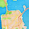
| |
| Toner by Stamen | Art | English | Black and white representation of map | Yes | 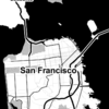
| |
| Treasure Maps | Art | English | OSM map data visualized in "vintage style" to get a look like an old sketchy map, a treasure map or a pirate map. | ?
|

|
Biking, hiking, geocaching, sport
| Name, link | Genre | Covered region | Language | Description | Free materials | Image |
|---|---|---|---|---|---|---|
| Online Outdoor Hiking Bicycle MTB Map | Hiking, mountain-biking, offline Maps, map service | English | Outdoor map with hillshading, elevation lines for hiking and biking. Download free offline maps | Yes | 
| |
| BeyondTracks Map | Hiking, bushwalking | Australia; Pacific, New Zealand | English | Bushwalking map for Australia and New Zealand | No | 
|
| Bicycle tags map | Biking | English | Customizable view of cycling related tags | Yes | 
| |
| Bike Citizens | Biking | worldwide | English, Spanish, French, German | Biking navigation app (freemium) with focus on urban areas. | No | |
| cycle.travel | Biking | English | Cycle route-planner with draggable routes and custom mapping for Western Europe and North America, run by Richard | No | 
| |
| Cycle Maps | Biking, map service, APP | English | This Application (IOS) Uses routing information from a number of sources and prefers all bicycle paths and low intensity roads - everywhere! See your route's elevation profile! | No | ||
| cyclemaps | Biking | worldwide | English | Highlights paved and unpaved bike paths, gravel roads, bike shops, bike rental, and bike parking worldwide | Yes | 
|
| Cyclofix - an open map for cyclists | Biking | English, Dutch, French | The goal of this map is to present cyclists with an easy-to-use solution to find the appropriate infrastructure for their needs. | Yes | ||
| CyclOSM [14] | Biking | Worldwide | English | A world wide cycle map for every cyclist from city to mountain, render cycle infrastructures as well as first aid or every day life activities. | Yes | |
| E-Bike u. Pedelec Ladestationen in Deutschland | E-Bike and Pedelec charging | Europe, Germany | German | Overview of e-bike and pedelec charging stations in Germany. | Yes | |
| LatLon | Interaction | Europe, Belarus | Russian | This style is focused on the roads and made suitable for cycling route planning in Belarus. | Yes | |
| Munzee | QR Code, game, geocaching | English | Scavenger hunt game where items (mostly QR codes) are found in the real world and captured using a smartphone. Mapnik and OpenCycleMap options. | No | 
| |
| OMA.sk - Slovensko | Biking, QR code, tourism | Slovak | Description of hiking and cycling trails, various amenities near the trail. Listing of trails by regions. Listing of amenities and POI by regions. | Yes | 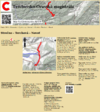
| |
| Hu:Merretekerjek [15] | Biking | Europe, Hungary | Hungarian | Feature rich bike route planner for Hungary and surrounding countries. | Yes | 
|
| MTB map Europe[16] | Biking | Europe | Czech, English | Mountain bike map of Europe (recently extended from Czech Republic) | Yes | 
|
| Topotresc Pyrenees map | Hiking, mountain-biking, offline Maps, map service | Europe, Spain, Pyrenees; Europe, France, Pyrenees; Europe, Andorra | Catalan,Spanish | Topographic map of the Pyrenees with countour lines and hillshading for trekking and mountaneering. | Yes. | |
| OpenBikeHero [17] | Biking | English | A Progressive Web App for finding and mapping Tag:amenity=bicycle_repair_station | Yes | 
| |
| OpenCycleMap [18] | Biking | English | Slippy map with contours, hill colouring, cycle routes, bicycle parking and cafes that do fryups. | No | 
| |
| OpenStreetMap.cz | Hiking | Czech, English | Czech OpenStreetMap with hiking trails overlay | Yes | 
| |
| OpenTrailStash [19] | Biking | English | Vector map & map style emphasizing unpaved roads&trails for biking and relevant amenities. | Yes | 
| |
| OpenTrailView [20] | Hiking, photo, streetview | English | Geolocate photos of trails, paths, ... and stitch them together in a Google StreetView like way | Yes | 
| |
| Mapa Prahou na kole | Biking | Europe, Czech Republic, Prague | Czech | Custom bicycle rendering for Prahou na kole (Prague on bike) | Yes | 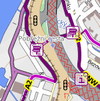
|
| Maps.Refuges.Info Refuges.info | Hiking | French | Showing shelter POIs on a French map | Yes, see configuration color-shade Aster | 
| |
| RouteYou | Routing, walk, bike, horse riding, motorcycle,... | Dutch, English, French, German, Italian, Spanish, Catalan, Danish | Routing based on osm data for several recreational modes walking, hiking, cycling, horse riding, motorcycle,... | Yes, freemium | 
| |
| XC Ski Trail Map [21] | Winter sports | Worldwide | English, German | Shows cross-country ski runs around the world | ?
|
|
| OpenSnowMap [22] | Winter sports | Asturian, Catalan, Czech, German, English, Spanish, Finnish, French, Hungarian, Italian, Japanese, Dutch, Norwegian Nynorsk, Russian, Northern Sami, Ukrainian | Yet another ski map! | Yes | 
| |
| Mountain Bike Routes - Santolibre | Biking | Worldwide | English | Worldwide overview of MTB routes, MTB routing, MTB route details with elevation profile and points of interest | No | 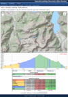
|
| MTB Trails | MTB, biking | English, German, Italian | Collection of mountain bike trails. Users are free to add, create, edit and delete contents. All the tracks are showed on the world map and can be searched by name. | Yes | 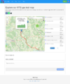
| |
| Topotresc Pyrenees map | Hiking, mountain-biking, offline Maps, map service | Europe, Spain, Pyrenees; Europe, France, Pyrenees; Europe, Andorra | Catalan,Spanish | Topographic map of the Pyrenees with countour lines and hillshading for trekking and mountaneering. | Yes. | |
| Waymarked Trails | Biking, hiking, MTB, inline, riding, skiing | Worldwide | multiple languages | Worldwide maps for various outdoor activities. Shows routes including the route symbols. With hillshading and relief. | Yes. | 
|
| VTTRack | MTB | multiple languages | Implements the MTB features on various underlying maps. | ?
|

| |
| haihui | Hiking | Romanian | Collection of hiking maps, optimized for mobile use | Yes | 
| |
| Relief Maps | Hiking, MTB, Skiing, Paragliding ..., APP | Worldwide | English, French | An Worldwide 3D GPS app (Android,IOS) for outdoor sports. | No | 
|
| safe bike routing | Biking, routing | Europe, Germany | German | This routing service considers dangerous roads for cyclists, and bypasses places where more than 6 accidents with cyclists have been reported per year. | No | 
|
| Traili Map | Biking | Europe | English | No | ||
| Trailmap.fi | Biking, hiking | Europe, Finland | English, Finnish | A number of MTB, trail and orienteering maps including MapAnt. Can show traces from a Strava account and traces saved as a GPX file. | Partial | 
|
| Nop's Reit- und Wanderkarte [23] | Hiking, horseback riding | Europe | German, English, Italian | Dedicated trail riding and hiking map with shaded hills, elevations, tracktypes and route symbols. Originated in Germany, it shows Europe from Portugal to Hungary and from Norway to Italy and Greece. Matching suite of slippy map, Garmin map, route editor, print map, places search and customized editor for hiking. Offers routing for hikers and riders. | No | 
|
| VeloPlanner | Biking | Worldwide | English, German, Polish | Download GPX files, access detailed route information, and plan your next ride with confidence. | No |
History, archaeology, monument
| Name, link | Genre | Covered region | Language | Description | Free materials | Image |
|---|---|---|---|---|---|---|
| Archäologie in OSM | History, archaeology | Europe, Germany | German | Archäologie in Deutschland | Yes | 
|
| HistOSM [24] | History, monument | English, German | Historic Information/Sites | ?
|

| |
| Old Oakland | History | America, United States, Oakland | English | Showing historical maps of Oakland on top of a own OSM map | ?
|
|
| Karte mit Stolpersteine-Layer | Monument, history | German | Showing Stolperstein on Wikipedia on OSM map. | Yes | 
| |
| Karte mit Grenzsteinen Sachsen-Preußen 1815 | History | German | Historische Landesgrenze Königreich Sachsen Königreich Preußen 1815 (Wiener Kongress) | Yes | 
| |
| Sächsische Postmeilensäulen | History | German | Karte mit Sächsische Postmeilensäulen und Poststraßen | Yes | 
| |
| Historic.Place | History | Worldwide | English, Danish, Czech, Spanish, French, German, Galician, Japanese, Dutch, Brazilian Portuguese, Romanian, Russian, Turkish | Weltweite Karte Historischer Objekte in OSM | Yes | |
| OldMapsOnline | History | English | Collection of historic maps from all over the world. Allows to upload and geolocate additional old maps. | No | 
| |
| OSM Historic Map [25] | History | Worldwide | English | Showing historic data from OSM with lifecycle prefix and name:date tags | Yes | 
|
Maritime
All for the navigation ! Seamap, NauticalChart, blinking lighthouses
| Name, link | Genre | Covered region | Language | Description | Free materials | Image |
|---|---|---|---|---|---|---|
| European Navigable Waterways (map) | Inland Navigation | Europe | English | Map showing inland waterways (Europe). | Partial | 
|
| OpenNauticalChart | Seamap navigation | German | OpenNauticalChart is the community around free nautical charts for sailing the seven seas. | Yes | ||
| OpenSeaMap [26] | Maritime, Seamap | multiple languages | Nautical chart, showing ports, marinas, lights, seamarks, etc. Weather chart, weather forecast. |
Yes, charts. | 
| |
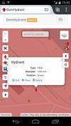
| OsmHydrant [27] | Edit | German, English, Polish, Ukrainian | Displays fire water utilities like fire hydrants, suction points and water tanks even on your smartphone. Additionally coverage can be checked on the map. | ?
|
| |
| Lights at sea | Seamap | English | This map shows all the blinking beacons from OpenStreetMap. | Yes | ||
| Lights of the sea online | Seamap | English, German, Portuguese, Russian, Spanish | Interactive map full of blinking lighthouses, light buoys and other beacons to discover and explore. | ?
|

|
3D
Main article: 3D
| Name, link | Genre | Covered region | Language | Description | Free materials | Image |
|---|---|---|---|---|---|---|
| F4 Map | 3D | English | WebGL technology, 3D buildings on a flat map, rotatable, shadows depending on time of day, visible rain depending on weather conditions. Impressions: Animated windmills, Animated Bellagio Fountains | No | 
| |
| fgmap [28] | Simulator, 3D | English | Real-time OSM map of flight position in FlightGear | Yes | 
| |
| Glosm | 3D | English | OpenGL hardware-accelerated 3D renderer (both tile renderer and realtime first-person engine) | Yes | 
| |
| Czech Republic/OpenKýbl3DMap [29] | 3D | Czech, English | Isometric 3D map of Czech republic (OpenKýblMap). | Yes (OL) | 
| |
| Little Big City | 3D, Art | English | This is a fun WebGL experiment which you can use to create a small world based on OpenStreetMap data. | Yes | ||
| CubicPower New York Maze | 3D, Art | English | A series of small 3D maps in block format of New York locations that can be explored. | ?
|
||
| Nutiteq 3D SDK for Android [30] | Mobile, 3D | English | Android SDK supporting 3D buildings and 3D models on top of OSM flat map | Yes | 
| |
| OSM2World [31] | 3D | English | Isometric slippy map of Germany, Austria, Switzerland and selected other locations worldwide created with OSM2World. | Yes | 
| |
| OSM go [32] | 3D | English | Symbolic rendering of OSM tagging in 3D, from actual OSM data (via OverpassTurbo) | Yes | ||
| OSM-3D [33] | 3D | English, German | Virtual Globe with SRTM terrain data and 3D buildings | Client only, since 05/04/2011 | 
| |
| OSMBuildings [34] | 3D | English, German | Digital city models from OSM and other open sources. Free 3D Viewer. Realtime data. Worldwide coverage. | Yes | 
| |
| Visualizing the Rendering of OSM Objects in MapboxGL | 3D, Building | English | This interactive visualization shows the height profile of all the buildings in a area. | ?
|
||
| VR Map | 3D, Virtual Reality | English | This experimental app displays OpenStreetMap data (ground tiles, trees, and buildings) in a web-based Virtual Reality environment. | Yes | ||
| Streets GL | 3D | English | Web-based 3D map that uses OpenStreetMap data on top of a dynamic terrain. | Yes |
Indoor
Main article: Indoor Mapping
| Name, link | Genre | Covered region | Language | Description | Free materials | Image |
|---|---|---|---|---|---|---|
| OpenLevelUp [35] | Interaction, indoor, routing | English | OpenLevelUp allows to navigate inside levels of a building interactively and displays pictures from the web, Mapillary or Flickr | Yes | 
| |
| OpenStationMap [36] | Interaction, indoor, routing | English | OpenStationMap is a project to map stations with routing, indoor, 3D and of course station specific features. | ?
|

| |
| Indoor= [37] | Interaction, indoor | Worldwide | English, français | indoor= is a map that displays indoor data. | Yes | 
|
Isochrone
- Main article: isochrone
For displaying a travel time area (isochrone) shape on a map.
| Name, link | Genre | Covered region | Languages | Description | Free materials | Image |
|---|---|---|---|---|---|---|
| CommuteTimeMap [38] | Worldwide | English | Allows you to build and visualize isochrones worldwide. | maybe | ||
| finderful.com | Isochrones, routing, housing | Australia | English | Find homes in a certain travel time "radius". Shows isochrone on map. Australia only. | No. | |
| Geoapify | Maps, geocoding, routing, isolines | Worldwide | English, German | Isochrones and reachability maps for different transportation modes: walk, bicycle, auto, transit. | Yes | |
| Iso4App [39] | Worldwide | English | Isochrones based on GTFS data. | maybe | ||
| Safe Routes to School Mapping Toolkit | Worldwide | English | working to create travel distance/time web app for pedestrians and bicyclists using OSM data (source code available) | maybe | ||
| TargomoAPI | Routing, isochrones, points/statistics reachability | Worldwide | English, German | Targomo offers routing-based analysis tools - isochrone polygons, points-of-interest, A-B routing, reachability, fleet management, statistics reachability for the following transportation modes: walk, bike, car, transit. | Yes | |
| TravelTime platform | Isochrones, routing, geocoding, distance matrix | English | Create isochrone shapes with an API or export to KML, get journey times from 1-100,000 points of interest in 1 request. Routing and geocoding also available. Available as a plugin for QGIS and ArcGIS. | Yes. | ||
| Walkscore Travel Time API | United States | English, German | Uses GTFS and OSM data for maps of Seattle, San Francisco, and Washington DC. Built on the open source Graphserver library. (no source) | maybe | ||
| WNYC Transit Time | New York City | English, German | Public transit isochrones for New York City | maybe | ||
| Iso4app |
Displaying GPS tracks
- Main article: Track drawing websites
Websites that can be used for drawing or sharing tracks or routes on an OpenStreetMap-based map.
| website | License | OSM routing | Sharing | OSM maps | other maps | import / upload | export / download | embedding (note!) |
|---|---|---|---|---|---|---|---|---|
| geojson.io[40] | ISC[41] | no | yes | ?
|
?
|
?
|
?
|
?
|
| gpx.studio | MIT[42] | via BRouter | ?
|
Mapnik, OpenCycleMap, MRI, Mapbox | Strava Heatmap | GPX | GPX | yes |
| MapBBCode Share | WTFPL[43] | no | yes | Mapnik, CycleMap | Bing Satellite | GPX, KML, GeoJSON, CSV etc. | GPX, KML, GeoJSON, HTML etc. | yes |
| nakarte.me | MIT[44] | no | ?
|
Mapnik, OpenTopoMap, OpenCycleMap, Outdoors | Google, Yandex, Bing, etc. (+ any custom tile layer) | GPX, KML, OziExplorer | GPX, KML | no |
| OpenRouteService | LGPL-3.0[45] | yes | ?
|
Mapnik, OSM-WMS, others | yes | GPX | GPX, KML, GeoJSON | yes |
| OSM GPX Overlay | MIT[46] | no | no | All styles available on OSM.org | no | GPX | no | no |
| uMap | AGPLv3[47] | no | yes | Mapnik, OpenCycleMap, many others | no | GeoJSON, KML, GPX, CSV | GeoJSON, KML, GPX | yes |
| WTracks | Apache-2.0[48] | no | yes | many OSM maps | no | GPX | GPX | no |
| Show Your Journey (no test instance) |
AGPLv3[49] | no | yes | Mapnik | no | GPX, KML, GeoJSON | GPX, KML | yes (see wiki page) |
| TrackProfiler | not open source but several components are[50] | no | ?
|
Mapnik | no | GPX, Garmin, OziExplorer, KML | GPX, KML, GPX-route | yes |
| Atlas.co | Proprietary | yes | yes | ?
|
?
|
GPX, File Geodatabase, Shapefile, Geopackage, KML, GeoJSON, OSM PBF, CSV, KMZ | GPX, GeoJSON, KML, Shapefile, DXF | yes |
| Bikehike.co.uk | Proprietary | yes - Cloudmade (car, bike, foot) | ?
|
OpenCycleMap | Google, Ordnance Survey (GB) | GPX, TCX, KML | GPX, TCX, KML | ?
|
| Bikemap.net | Proprietary | yes | ?
|
Mapnik, OpenCycleMap | GPX, KML | GPX | yes | |
| cycleplanner (wjst.de) | Proprietary | yes (combine car, bike, foot, openflight segments) | ?
|
OpenCycleMap | Earth, Relief, Weather, editable route instructions | GPX | GPX (Garmin route) | no |
| felt.com | Proprietary | Kind of. By default draws lines along the roads. | yes | ?
|
?
|
File Geodatabase, Shapefile, Geopackage, KML, GeoJSON, OSM PBF, CSV, KMZ, GPX | ?
|
?
|
| Garmin Connect | Proprietary | yes | ?
|
Open MapQuest | Google, Bing | GPX, TCX, FIT, Garmin device | GPX, TCX, KML | ?
|
| Gmaps Pedometer | Proprietary | no | ?
|
Mapnik, OpenCycleMap | Google, USGS | no | GPX | ?
|
| GPS Visualizer | Proprietary | no | ?
|
Mapnik, OpenCycleMap, OpenTopoMap, OpenSeaMap, Komoot, Thunderforest, others | Google, ArcGIS, USGS, USFS, Toporama (Canada), IGN (France), many more | GPX, KML/KMZ, Excel, CSV/plain text, FIT, TCX, Google Maps URLs, OSM data files & URLs, many proprietary GPS formats | GPX, KML/KMZ, plain text, Google Maps, Leaflet Maps, JPEG/PNG, SVG, elevation profiles | yes |
| MapMyRun/walk/etc. | Proprietary | yes | ?
|
Mapnik, OpenCycleMap | Google, | GPX, Garmin device | GPX, KML | ?
|
| meurisse.org | Proprietary | no | ?
|
Mapnik | no | no | GPX, KML, CSV | no |
| Openrunner.com | Proprietary | no (only Google routing - car, bike, foot) | ?
|
Mapnik, OpenCycleMap, MapQuest | Google, IGN France | GPX, TCX, KML, KMZ, TRK, Garmin device | GPX, KML, TRK, RTE | yes |
| RouteYou | not open source code but freemium to use | yes (walking, hiking, cycling, horse riding, motorcycle,...) | yes | RouteYou, OpenCycleMap, Outdoors | Google, Google satellite, Topo maps: BE (NGI/IGN), NL (Kadaster), FR (IGN), GB (OS), LU (ACT), NO (Kartverket), ES (IGN), CH (swisstopo), CZ (CUZK) | GPX, TCX, FIT, ITN, KML, GDB, connections with Garmin and Strava | GPX (tailored to different devices), KML, ITN, Shapefile, CSV | yes |
| Ride With GPS | Proprietary | yes (car, bike, foot) | ?
|
Mapnik, OpenCycleMap | Google, ESRI Topo, USGS Topo | GPX, TCX, FIT, KML | GPX, TCX, KML | ?
|
| Strava [51] | Proprietary | yes | ?
|
Mapbox Standard, Mapbox Terrain | Mapbox Satellite | GPX, TCX, FIT, Garmin device etc | GPX, TCX | ?
|
| WikiLoc; Wikiloc | Proprietary | ?
|
?
|
Mapnik, OpenCycleMap | Google, World Relief Map | GPX, Garmin device | GPX, KML | ?
|
| GraphHopper Maps | Apache-2.0[52] | yes | yes | many OSM maps, satellite | yes | no | (only via URL) | GPX, URL | no |
Routing
- Main article: Routing
| Name, link | Genre | Covered region | Language | Description | Free materials | Image |
|---|---|---|---|---|---|---|
| A Better Routeplanner | Routing, car | English | A route planner for planning trips and charging with a Electric Vehicle. | No | ||
| Agilogik GmbH | Routing, maps, tile server, geocoding, geo reverse coding | Worldwide | English, German | Worldwide tile server and services for commercial use | No | |
| BBBike [53] | Routing | English, Chinese, Danish, Spanish, French, German, Croatian, Dutch, Polish, Portuguese, Russian | Routing focused on bikes (no. of traffic lights, height profile, lit, road surface, …) | ?
|

| |
| Bike Citizens [54] | Routing | English, Spanish, French, German | Bike Citizens is a navigation app designed for and by cyclists, offers offline routing, predefined tours and various routing profiles | ?
|

| |
| BRouter [55] | Routing | English, Hungarian | BRouter: Let's get serious about bike routing. BRouter offers routing for trekking and cycling with predefined profiles and the ability to modify and upload custom profiles | ?
|
||
| Curvature | Routing | English | Curvature generates a map highlighting the most twisty roads, all across the world. | Yes | ||
| CycleStreets [56] | Routing | English | Bicycle routing and planning and photo map based on OpenStreetMap data and the OpenCycleMap for the British Isles. API available. | Yes | 
| |
| FacilMap [57] | General, routing, share, social, interaction | English | Different OSM renderings, search and draggable routes, create custom maps with live collaboration where markers, lines, routes and GPX/KML/GeoJSON/OSM files can be added. | Yes | ||
| GraphHopper [58] | Routing, car, bike, walking, public transport, wheelchair | Worldwide | multiple languages | Fast routing for bikes, pedestrians and cars with worldwide coverage. Using the open source routing engine GraphHopper. | Yes | 
|
| GraphHopper Direction Api | Road Routing, car, bike, walking | Worldwide | multiple languages | Fast routing service including a powerful Matrix and Route Optimization API based on the open source routing engine GraphHopper | No commercial | 
|
| KOMOOT Routing | Routing, hiking, bike | German, English | Calculate routes for mountain bikes, touring bikes and hiking taking your fitness level and elevation into account | Yes, see GraphHopper | 
| |
| Kurviger | Routing, motorcycle | English, French, Italian, Spanish, Dutch, German | Routing and navigation specialised for motorcycles. Kurviger calculates curvy routes that are fun to ride on bike. Curves and slopes are preferred, while cities and highways are avoided. Generate loop trips with one click. Personalise the routing to your own riding style. | Yes, see GraphHopper | 
| |
| Mapzen Turn-by-Turn (Valhalla) | Routing | Worldwide | English | Worldwide routing by automobile, bus, foot, and bicycle. | Yes | 
|
| Naviki | Routing | multiple languages | Planning bicycle trips and routing and collecting GPS traces | ?
|

| |
| Nop's Reit- und Wanderkarte [59] | Routing | German, English, Italian | Dedicated routing for hiking and horseback riding with multiple targets. Dynamic route options e.g. for following marked hiking routes or weather conditions. Options to modify caculated route manually, download or print it. | No | 
| |
| OpenRouteService [60] | Routing, wheelchair routing | Czech, Danish, German, English, Spanish, French, Croatian, Hungarian, Italian, Dutch, Polish, Portuguese, Russian, Ukrainian, Chinese | Route navigation based on osm data and TMC for car, bike and pedestrian | Yes | 
| |
| RouteYou | Routing, walk, bike, horse riding, motorcycle,... | Dutch, English, French, German, Italian, Spanish, Catalan, Danish | Routing based on osm data for several recreational modes walking, hiking, cycling, horse riding, motorcycle,... | Yes, freemium | 
| |
| routing.osm.ch | Routing | Europe, Switzerland | German, English, French, Italian | Routing with Leaflet slippy map for pedestrians (two types), cyclists (two types) and cars in Switzerland only (based on OSRM) | Yes, free | |
| OpenTripPlanner | Routing | English | A multimodal router combining OSM and Public transport tables | Yes | 
| |
| Ride the City | Routing | English, French, Spanish, Icelandic | Bicycle routing based on OSM data. Coverage: Selected big cities (currently 42) in U.S., Canada, Australia, France, Spain, few cities in other countries. | No | 
| |
| TargomoAPI | Routing, car, walk, bike, public transport, network analysis, isochrone | English, German | Targomo offers routing-based analysis tools - isochrone polygons, points-of-interest, routing, reachability, fleet management, statistics reachability. | No | ||
| Open Source Routing Machine (OSRM) | Routing | Worldwide | Bulgarian, Czech, German, Danish, Greek, English, Spanish, Finnish, French, Italian, Irish, Georgian, Latvian, Norwegian Bokmål, Polish, Portuguese, Romanian, Russian, Swedish, Turkish | A new fast routing service for car covering the world |
Yes. | 
|
| Sputnik | General, render, routing | Russian | Russian website that provides search of state services, POIs and routing to them | Partial | 
| |
| StreetCritic | Routing, bike | Worldwide | English | Routing for cyclists that uses both user and algorithmic ratings to calculate routes and visualise streets | Yes | |
| uNav | General, routing | multiple languages | Map viewer and GPS navigator for Ubuntu Phone | Yes | 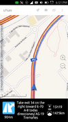
| |
| VROOM [61] | Routing | English | Vehicle Routing Open-source Optimization Machine It's aim at providing good solutions to various real-life vehicle routing problems (VRP) within a small computing time. |
Yes | ||
| brouter.grade.de [62] | Waterway routing | Europe | English | Inland waterway routing (Europe) taking size of vessel into account. Based on Brouter router-software | Yes | 
|
Services
| Name, link | Genre | Covered region | Language | Description | Free materials | Image |
|---|---|---|---|---|---|---|
| WhereOS | Operating system for developing data driven applications (with routing, geocoding, tile server etc.) | English | WhereOS is an operating system to develop and host applications based on (location) data. WhereOS offers simple OpenStreeMap based routing, geocoding, data import, data export etc services, and enables quick development of new application combining open data (such as OSM) and data owned by the developer. | Yes. See sample applications. | ||
| Agilogik GmbH | Maps, tile server, routing, geocoding, geo reverse coding | Worldwide | English, German | Worldwide tile server and services for commercial use | Yes | |
| Horse features | Horse | English | Horse related tags in OSM | ?
|
||
| Maxspeed Map | Maxspeed, Roads | English | Shows maxspeed tagging on streets | ?
|
||
| Veggiekarte | Vegetarian, vegan, restaurants, cafes | Worldwide | English | A map to find vegetarian/vegan POIs in your area. | Yes | |
| Bärn isch eso - Die Stadttour mit der Burgergemeinde Bern | Community service, PR/image campaign | German | In sections as e.g. Hörbeiträge, Lieblingstouren or Praktisches use of OSM data and kind of OSM swiss style layer (download github) | ?
|

| |
| Open Brewpub Map | Service, fatory, social, food | English, German | Lists all pubs where you can get homebrew beer (Hausbrauerei) | Yes | 
| |
| OpenBeerMap [63] | Food | English, multiple languages | This application was created to help people find their favourite beers. | Yes | ||
| Veganes Bern | Report, food, service | Europe, Switzerland, Bern | German | Nice example of data/multimedia journalism. BZ report by journalist and visual designer about situation of vegetarian life in the city of Bern supported by SOSM's uMap tool | ? , Free map service
|
|
| OSM Parking Map | Parking, POI | English | Openlayers maps showing extended parking propierties from OpenStreetMap. | Yes | 
| |
| OpenFireMap [64] | Service, emergency | Worldwide | English | Worldwide map showing fire stations and hydrants on different backgrounds | Yes | 
|
| Vending machines for cigarettes | Shops, vending, cigarrettes | German | Based on Leaflet map using an overlay showing the vending machines for cigarettes. | ?
|
||
| Wanderpferde | Service, sports, tourism | German | Directory of accomodations for trail riders and horses in southern Germany. Also offers routing for horseback riding. | No | ||
| Property search | Service, estate agency | English | Nestoria - Property search in Europe (UK, France, Italy, Germany, Spain), India, Brazil, Australia. | ?
|

| |
| XAPI Viewer | Service | English, French, Dutch | Search and display any kind of tagged data | Yes, see about box. | ||
| CoinMap | Payment | English | Map showing places where Bitcoin is accepted. | Yes | 
| |
| QuiBitcoin | Payment | Europe, Italy | Italian | Enhanced map showing places in Italy where Bitcoin is accepted. | Yes | |
| OpenLoveMap | Service | German, English | Map showing some sex-related POIs. | ?
|
||
| Gesucht: Die grössten Ärgernisse im Stadtberner Verkehr by BZ graphic department | Interactive service, involvement of readers | German | Project for reader involvement by BZ Berner Zeitung. The readers can add their points of traffic annoyance and other readers can comment/agree. | ?
|

| |
| WaterSupply.at | Service | German, English | Map showing drinking waters sources. Apps for Android, iOS, and Windows Phone are also provided. | ?
|
||
| CTGuides.com | Service, travel | English | Generates free custom self guided walking tours around London based upon choices such as length of tour and starting points. Uses OSM data for routing. | No | 
| |
| streetdir | Spanish, French, English, multiple languages | POI searching | ?
|
|||
| OSM Landuse | English | Landuse and landcover information | ?
|
|||
| OpenAdvertMap | Advertisement | English | Interactive map showing advertisement data of OSM | Yes | 
| |
| Georeferencer | Georeferencing | English | Allows to georeference JPG or TIFF picture on OSM map | no | 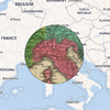
| |
| Bounding Box Tool | English | Service for defining bounding box, which allows to download them in different formats | no | 
| ||
| MAPCAT [65] | Map tiles, search, POI, routing, geocoding, reverse geocoding, editing | Worldwide | English, Hungarian | Custom-made, OSM-based worldwide map API for public websites, internal systems or mobile apps to let your location-based info come to life. | Partial | |
| Mapcherry | Map tiles, geocoding, mapping, custom OSM solutions | Worldwide | English | Vector tiles, geocoding and mapping services for your web or mobile application. Custom GIS and OSM-based solutions. | Yes | |
| Organic TransforMap | Food, organic, sustainable | Worldwide | English | This map displays places where you can get stuff organically produced. | Yes | 
|
| TransforMap of Identities | Identities, sustainable | Worldwide | English | The map of identities displays the different identities of the TransforMap movement. | Yes | |
| Regional TransforMap | Regional, sustainable | Worldwide | English | This map displays places where you can get stuff regionally produced. | Yes | |
| Fairtrade TransforMap | Fair, sustainable | Worldwide | English | This map displays places where you can get stuff produced fair. | Yes | |
| Second Hand TransforMap | Second hand, sustainable | Worldwide | English | This map displays places where you can get second hand goods. | Yes | |
| Green TransforMap | Relax | Worldwide | English | This map displaying green places around you, where you can relax and enjoy nature. | Yes | |
| Walk Score | Service | English | A calculated score on walkabilty often used in real estate listings and research. Walk Score Methodology page mentions OSM data as one source. | yes, limited to certain scores |
Export
Offer OSM maps and -data to end-consumers.
See also Processed_data_providers for services which offer OSM data in analyzable GIS vector data formats.
| Name, link | Genre | Covered region | Language | Description | Free materials | Image |
|---|---|---|---|---|---|---|
| CH-OSM | Export, visualization | German, French, Itlian, English | OpenStreetMap daily up-to-date thematic data available as WMS/WFS service and for download as SHP, KML ... | Yes | ||
| 123map Illustrator Export | Export | German, English | Export map regions to Adobe Inkscape, Illustrator, Affinity Designer, CorelDraw | No | 
| |
| 4UMaps | Export, download | German, English | Download Free City Maps. | Yes | 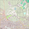
| |
| Bigmap [66] | Render | English | Tool to create big maps | Yes | 
| |
| cast a map | Export | German | Online service for generating (small) personal free-of-charge maps. Individual styles can be used against payment. | No | ||
| Creating and downloading your individual multimedia map | Export | German, English, Spanish, multiple languages | Comfortable-to-use online service for creating maps with "needles" containing links to audio, photo, video. Example of a city-map | Yes | 
| |
| EasyMap SlippyMap Generator | Export | English, German | Create comfortably a SlippyMap based on OpenLayers and OSM-Tiles with markers and different layers. | No (except JS and HTML ofc) |

| |
| GeoDataMine [67] | Export | French | OpenStreetMap thematic data exports (CSV, SHP, GeoJSON) for public authorities | Yes | 
| |
| Gimme Geodata | Export | English | Get quick access to OpenStreetMap boundaries and any other polygons such as administrative areas, parks, houses and many more. | ?
|
||
| magOSM | Export, visualization | French | OpenStreetMap daily up-to-date thematic data available as WMS/WFS service and for download as SHP, KML ... | Yes | 
| |
| MapOSMatic [68] | Export, print | English, French, multiple languages | Export city maps as printer friendly PDF, SVG, ... | Yes | 
| |
| Map-Illustrators | Export | English | OpenStreetMap available in Adobe Illustrator, PDF and EPS format. Editable vector map layers vector for print and online purposes. | No | ||
| OpenOrienteeringMap | Export | English | Orienteering-style maps with overlaid features and contours for orienteering and other navigation activities. Map export as vector PDF or jpg image. | Yes | 
| |
| OSM POI Export | Export | English, German, Dutch | Export POI from OSM into different formats (TomTom overlay (ov2), Garmin (csv), gpx, kml, OziExplorer (wpt)), GeoJSON. ATM restricted to BeNeLux region. | Yes | ||
| osmdata.xyz | Export, download | English, German | Monthly global extracts of each primary map feature with all tags as geopackage. | Yes | ||
| Print maps | Export, download, print | English, German | Create printable maps in Photoshop / Illustrator and image format | Free printable maps for Nonprofits, free web resolution | 
| |
| Query-to-map | Export | English | Online service for exporting POIs and lines as KML | Yes | ||
| Field Papers [69] | Export, editing, tool | English, German, French, Russian | Wizard to print an map area for drawing on it to contribute to OSM. | Yes | 
|
Interaction
Explore OSM data with more than just a slippy map and markers.
| Name, link | Genre | Covered region | Language | Description | Free materials | Image |
|---|---|---|---|---|---|---|
| Burgen-Dossier Schweiz [70] | Interaction, castle | Europe, Switzerland | English, German, French, Italian, Romansh | Castles in Switzerland, shows Wikipedia articles in various languages. | Yes | |
| BuDongSan (부동산) | Interaction, game, building, 3D | Worldwide | English | An OpenStreetMap based realtor tycoon game. BuDongSan (부동산) is the Korean word for real estate. | Yes | |
| Defikarte.ch - Die Defikarte der Schweiz | Interaction, defibrillator | Europe, Switzerland | German | Defibrillators in Switzerland. | ?
|
|
| Feuerlöscher - weltweit | Interaction, fire protection | worldwide | German | fire extinguisher worldwide | ?
|

|
| Gobierno de la Provincia de Misiones - Recursos para el Manejo de Emergencias | Interaction, emergency | South America, Argentina | Spanish | Interactive map for environmental emergency management. | Yes | |
| Notfallkarte der Feuerwehr Gossau ZH | Interaction, emergency | Europe, Switzerland, Zurich, Gossau | German | Emergency map of the fire department Gossau ZH in Switzerland. | ?
|
|
| EFA | Interaction | German | An Interactive search engine for public transport time tables in Germany, displaying all bus- and train-stopps as overlay on OSM (mapnik) | ?
|

| |
| European Water Project | Interaction, drinking water | English, German, Greek, Spanish, French, Italian, Dutch, Polish | A map showing establishments that participate in a water refill network and drinking water fountains. | ?
|
||
| FacilMap [71] | General, routing, share, social, interaction | English | Different OSM renderings, search and draggable routes, create custom maps with live collaboration where markers, lines, routes and GPX/KML/GeoJSON/OSM files can be added. | Yes | ||
| Farmshops Map | General, farm, regional, interaction | Europe | German | Data viewer for markets, farmshops, milk and food vending machines and other direct marketers on openstreetmap. | Yes | |
| finde.cash! | General, interaction, ATM, Add POIs | German | Locate ATMs and add new ones to the map. | Yes | ||
| FLOSM | Interaction, POI, tool | WorldWide | German, English | OSM with the Points of Interests of your choice, you can also download map as JPG or SVG. | ?
|

|
| Geldautomaten finden (ATM Map) | General, interaction, ATM | German | Locate ATMs of different networks. | Yes | ||
| Kort - Já.is | General, interaction, street-view | Europe, Iceland | English, Icelandic | Map of Iceland with a street-view feature. | ?
|
|
| Mapalizer | Map tool, data visualization, interaction | Website: English Widget: English, French, Spanish, German, Japanese |
Personalized location analyzer map tool for real estate websites/platforms. Mapalizer adds a widget on your map. It lets your visitors/clients compare location features according to their preferences. |
Partial, methodology is given. | ||
| MapBBCode Share | Interaction, tool | English | Import or draw paths and polygons and markers on a map, embed or share or export | Yes | ||
| Mittelsachsen Atlas | Interaction | Europe, Germany, Saxony | German | One of the first OSM maps by German officials presenting POIs of Landkreis Mittelsachsen | Yes | 
|
| OpenPianosMap | Interaction, Piano | English | A map based on mapcontrib.xyz that shows pianos. | Yes | ||
| Parkulator | Interaction, parking | English | The map calculates the area of the selected region being used for parking, and tells you how many houses could have been built in the space instead. | ?
|
||
| Open and Free Map | Interaction | Europe, Lithuania | Lithuanian | Interactive map of Lithuania with different layers for e.g. ferries, rivers, topo, sights. | Yes | |
| OpenLinkMap | Interaction, POI, time | German, English, French, Italian, Japanese, Russian | Slippy map showing additional information on the map. | Yes | 
| |
| OpenSeaMap [72] | Interaction | English, multiple languages | Nautical chart, showing Ports, marinas, lights, seamarks, etc. with integrated Port Pilot Book various formats, online and offline |
Yes Source Charts download |

| |
| OpenStreetBrowser [73] | Interaction, POI | English, multiple languages | Interactively browse not only the map but also the contained information. | Yes | 
| |
| OSM POIs Map [74] | Interaction, POI | Spanish | See main categories and brand places in OSM. | Yes | ||
| OSM Trafficsigns Map [75] | Interaction | Spanish | See traffic signs in OSM. | Yes | ||
| OSMViz | Interaction | English | Animate/visualize things on a map. Uses Python. | Yes | 
| |
| ÖPNVKarte[76] | Interaction | German | Map displaying routes of local public transportation (PSV) in Europe | ?
|

| |
| Priceless map | Interaction, POI, solidarity | English, German | This is a map showing public and free facilities and offers. | Yes | 
| |
| Public bookcase map | Interaction, POI, books | English, German | This map shows public bookcases near you. | Yes | 
| |
| It remains open | Interaction, POI, opening hours | English, German, French, Catalan, Spanish, Galician, Finnish, Italian, Irish | The essential tool to avoid unsuccessful movement around your home during lockdown and thus limit the risk of contagion. | Yes | ||
| Stolpersteine[77] | Interaction | German | Map displaying all small memorial bricks ("Stolpersteine") for killed Jews during the 2nd world war | Yes | 
| |
| Street Lamps in OSM | Interaction, light, lamps | German | This map shows street lamps and their settings. It shows e.g. operators, reference numbers and details about the used lights. | Yes | ||
| Surveillance under Surveillance | Interaction, surveillance | English, German, Spanish, French, Russian | Shows you cameras and guards — watching you — almost everywhere. | Yes | ||
| Sustainable map | Interaction, POI, solidarity, sustainable | English, German | This is a map that shows facilities and services in your area that are environmentally, socially and economically sustainable. | Yes | 
| |
| Sygic | Interaction, POI, travel, routing | Worldwide | English, German, Italian, French, Dutch, multiple languages | A Trip planning, detailed maps and worldwide travel guides. | ?
|
|
| uMap | Interaction, tool | English, Spanish, French (on a production instance) | Draw lines, markers, texts on OpenStreetMap base layers in a web map and share and collaborate with others | Yes | ||
| Wikipedia-World Layer | Interaction | multiple languages | Shows categorized overlay of georeferenced Wikipedia articles | Yes | 
| |
| Frankfurt vegan: Restaurants, Cafes, Eis | Interaction, vegan | Worldwide | English, German | On this map you will find vegan shops, restaurants and other points of interest. | ?
|
|
| Wikipedia overlay | Interaction | multiple languages | Zoomzoomzoom map highlighting map objects that contain external links, such as those tagged with Key:wikipedia or Key:url, flickr, dopplr, etc. | ?
|

| |
| ZonesWIFI | Interaction, POI, WiFi | Worldwide | English, French | Worldwide Wifi Hotspots from OSM. Locate me button and Search panel let zoom-in to a zone and see the WIFI hotspots. Navigator refresh Button to request Wifi hotspots for a new zone. | Yes | 
|
Compare
| These tools should not be used as a source or discovery tool by people contributing to OpenStreetMap... and it will be tempting! See also Completeness#License issues |
Compare OSM maps with historic data or other commercial alternatives.
| Name, link | Genre | Covered region | Language | Description | Free materials | Image |
|---|---|---|---|---|---|---|
| Apple Map Tiles | Compare | English | Switching between Apple map, to OpenStreetMaps and Google Maps | ?
|

| |
| Geofabrik Map Compare | Compare | English | Two maps side by side. Several OpenStreetMap and Google maps are available. | Yes (JS) | ||
| BBBike Map Compare | Compare | English | Map Compare shows up to 170 different maps from OpenStreetMap, Google, Bing, Yahoo, Mapquest, Esri and others side by side. With the admin console you can configure your own local tile server and compare the map with others. Service by BBBike_@_World, software based on Geofabrik Map Compare | Yes (JS) | 
| |
| OSMCompare | Compare | English | BEFORE and AFTER Compare Map shows the reactivity of the OSM community to update areas. | ?
|

| |
| OSM with Streetview | Compare | English | Compare the coverage of UK between Ordnance Survey and OSM | ?
|

| |
| Quadmap Compare | QA | English | Compare 4 maps at the same time : OSM, Google Maps, Bing Maps, Yahoo Maps. | ?
|
||
| Appspot Transp. Map Comparison | Compare | Another transparent map comparison website. | ?
|
|||
| Глобус Беларуси | Compare | русский | Archive and modern maps of Belarus | ?
|
Edit
Edit OSM data in a web browser. Mostly focused at a specific topic.
| Name, link | Genre | Covered region | Language | Description | Free materials | Image |
|---|---|---|---|---|---|---|
| OpenSeaMap | Edit | multiple languages | Nautical chart with GUI Online-Editor and JOSM "SeaMapEditor" showing Ports, Marinas, Lights, Seamarks, etc. Weather chart, Weather forecast |
Yes Source Charts Wiki |

| |
| Wheelmap [78] | Edit | French, English, German, Spanish, Japanese | Wheelchair map that let user contribute to vote for Accessibility | Partial | ||
| Map your neighbourhood nature | Edit, Nature | Dutch | Nature makes you happy. On the basis of this website we want to make a better inventory of nature close to us. The goal is to let more people enjoy accessible nature and to fight for more nature in our neighbourhoods. | Yes | ||
| OnOSM | Add POIs | English, Deutsch, español, suomi, italiano, français, norsk, Nederlands, brezhoneg, русский | A website where you can add companies or other commercial businesses on OSM without having an account. | Yes | ||
| On OpenStreetMap | Add POIs | English, Italian | A website where you can add companies or other commercial businesses on OSM without having an account. | Yes | ||
| MapComplete maps | ||||||
| MapComplete | Edit | English | View and edit OpenStreetMap information about specific themes (such as bicycle infrastructure, shops, campsites, and many more) | Yes | 
| |
| Open Bookcase Map - MapComplete | Edit, bookcase | English, Dutch | This map aims to collect all these bookcases. You can discover new bookcases nearby and, with a free OpenStreetMap account, quickly add your favourite bookcases. | Yes | ||
| A map of maps - MapComplete | Edit | English | This map is a map of physical maps, as known by OpenStreetMap. | Yes | ||
| Open AED Map - MapComplete | Edit, AED, emergency | English, Dutch, French | On this map, one can find and mark nearby defibrillators | Yes | ||
| Ghost bikes - MapComplete | Edit, memorial | English, Dutch | On this map, one can see all the ghost bikes which are known by OpenStreetMap. Is a ghost bike missing? Everyone can add or update information here - you only need to have a (free) OpenStreetMap account. | Yes | ||
| Open Toilet Map - MapComplete | Edit, toilet | English | A map of public toilets | Yes | ||
| Open Artwork Map - MapComplete | Edit, artwork | English, Dutch, French | Welcome to Open Artwork Map, a map of statues, busts, grafittis, ... all over the world | Yes | ||
| Cyclestreets - MapComplete | Edit, bike | English, German, Dutch, French, Czech, Spanish, Catalan, Polish, Korean | On this open map you can see all known bicycle streets and you can indicate missing bicycle streets. To modify the map, you have to log in with OpenStreetMap and zoom in all the way to street level. | Yes | ||
| Level0 [79] | Edit, Add POI | English | low-level text-based web editor | ?
|

| |
Accessibility for persons with disabilities
| Name, link | Genre | Covered region | Language | Description | Free materials | Image |
|---|---|---|---|---|---|---|
| Wheelmap | Accessibility, edit | English, German, French, Italian, Japanese, Swedish, Turkmen, Greek, Icelandic, Klingon! | Wheelchair map (locations) | Yes | 
| |
| OSM Accessibility Map [80] | Accessibility, edit | Worldwide | English, Catalan, Spanish, | Map about wheelchair, kerbs, sidewalks, crossings, ways, areas, parkings, obstacles and inclination accessibility in OSM. | Yes |
Infrastructure
To see the OSM data relating to Infrastructure.
| Name, link | Genre | Covered region | Language | Description | Free materials | Image |
|---|---|---|---|---|---|---|
| Open Infrastructure Map [81] | POI, infrastructure | English | Open Infrastructure Map is a view of the world's hidden infrastructure mapped in the OpenStreetMap database. | Yes | 
| |
| Wind Turbine Map | Tool, Wind, Energy, Turbine, Travel | Worldwide | English | Shows overlay of OSM listed wind turbines world wide. Includes info boxes with turbine type, manufacturer, rated power, hub height, rotor diameter and operator if available. | Yes | 
|
Public transport
To see the OSM data relating to public transport.
| Name, link | Genre | Covered region | Language | Description | Free materials | Image |
|---|---|---|---|---|---|---|
| Cualbondi | Interaction | English, Spanish, French, Portuguese, Chinese | Search public transportation from point A to B, using OSM data. | Yes | ||
| ÖPNVKarte [82] | Interaction | Worldwide | German | Worldwide map displaying routes of public transportation (PSV). |
No | 
|
| OpenRailwayMap [83] | Interaction | Catalan, Czech, Danish, German, Greek, English, Spanish, French, Japanese, Lithuanian, Dutch, N’Ko, Polish, Portuguese, Russian, Slovenian, Swedish, Turkish, Ukrainian, Vietnamese | Detailed map of the railway network, based on OpenStreetMap. It considers all rail-mounted and automotive vehicles, e.g. railways, subways, trams und miniature railways. | Yes | 
| |
| OpenRailwayMap-vector | Interaction | Europe | English | Detailed vector map of the railway network, based on OpenStreetMap. Shows information about infrastructure, speed train protection, electrification and railway gauge for all rail-mounted and automotive vehicles, e.g. railways, subways, trams and miniature railways. | Yes | 
|
| OSM3S PT diagrams [84] | Interaction | English | Public Transport Line Diagram | Yes | 
| |
| Public Transport Network Analysis (PTNA) [85] | Interaction, OSM tool, QA | German, English, French, Italian, Portuguese, Spanish, multiple languages | PTNA finds and aggregates information about public transportation lines mapped in OSM including a daily quality assurance and display of GTFS data in a human-readable way. | Yes | 
| |
| Actuele spoorkaart Nederland | Interaction, realtime | Europe, Netherlands | Dutch | Realtime train position in Netherlands | Yes | 
|
| Raildar | Interaction, realtime | Europe | French | Realtime train position in France (TGV, TER, Transilien, ...), Denmark, Finland, Ireland | Partial | |
| TapTap Map | Interaction | America, Haiti | English | See routes for TapTap's in Haiti as well as station information. | ?
|
|
| World Airport Codes | Interaction | English | The place to find airport codes, abbreviations, runway lengths and other airport information. | No | 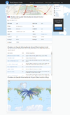
| |
| TransitMix | Interaction | English | Tool for creating your own bus systems using OpenStreetMap data. | Yes | ||
| AllRailMap | Interaction | English | Simple and intuitive world railway map, improving upon the outstanding and sadly outdated Thorsten Büker's and Boris Chomenko's railway maps. Shows gauge, electrification status and voltage. | No | ||
| FlightStats | English | Flight tracking service which uses OSM data as a part of their map data (attribution page). | No |
Live/real-time edits to OSM data
| Name, link | Genre | Covered region | Language | Description | Free materials | Image |
|---|---|---|---|---|---|---|
| OSM In Realtime [86] | Art, OSM tool | English | OSM In Realtime is a simple visualization of the changes made to OpenStreetMap in (near) real-time. | Yes | 
| |
| OSM Live (not active as of 2024-10-18) [87] | Art, OSM tool | English | Monitoring the OSM edits in nearly realtime. Shows location and user name on a world map, not detailed. | No | 
| |
| LiveMapViewer | Art, OSM tool | English | A java tool to see live changes based on Planet.osm diff. | Yes | ||
| Show me the way [88] | Art, OSM tool | English | Shows near live edits (ways and nodes) overlaid on bing aerial imagery and shows a small overview OSM map (MapBox tiles). No "Pause" button or "previous" button (could be improved to be usable as anti-vandalism tool). Seems to use Overpass API/Augmented Diffs as data source. | ? github
|

| |
| live.osm.fr | Art, OSM tool | English | Shows near live edits on both overview map (pin) and local map (bounding box), with stats, activity graph, and misc changeset info. | Yes, osm-livechanges itself Apache License Version 2.0.) | 
|
Quality assurance - OSM tool
Here we list web utilities to work with OSM so monitoring, debugging, …
| Name, link | Genre | Covered region | Language | Description | Free materials | Image |
|---|---|---|---|---|---|---|
| OSM History Viewer | OSM Tool | English, German, Hungarian | To see the difference last change on the tags and map. | Yes | 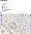
| |
| WhoDidIt [89] [90] | OSM tool, interaction | English | OpenStreetMap Changeset Analyzer | Yes | 
| |
| OSM Relation Analyzer [91] | QA | English | Analyze relations and find errors (optimized to find errors in the route relations) | Yes | 
| |
| How did you contribute to OSM | OSM Tool | English | Goes back in the user edits history and shows what are the first/last edits on OSM | No | 
| |
| opening_hours map | QA, analyser | English, multiple languages | Map which evaluates opening_hours like tags. | Yes | ||
| OSM Country Statistics | QA | English, Russian | Details on user count, speed, node count | ?
|

| |
| OhsomeHeX [92] | QA, OSM tool | English | Tool for visualising mapping progress/quality | No | 
| |
| osm-node-density | Analyse | English | A visualization of OpenStreetMaps node density. | Yes | ||
| Query-to-map [93] | QA | English | Exports custom data requests as lists and shows them on a map | Partial | ||
| Refs for U.S. interstates | QA | America, United States | English | Lists and finds the corresponding road segments and reference numbers for the American interstates | ?
|
|
| Taginfo [94] | QA | multiple languages | List and search for all tags | Yes | 
| |
| Verkehrszeichen Tool [95] | QA | Europe, Germany | German) | Wizard to get the right tags for traffic signs look alternative JOSM-Plugin RoadSigns |
?
|

|
| layers@osm-fr [96] | QA | Overlays showing streets with no name, no ref, no oneway; fixmes & notes text; administrative boundaries . | Yes | |||
| Editor usage stats | QA | English | Statistics on which editor is used most. | ?
|
||
| Geofabrik Tile coordinates map | QA | English | Showing coordinate grid with Tile IDs | No | 
| |
| Osmose [97] | QA | English, Dutch, French, German, Italian, Spanish, Swahili | Checks for issues. | Yes | 
| |
| Information Freeway | QA | English | Slippy map with tiles from Tiles@home, several sources, interface for rerender requests | Yes, OpenLayers + HTML Source | 
| |
| Keep Right [98] | QA | multiple languages | Displays mapping errors | Yes, at sourceforge | 
| |
| NoName [99] | QA | English | Highlights roads with no name=* tag
|
No | 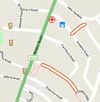
| |
| NOVAM | QA | English | Bus stop verification tool developed for the NaPTAN import in the UK | Yes | 
| |
| OSM Inspector [100] | QA | English | Displays all kinds of possible dataset quality problems | No | 
| |
| achavi | OSM tool | English | Augmented OSM Change Viewer: visualizes OpenStreetMap changes based on the Overpass API Augmented Delta (adiff) query. Supports continuous monitoring of an area of interest and visualizing single changesets (with some limitations). | Yes. | ||
| OSM Lane Visualizer | OSM tool, QA, Interaction | English | Schematic visualization of the lanes of a way including destination. Covers all important attributes (e.g. maxspeed, :lanes-extension and destination).
|
Yes. | 
| |
| YoHours | OSM tool | English | Webpage for easy generation of opening hours (opening_hours=*)
|
Yes | ||
| ohsome API | OSM tool | English | The ohsome API is a generic web API for analysing OSM history data. | Yes | ||
| Ohsome Dashboard | OSM tool, QA | English | The ohsome dashboard generates accurate statistics about the historical development of OSM data for custom regions, tags and time ranges. | ?
|
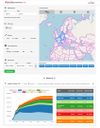
| |
| magOSM - Tracking changes [101] | Export, Visualization | Europe, France | French | Visualize OSM thematics dataset changes on metropolitan France for last 30 days. | Yes | 
|
| Public Transport Network Analysis (PTNA) [102] | OSM tool, QA, Interaction | Worldwide | English, French, German, Italian, Portuguese, Spanish, multiple languages | PTNA finds and aggregates information about public transportation lines mapped in OSM including a daily quality assurance and display of GTFS data in a human-readable way. | Yes | 
|
| OSM Blitzermap | OSM tool, Visualization, QA | Worldwide | English | Showing a map with speed camera and other enforcements POIs. The related OSM tags are highway=speed_camera and Relation:enforcement
|
?
|
|
| Atlas Checks | OSM tool, QA | Worldwide | English | a suite of open-source data quality checking tools using the Atlas framework and Spark. There are a number of different checks looking at topology issues, tags, and more looking at all kinds of OSM data. The results can be used in MapRoulette or in JOSM or your favorite editor. | Yes |
Miscellaneous software
Geocoding and autocompletion
| Name, link | Genre | Covered region | Languages | Description | Free materials | Image |
|---|---|---|---|---|---|---|
| OSMNames | Search | English | Fulltext search based on OpenStreetMap database, ranking based on the popularity of related Wikipedia page. | Yes | 
| |
| Osmocoder | Geocoding | Europe, Germany | German | Geocoder für D | No | 
|
| Kartana | Autocomplete, Search | Europe, Germany | Deutsch | Autocomplete for German addresses | Yes |
WordPress plugins
| Name, link | Genre | Covered region | Languages | Description | Free materials | Image |
|---|---|---|---|---|---|---|
| Maps Marker Pro - www.mapsmarker.com | WordPress plugin | English, Bulgarian, Catalan, Chinese, Dutch, French, German, Hindi, Italian, Japanese, Polish, Russian, Slovak, Spanish, Turkish, Ukrainian, Yiddish | The #1 mapping plugin for WordPress - ready-to-use with free maps & free geocoding | Yes | 
| |
| WP OSM Plugin | WordPress plugin | English, French, German, Russian | The mapping plugin for WordPress that supports GPX, KML, geotagged posts / pages and more ... | Yes | ||
| WP Leaflet Map | WordPress plugin | English, French, German | The mapping plugin for WordPress that supports GPX, KML, geotagged posts / pages and more ... | Yes | ||
| Extensions for Leaflet Map | WordPress plugin | English, French, German | The mapping plugin for WordPress Leaflet Map that supports more funktions like clusterung, Tileswitch... | Yes |
Drupal Modules
| Name, link | Genre | Covered region | Languages | Description | Free materials | Image |
|---|---|---|---|---|---|---|
| OpenStreetMap | Drupal module | English | Drupal module that enables imports of nodes, ways, and Overpass queries into Drupal's entities | Yes |
Offline but the source code still exists
| Name, link | Genre | Covered region | Languages | Description | Free materials | Image |
|---|---|---|---|---|---|---|
| Amenity Editor |
Edit | German | Easily edit existing or create new POIs. | ?
|

| |
| OS Locator Musical Chairs |
QA | UK | English | Browsable comparison of OSM street names with the GB Ordnance Survey Locator street name database | Yes | 
|
| biking, export, GPS, planning, tool | English | Create and download gpx tracks or edit your uploaded ones for planning routes by bike. | Partial (OSM Mapnik + Openlayer + jersey) |

| ||
| Edit | German | Analysing if a hotel, restaurant, ... allows smoking or not. | Yes | 
| ||
| OSM Tool | English | Tool to coordinate a mapping party by delimited zone | Yes | 
| ||
| OSM Tool | English | List of contributors who have participated in a given OSM area | Yes. | 
| ||
| OSM Route Manager |
QA | English, German | Analyze route relations, find gaps and export GPX files. | Yes | 
| |
| Service, food | German | Shows cuisines of restaurants, cafes, etc. as little flags on the map. Additional information is available on click. Only D/A/CH region, at present. | Yes | 
| ||
| Interaction, POI, time | English | Slippy map showing additional information on the map. Bootstrap powered | Yes | 
| ||
| Various OSM map |
QA | English, French | Displays all kinds of map in the same interface, with also a mobile version [107]. | Yes | 
| |
| MapJumper |
Compare | English, French | Jumping from map to map, keeping lat, lon & zoom; up to 50 maps or services available | Yes JS+PHP:on demand |

| |
| QA | English, German, French, Italian | Allows you (1) to 'lock' areas as your working area to coordinate teamwork (2) to mark completion regarding map feature keys on a square grid | Yes see QualityStreetMap | 
| ||
| WeoGeo Market |
Export | English | Request OSM data in multiple file formats for user-specified areas of interest. View quick walkthrough. | Yes | 
| |
| 3D | English | Isometric 3D maps of some cities (Berlin, Braunschweig, Bremen, Dresden, Frankfurt, Hamburg, Hannover, Munich, Rostock, New York (Manhattan), Oyten, Uetze, Scharnebeck, Radeberg) | Yes | 
| ||
| OSM Watch List (OWL) |
QA | English | Monitors changes, summarises in a grid and offers RSS feeds teamwork on a bigger area | Yes | 
| |
| analyser.openstreetmap.fr |
QA | French, ??? | Relation analysing tool. Given a relation id, it tests for validation of multipolygons of any kind, admin boundaries (and also linear relations to some extend). | Yes | ||
| QA | Germany | German | Estimates where postboxes might be missed in Germany basing on statistics. Seems to be not working anymore (fails with a Openlayers exception in FF and Opera) | ?
|

| |
| Interaction, routing, biking, comparison | Swedish, English | Travel Compare Server in English, is a multi-modal router for the Øresund/Öresund region. It uses OpenStreetMap data and was created by Lund Municipality in 2009. Comparison of time, price, carbon dioxide emissions and calorie usage for different travel options. | Partial | 
| ||
| Communication. | English | Collect informations on cell tower and wifi base stations and bring them on a map. | Yes | 
| ||
| QA | English | Checks for corrupted coastlines | Partial Map generated, “Bad Geometry” and “missing shape parts” layers |

|
See also
- Map internationalization
- Lacking proper attribution
- Related Projects
- WMS
- Software
- Feeds
- OSM Internet Links - listing endusers embedding our map (see also other languages)
- Commercial OSM Software and Services — message at companies: please leave a link to your company or service at this page and not somewhere else at wiki. Thank you!
- OSMcode.org — Open Source Software for Working with OpenStreetMap Data