User:Jamiegray
Hello friends! I'm Jamie Gray, I live in Brooklyn, New York by way of Dallas, Texas. I'm a Product Designer / UX Designer, here's my portfolio. I hope to contribute to the OpenStreetMap community develop map-based products that are ultimately able to help people improve our understanding of the world, so we can change it for the better.

My interests:
Improving OSM on Paper since all the projects mostly suck
Environmental
Here's my wish list for Environmental OSM
- Crowdsourced water quality map
- add water tests to a point on a waterway, associated with a specific time
- show changes over time
- Identify potential pollution sources
- sustainability index for all objects on the map
- Ecosystem Modeling Tools
- What additional map tags do we need to add to be able to make a functional Ecosystem Model ?
- build a web-based alternative to Ecopath, a powerful ecosystem modeling software.
- Measure migration patterns in realtime
- Measure the effectiveness of wildlife crossings
- Embed documents into the map
- Use case A: Extract map data from documents
- Use case B: Place documents on map so they can be easily discoverable to users
- Example documents: Environmental studies, EPA reports, research papers, articles, etc
- Building Information Modeling to estimate resource consumption on a per-building basis
- Build a more collaborative and up-to-date Environmental Justice Atlas
- Environmental agency jurisdiction map
- "which environmental agency is this area under?"
- Invite climate scientists to help guide the direction of OSM projects
- Detailed live map of soil health especially to track changes over tie
- soil depletion over time, soil regeneration over time


Things to keep an eye on:
Indoor
Indoor Mapping, for indoor navigation, improving accuracy of business listings, optimizing flow (throughput) of pedestrians through complex urban terrains
Wish list:
- Editing: easier tools for editing indoor map data, take some UX/UI inspiration from floor planning apps and websites
- 3D Wireframe view: to peek inside of buildings, like an x-ray view (shown below)
- Floorplan: (wiki search) for indoor navigation
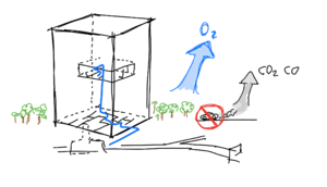 Indoor mapping and navigation (blue), 3D rendering, ecological modeling and sustainable transport modeling.

3D - Viewing, editing, further applications
Main article: 3D
Wish list:
- Wire-frame view, to be able to see inside / through buildings
- Camera viewport settings, adjust angle of view (see also: field of view, projection) (gif)
- An editor with 3D visualization and editing tools.
- Sunlight studies, realistic shadow rendering, reflections on skyscrapers, etc.
- Script to generate 3D snapshots cities to put on Wikipedia for every city (using Wikidata)
- would help identify cities which cities lack 3D OSM data, and would get more contributors from Wikipedia
- Build a partnership with Google to license their 3D imagery
- Circumvent Google by building our own publicly licensed 3D imagery
- Contract vendors to gather 3D data to be hosted on OSM
- Zooming out all the way should show a spherical earth instead of a flat projection.
- Virtual Reality / Augmented Reality
- VR/AR viewing
- VR/AR editing


Collaborative Urban Planning
Urban planning should be collaborative process, where development is determined by community needs. If there was a temporal dimension to OSM, we could not only accommodate historical maps, but also future maps, in the form of proposals. Specifically, grassroots, non-approved, community-led proposals. As opposed to the top-down proposals given to communities by the profiteers and gentrifiers who seek only to raise rents and profitability, which often leads to displacement and discontent in the community.
- ability to submit a proposal to be voted on by the community
- vote and comment on proposals from the community, architectural firms, planning bodies, etc.
- existing map contributions are aimed at improving the "as-built" dimension, OSM does not yet support "future plans" mapping.
- Proposals can be placed in a time-series at "sometime in the future"
- Similar to Open Historical Map, but in the future. An "Open Future Map"
- figure out which aspects of placemaking could be modeled in OSM

General Systems Modeling
Theoretically, all complex systems (environmental, economic, social, political) could be modeled and attached to geographical attributes on the map. This would allow users to contextualize themselves within those systems.
Building Information Modeling (BIM)
Wiki - The generation and management of digital representations of physical and functional characteristics of places.
Economic systems
- Industrial systems
- Who controls this facility? Who owns this facility? Where does the profit go?
- Business Process Models to visualize the flow of business inputs and outputs.
- inputs: suppliers (build supply chain network diagram based on connections)
- output:type = service, product, menu
- output:quantity = customers served over time, units produced over time,
- Labor conditions (wiki)
- How high are the wages?
- Above / below market rate
- Above / below living wage levels
- Working conditions?
- Relations to Production
- Do workers have collective bargaining power?
- is the workplace cooperatively owned?
- Is there precarious work at this workplace?
- What benefits are given?
- How high are the wages?
- Social systems
- Poverty maps to aid in poverty alleviation campaigns
- Food security to see which communities are at risk
- Map to identify our Third Places which have significant impact on our collective social experience
- Infrastructure, wiki
- Open Infrastructure Map, map, about,
- related: WikiProject Telecoms
- Democratic economic planning
- "Project Cybersyn for the 21st Century"
- According to the Good regulator theorem, we must build a 1:1 model of the economy if we can begin to attempt to control it. (democratic control, of course)
- Optimization: Automation of processes
Governance and law
- Legal Jurisdiction map
- Districts of elected officials
- Map OpenPolicy wiki policy ideas onto the relevant geographical elements
Epidemiological Network Mapping
Looking to build decision support systems for policy-making during the ongoing COVID-19 pandemic.
- Collaborative Disease Surveillance
- Disease Spread Modelling / Predictions
- Auto-classify areas based on risk of spread
- Traffic nexuses, throughput of people
Examples of related projects:
- 2014: West Africa Ebola Response by Humanitarian OSM
- 2019: COVID19

Further Description of System Modeling
System models are typically visualized as flow charts, diagrams, with states and logical pathways. Some useful concepts are explained by Graph Theory and Network Theory.
All that's required is to map entities/nodes onto physical geography, and build the proper visualizations and interactions. (eg. systems collapse as you zoom out, etc)
Potential Data Sources for System Modeling
Public records (financials, tax documents) are useful for mapping organizational structures, they indicate the flow of information and materials within an organization. Therefore, record compliance could be a primary target goal; for each entity, institution, workplace, how many records do we have access to?
FOIA requests apply to US Government institutions, muckrock is a popular example. This would be broader than FOIA, it'd encompass non-governmental organizations as well.
Social Impact
I'd love to find ways to use mapping technology to have social impact such as poverty alleviation or disaster response.
Timelapses
Main article: Timelapse videos
OSM has, as far as I can tell, two temporal dimensions:
- Changes to the real world over time
- Updates to the map over time (the map approaching the real world)
Both of these dimensions should be exportable and viewable as timelapses.
Head Hunting - Talent
We should try to find skilled workers who work in the proprietary mapping industry to encourage them to contribute some of their time to various OpenStreetMap projects.
| Name | Current company | Position | Link |
|---|---|---|---|
| Sophia Lin | Google Maps | Project Manager | https://www.linkedin.com/in/sophia-lin-89886028/ |
| Claire Barry | Google Maps | Lead Visual Designer for the Measurement UX team | clairebarry.com |
| Jesse Head | Google Maps | UX Designer | jessehead.co |
| Suzanne Pellican | Google Maps | Head of Design | https://www.linkedin.com/in/suzannepellican/ |
Is this legal? All of this data is publicly accessible through LinkedIn so I don't think I'm breaking any laws or anything.
We can also look for talent on freelancing sites such as Fiverr and UpWork.
Feature Requests:
Just some feature requests for various components in the OpenStreetMap ecosystem. I need to find ways to introduce these ideas into the correct channels for tracking such requests.
ID Editor
- Allow users to customize which layers to show
- ⚠️ BUG: "Layer" button doesn't work on Safari
- Simplify "Custom Background Settings"
- allow users to upload an image (without using an external URL)
- easily rearrange the image placement (without using the URL schema)
- why ? this would allow users to upload a floorplan and trace over it, adding to the Indoor mapping coverage
- In the "describe your changes" box, disable the suggestions from past entries. Rarely are entries repeated.
- User Experience studies to improve ease of use to increase frequency of contributions.
- 3D tilt / angle
- cmd+enter to submit an edit without needing to click the button with cursor
- Mobile Web Editing Capabilities
- Click on objects (especially location names) to view details in a sidebar or pop-up
Swappable UI components
To enable users to find and vote on the best UI components to build the optimal experience.
- Swappable Main browser
- Swappable search engine, since Nominatim is absolutely terrible
- Swap different UI / styles for results
- Swap different search engines entirely
- Wish list: Show wiki results in addition to map results
- Each editor needs a "view in other editor"
- quick link: submit feature requests to ID editor on github
Main browser
- Ability to click on elements to view data
- view data as a sidebar or a pop-over
- show an "edit" button on the data to improve the ease of editing (without entering the ID editor)
- Different themes; dark / light / color themes, like mapstyle for google maps
- Explode view to better visualize layers
- Show 3D
- Support 3D gestures
- Smooth scrolling: The map jerks at zoom intervals. I wish it was smooth like Mapbox or Google Maps.
- Allow users to zoom in farther to view more details.
- Thinking sidewalk granularity, for "placemaking" studies
- meta: how to send feedback?
- meta: a collaborative usersnap interface for sending feedback
UI Component Documentation
All UI components could link back to the wiki, which would allow us to see the github repos, make and submit code changes, and create issues and suggestions.
For example, the ID editor uses their discussion page to ask folks to submit bug reports to their github.
Pump Public Documents into OSM
to populate the map with data available in public records, land surveys, etc.
- this might need to be policy-driven, requiring government agencies to integrate with existing OSM APIs.
Social OSM
A proposed layer to comment on the map itself, to interact with other editors.
- Discussions about the map itself:
- "Can someone please add the courtyard? I don't know how to use multi-polygon feature"
- Discussions about how the map is visualized
- "I wish I could see the infrastructure, I'd like to report a plumbing problem"
- Discussions about the real world on the map
- "Who else wishes we had a sidewalk right here?"
Financing the community
Projects to donate to
I'd like to add a table of projects that I believe in that I'd like to donate to, to hopefully encourage others to donate to them as well.
| Project | Donation Link |
|---|---|
| OpenStreetMap | Donations |
| MediaWiki (powers this wiki) | link to Wikimedia Foundation |
| Go Map!! iPad app |
Bug Bounty / Feature Bounty
I propose we create crowdfunded bounties for bug fixes, as well as new feature development. This could be modeled after Monero's Community Crowdfunding Service (CCS) (link)