OSMaPaaralan - The big project for the time. Its goal is to map every public school an most corners of the country. Also part of the MapaTime initiative.
Participatory mapping and LGU decision support tools for Disaster Risk Reduction (DRR) - a disaster risk reduction pilot mapping project implemented to 3 municipalities in Pampanga for updating the LGU's basemaps using OpenStreetMap and InaSAFE. Implemented by the Environmental Science for Social Change and OSM-PH supported by WorldBank GFDRR. Implementation period: May - December 2013. See project brochure and WB-GFDRR's publication.
Swiss Red Cross and PRC mapping in Busuanga
OpenRoads
Luzon road and waterway remote mapping - Implementation period: May 2014.
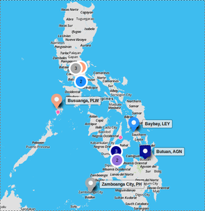
Crowd-sourced Mapping Worshops by The Asia Foundation - Conducted in Tagbilaran, Iloilo City, Butuan, Dumaguete.