Key:monitoring:water_level
 |
| Description |
|---|
| Monitoring station for level of rivers |
| Group: man made |
| Used on these elements |
| Requires |
| Useful combination |
| See also |
| Status: de facto |
| Tools for this tag |
|
Used in combination with man_made=monitoring_station to indicate water levels in rivers, streams, lakes and other non-tidal areas, often to determine upstream flood levels during heavy rains.
Useful combination
man_made=monitoring_station(mandatory)monitoring:water_level=yes(mandatory)
monitoring:water_level:zero=###.##(Gauge datum in meter.centimeter above mean sea level)display:analog=yesdisplay:digital=yesrecording:manually=yesrecording:automated=yesrecording:remote=yesname=*ref=*operator=*
Examples
-
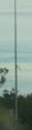
 Ilmpegel Ilmenau
 -
 Rheinpegel Maxau bei Karlsruhe
 -
-
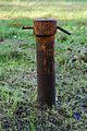 A piezometer in France


See also
seamark:type=signal_station_warninghistoric=highwater markA flood mark is a point that represents the recorded maximum of water table.historic=flood_mark