Delaware Valley Regional Planning Commission
The Delaware Valley Regional Planning Commission (DVRPC) is the federally designated Metropolitan Planning Organization for the Greater Philadelphia region, established by an Interstate Compact between the Commonwealth of Pennsylvania and the State of New Jersey. Members include:
Pennsylvania:
- Bucks County
- Chester County
- Delaware County
- Montgomery County
- Philadelphia County
- City of Chester
New Jersey:
- Burlington County
- Camden County
- Gloucester County
- Mercer County
- City of Camden
- City of Trenton
Orthoimagery
DVRPC offers two types of aerial imagery; orthoimagery and historical aerial imagery. Orthoimagery is available in a five-year increments.
Pennsylvania Spatial Data Access (PASDA) has made a web service online for the DVRPC 2020 orthoimagery, more details can be found here: DVRPC 2020 Digital Orthoimagery - County Mosaics.
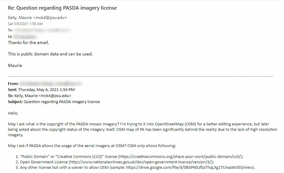
According to PASDA Director Maurie C. Kelly, the data hosted at PASDA is public domain and can be used by OpenStreetMap without hassle. A proof has been obtained and uploaded to the OpenStreetMap Wiki. 
Usage
If you wish to use this imagery out of iD, please follow the instruction at https://github.com/osmlab/editor-layer-index.