ES:Educación
Usando OpenStreetMap en Educación
- Para informacion sobre recursos académicos relacionados con OpenStreetMap, véase Research.
- Para articulo general sobre Openstreetmap en la educación., véase Education features.

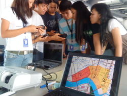
OpenStreetMap se está usando en las escuelas, universidades y colegios en un aplio rango de disciplinas. OSM es relevante en la educación de geografía, matemáticas, ecología, planes de comunidades, gobiernos e información tecnológica. Algunos educadores usan los datos existentes en Openstreetmap en sus clase, mientras que otros contribuyen con nuevas aportaciones. En el proceso de uso de OpenstreetMap y la contribución con nuevos datos, los estudiantes desarrollan conocimientos de información tecnológica (necesarios para el procesado de los datos) y obtienen valiosos conocimientos en el campo de los SIG, la planificación y el desarrollo en comunidad.
Active Projects for Education 2014
- Resources and activities related to Geography Awareness Week 2014 are on the GeographyAwarenessWeek page.
- Members of MappingDC have been working with local community development organizations to help train young adults in mapping landmarks in their community. Details on the Georgia_Avenue_Youth_Ambassadors_Mapping_Project page.
- As of April 2014, there is a TeachOSM repository of information for educators about how to map in OpenStreetMap.(See below on how to contribute)
- Since 2012, students of GEO109: Digital Mapping at the University of Kentucky have helped map various hometowns across Kentucky and surrounding states.
Older Projects pre-2014 (may be active)
- 2011-2013 - The Comenius project, part of the Comenius program for Life Long Learning of the European Union EU, initiated a program involving OpenStreetMap in 2011, titled "To boost local and international tourism with OpenStreetMap" (BoostOSM). Students from Portugal, Slovenia, Romania, Turkey and Germany are improving the map and advertising the idea of OpenStreetMap in their communities.
- At the Karacabey İMKB Technical and Vocational High School in Turkey, which takes part in the Comenius Project, students learn how to map and do GPS tracking. The school's work was selected to be shown as the Image of the Week on the main page of the OSM wiki. Comenius - Karacabey,Turkey
- French mapping company GéoBretagne uses OpenStreetMap while working with high schools to contribute data to the project. FR:ProjetLyceesBretagne#Animation_OpenstreetMap-G.C3.A9oBretagne-Lyc.C3.A9es Projet Lycees Betagne
- Luxemborg high school students used data from Map Kibera (www.mapkibera.org), a project to map marginalized communities in Kenya, in their GIS course. Luxembourg Students Make Maps with Kibera
- In April 2012, students enrolled in The Ohio State University's Geography 607: Fundamentals of GIS course contributed a variety of local points of interest both around the OSU campus in Columbus and in small towns throughout Ohio.
- RGS Geography Ambassadors (9th November 2011) - Sam Larsen spoke to students about geography as a discipline and as a career, then took them on an OSM practical exercise in adding their houses to OSM.
- University College London (UCL) Masters student mapping event Sept 2010 - Students at the UCL Department of Civil, Environmental and Geomatic Engineering who are taking the MSc in GIS had a mapping event as part of their induction week in September 2010. The activity was carried out over two days. On the first day the students used Walking Papers, an easy-to-use method to capture geographical data, to acquire information locally, and on the second day they digitized the information. The activity was designed to introduce students to the concepts of mapping, digitizing and working together. The mapping event was organized in collaboration with the local OSM community.
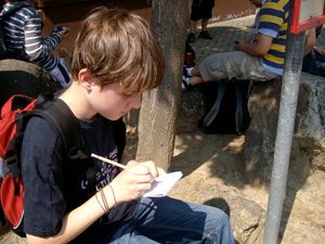
- Ruth James (Sustrans Bike-It officer) and Anna Fairhurst (primary ICT advisor for Swindon Borough Council) in Swindon, UK, have been working with an OSM project for primary schoolchildren. The kids have surveyed their local area in order to create a cycle map of safe routes to school, which is then used to promote cycling to school.
- In April 2009, students at UC Merced enrolled in History 109: Topics in the History of Science and Technology- Spatial Representation and The History of Cartography with Professor Ruth Mostern will participate in an OSM education project. See Education Merced to learn more about what Merced students are contributing.
- Students at San Francisco State University enrolled in Locative Studio course in the Conceptual Information Arts (CIA) Program with Professor Paula Levine participated in the OSM education project in February 2009. See Education SFSU to learn more about what SFSU students are contributing.
- Randal Hale and Leah Keith presented their experiences of "OpenStreetMap used in a High School Environment" (slides) at State Of The Map U.S. 2010. Chattanooga, U.S.
Research
OpenStreetMap is being used in many academic research projects around the world.
The OpenStreetMap Curriculum
OpenStreetMap is working to create a curriculum for educators that is focused on introducing mapping, open-source technologies, crowd sourcing and community activities.
|
This Curriculum documentation project is very unfinished. |
Audience
Currently, the curriculum is geared toward university-level students, but it is available for download and improvement by any interested educator or student.
Benefits to students

By participating in OpenStreetMap, students will be introduced to basic concepts of mapping and geography. The curriculum's lessons focus on teaching students how to collect, edit and contribute map data to OpenStreetMap. This allows them to observe the correlations between physical geography of the world and the lines on the map. Students will gain a greater appreciation for maps because they will have the ability to contribute, change and use OSM in their own way. The chance to find errors and fix them on the spot creates a sense of contribution and ownership in the OSM map project and community.
Benefits for educators
OpenStreetMap is a real world project that your students participation can make a lasting impact on. Students become a part of a multi-cultural, global community that they can both learn from, as well as contribute to. Since OSM is open, not only the map and all its data, but curriculum linked here is available for you to use, change and re-distribute for free.
Curriculum
The curriculum is broken into 4 major units:
State of Mapping: This unit looks at why maps are important, investigating historical and present uses. It addresses mapping on the web, looking at how the internet has changed the way we view, use and interact with maps. It looks at how accessible map data is and how people are collecting, using and sharing map data. Students are introduced to GPS, what it is, how it works, and where they can find and use it.
Crowd Sourcing: In the Crowd Sourcing unit, students will investigate what crowd sourcing is, looking at how these communities develop, interact and evolve. Students will be introduced to open source technologies and philosophies. OpenStreetMap will act as the primary case study for investigation into the crowd sourcing movement.
Introduction to OpenStreetMap: This unit is an introduction to OpenStreetMap. It focuses on how to contribute and edit in OSM. The activities teach students how to head out in their local neighborhoods and map using paper maps as well as GPS units. This unit describes how to edit in OSM's online editor Potlatch, as well as its desktop editor JOSM.
Integrating OpenStreetMap: In this unit students take OSM a step further and learn methods for using OSM data for their own personal projects. Students will look at how to filter OSM data for specific use cases, as well as how to overlay other data. This unit was created with the help of Alex Mandel of OSGeo
License
All curriculum documents are licensed with a Creative Commons Attribution, Share-alike 2.0 license
How do I get Involved?
- Review the Hackpad notes from the TeachOSM birds-of-a-feather session from the State of the Map US conference in April 2014.
- To contribute to TeachOSM, follow Robert Soden's instructions on the GitHub repository.
- Join the TeachOSM mailing list...
- ...and add your name to the list below if you'd like to work on issues related to OpenStreetMap in education:
See also
- OpenStreetMap and Home Education
- RGS Geography Ambassadors
- Jeff Meyer's 2013 presentation on using OpenStreetMap in the K-12 setting.
External links
- UMapper's GeoDart, a geography trivia game that allows you to play and create your own map based game. [1]
- Strange Maps Blog: Great resource for unique maps.
- ScribbleMaps, great for students since it does not require registration, simple to use interface [2]
- In the United Kingdom, Find a Geography Ambassador - Some geography ambassadors are able to help out with OSM editing sessions
- Geospatial learning in primary schools - using One Laptop Per child and OSM