Education Merced
This page is for contributions from students, faculty and anyone interested in Mapping at UC Merced. The first contributors are students enrolled in History 109: Topics in the History of Science and Technology- Spatial Representation and The History of Cartography in the with Professor Ruth Mostern.
Merced map
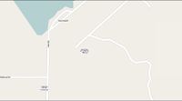
Here is the current UC Merced Map [map]
Screen Shot (mapnik) of UC Merced Map as of April 17, 2009:

Screen Shot of UC Merced Map
Assignment
1. Map UC Merced and provide Prof Mostern with a before and after screen shot of your efforts.
2. Create your own map using the CloudMade style editor.
Mapping Party
Join us on Thursday April 23rd from 10am to 3pm for a campus mapping party. We will be in COB 3rd Floor Atrium (turn left when you get off the elevators). We will have GPS units available to use throughout the day. Lets help make UC Merced a model campus.
Resources
Beginners Guide with Online video tutorials
Mailing Lists: New User list, United States list, Global list (some of these lists have very high traffic so you may want to filter them in your inbox)
User Groups: United States User Group
Special Projects: OpenCycleMap, OpenPisteMap, and more under Mapping Projects
OSM Mapper can be used to track recent updates to the map.
Notes can be used to mark spots on the map that need fixed.
Downloads are available are available for various states across the US. You can find them [here]
Introduction to OSM
User: Sarah M will present an introduction to OpenStreetMap on to the April 22nd, 2009. You can view and download her presentation on slide share here: http://www.slideshare.net/Sarah_Manley/intro-to-openstreetmap-uc-merced-42209