FR:Featured images/Oct-Dec 2013
< FR:Featured images(Redirected from FR:Featured Images/Oct-Dec 2013)
Jump to navigation
Jump to search

Voici quelques images remarquables, ce qui veut dire qu’elles ont été sélectionnées comme étant parmi les meilleurs exemples de cartographie basée sur les données d’OpenStreetMap, ou qu’elles apportent une illustration utile du projet OpenStreetmap.
Si vous avez une image répondant à cette définition, vous pouvez la proposer sur la page des Propositions d’image remarquable (en).
| ← d’octobre à décembre 2012 | ← de juillet à septembre 2013 | de janvier à mars 2014 → | d’octobre à décembre 2014 → |
Galerie des images remarquables d’octobre à décembre 2013
2013, semaine 40
2013, semaine 41

2013, semaine 42
2013, semaine 43
2013, semaine 44
2013, semaine 45
2013, semaine 46

2013, semaine 47
2013, semaine 48
2013, semaine 49

2013, semaine 50
2013, semaine 51

2013, semaine 52
Détails et descriptions
Semaine 40 (du lundi 30 septembre 2013 au dimanche 6 octobre 2013) [Edit]

- English : The new "Humanitarian" style (also available on osm.org) offers a new window on OpenStreetMap data. This new style focuses on the needs of the HOT work, for example water and sanitation, road quality, fire hydrants, electricity network, street lights, or social facilities.
Semaine 41 (du lundi 7 octobre 2013 au dimanche 13 octobre 2013) [Edit]

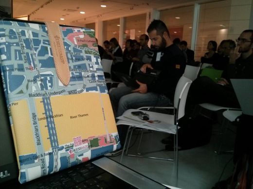
- English : A leather iPad cover with an OpenStreetMap design on show at OSMit conference last weekend. The creators dressmap.it have more pictures on their site
Semaine 42 (du lundi 14 octobre 2013 au dimanche 20 octobre 2013) [Edit]

- English : State of the Map Scotland 2013 took place last weekend in Edinburgh
Semaine 43 (du lundi 21 octobre 2013 au dimanche 27 octobre 2013) [Edit]

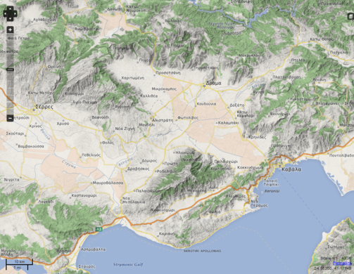
- English : A map rendering with hillshading by OpenMapSurfer – shown here: openmapsurfer "OSM Roads (new)" with "ASTER GDEM & SRTM Hillshade (experimental)" (Greece).
Semaine 44 (du lundi 28 octobre 2013 au dimanche 3 novembre 2013) [Edit]

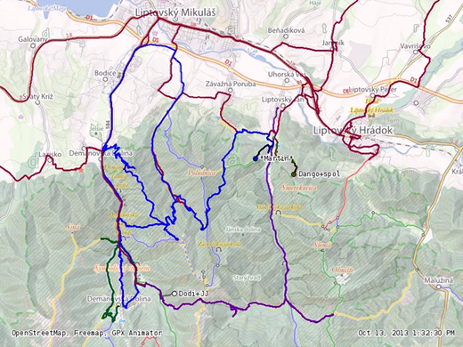
- English : A mapping party in Low Tatras (Slovakia) took place on 12th and 13th October 2013 whose main objective was to add missing hiking and bicycle trails to the OSM data. The video shows a time-lapse animation of the participants' GPS traces.
Semaine 45 (du lundi 4 novembre 2013 au dimanche 10 novembre 2013) [Edit]

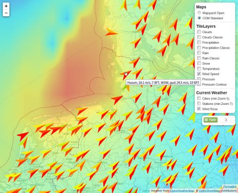
- English : Wind speeds and directions of storm Christian at 28th October 2013 in Northwest Germany overlaid on an OSM base map. The leaflet-openweathermap JavaScript library shows free OpenWeatherMap data in a slippy map. View this layer on a demo service!
Semaine 46 (du lundi 11 novembre 2013 au dimanche 17 novembre 2013) [Edit]

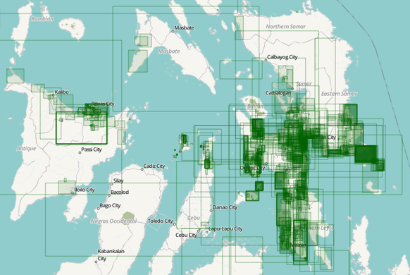
- English : Typhoon Haiyan editing activity visualised. Pascal Neis analysed changesets in the Philippines and Vietnam. In his blog post he reports that we had contributions from 245 different people by Sunday evening, all helping to improve our map data which is being used by aid organisations and crisis responders. OSM contributors, thank you and keep up the good work!
- français : Activité sur la cartographie de la zone du Typhoon Haiyan. Pascal Neis a créé une page sur les modifications sur les Philippines et le Vietnam. Sur blog il est signalé qu'il y a déjà 245 personnes différentes qui ont contribué en date du dimanche, Ces améliorations cartographiques sont dès à présent utilisé par les ONG et services de secours sur le terrain. OSM contributeurs, merci et continuez!
Semaine 47 (du lundi 18 novembre 2013 au dimanche 24 novembre 2013) [Edit]

- English : Every Line Ever in San Francisco! “OpenStreetMap: Every Line Ever, Every Point Ever” is an artistic experiment in drawing every version of every point or line feature that ever existed in the OSM database. Read more info and explore the slippy map of San Francisco or London.
Semaine 48 (du lundi 25 novembre 2013 au dimanche 1 décembre 2013) [Edit]

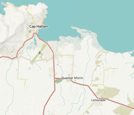
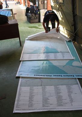
- English : Large OSM-based poster maps of Tacloban, Guiuan and Ormoc printed and delivered by International Organization on Migration in DSWD Operations Center in Tacloban Airport. The maps will be used to coordinate the relief and rescue efforts for the victims/survivors of Typhoon Haiyan.
- français : Cartes OSM format Poster de Tacloban, Guiuan et Ormoc imprimées et livrées par l'Organisation internationale pour les migrations (IOM) au Centre des opérations DSWD à l'aéroport de Tacloban. Les cartes seront utilisées pour coordonner les secours et le sauvetage pour les victimes / survivants du typhon Haiyan.
Semaine 49 (du lundi 2 décembre 2013 au dimanche 8 décembre 2013) [Edit]

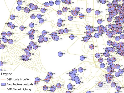
- English : Linking UK Food Hygiene Rating System data (licensed under the Open Government License) to OSM highways. This is a potentially rich set of address and other data for OSM. Records are located to postcode centroid but contain full addresses. This image shows an intermediate step in assigning the postcodes to an individual named road. Work done at London Hack Weekend last weekend.
Semaine 50 (du lundi 9 décembre 2013 au dimanche 15 décembre 2013) [Edit]

- English : A colourful artistic map of Lille (France) with its characteristic star-shaped citadel, made using OpenStreetMap data and QGIS as described in the tutorial here.
- français : Une représentation artistique colorée de la ville de Lille avec sa citadelle caractéristique en forme d'étoile, faite à partir des données OpenStreetMap et QGIS comme expliqué dans ce tutoriel
Semaine 51 (du lundi 16 décembre 2013 au dimanche 22 décembre 2013) [Edit]

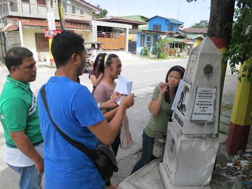
- English : During an disaster risk reduction OSM training held November 2013 in Guagua (Pampanga, Philippines) the participants were divided into groups and did a field survey in various parts of the town. Shown in the photo is the Betis group taking down notes beside a Death March trail historical marker
 Death March trail historical marker.
 - français : Pendant un entrainement OpenStreetMap pour la réduction des risques en cas de catastrophe tenue en novembre 2013 à Guagua (Pampanga, Philippines), les participants étaient divisés en plusieurs groupes et ont effectué une reconnaissance sur le terrain dans plusieurs quartiers de la ville. La photo montre le groupe s'occupant de Betis qui prend des notes face à un mémorial de la Marche de la Mort mémorial de la Marche de la Mort.
Semaine 52 (du lundi 23 décembre 2013 au dimanche 29 décembre 2013) [Edit]

- English : OpenStreetMappy Xmas to all our contributors and users!
Festive biscuits at the OpenStreetMap Christmas Party in London