File:2014 Natori mapping event.jpg
Jump to navigation
Jump to search


Size of this preview: 800 × 600 pixels. Other resolutions: 320 × 240 pixels | 640 × 480 pixels | 1,000 × 750 pixels.
Original file (1,000 × 750 pixels, file size: 241 KB, MIME type: image/jpeg)
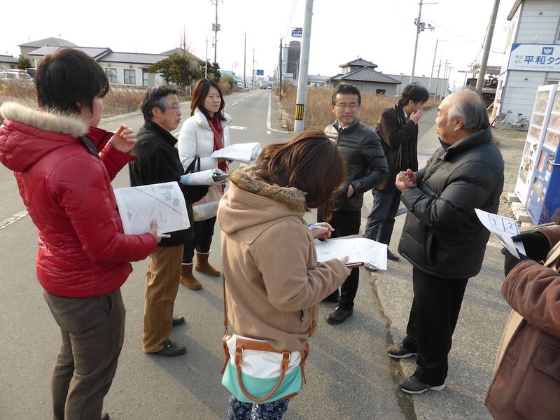
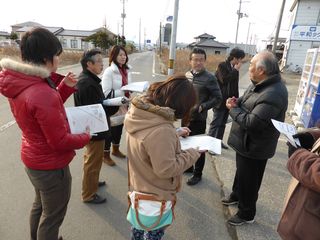
Photo taken on Natori, Yuriage district Mapping Party for reseaching 2011 Japan Tsunami Disastered Area.
Aims of this mapping party are following. to map remaining buildings & path. -> collect on OSM to share memory & story -> collect on localwiki
Lisence is CC BY 3.0 unported. Original post is here. Natori.localwiki.jp
This is a Featured image, which means that it has been identified as one of the best examples of OpenStreetMap mapping, or that it provides a useful illustration of the OpenStreetMap project. If you know another image of similar quality, you can nominate it on Featured image proposals.
Front-page image for week 26 of 2014 (23–29 Jun.).
- Image descriptions
- English : This event in Natori, Japan, was an OpenStreetMap mapping party as part of a LocalWiki initiative to describe city neighbourhoods, and promote community building in an area struck by the 2011 tsunami. Read more on the localwiki blog
- italiano : Questo evento a Natori, in Giappone, è stato un mapping party di OpenStreetMap nell'ambito di un'iniziativa di LocalWiki per descrivere i quartieri della città e promuovere la costruzione di una comunità in un'area colpita dallo tsunami del 2011. Leggi tutto sul blog di localwiki (in inglese).
- русский : Очередная картовечеринка прошла в японском городе Натори, её организовали в рамках проекта Локал-вики. Целями проведения мероприятия было улучшение карты на пострадавшей от цунами территории и укрепление местного сообщества.
- 中文(繁體) : 這次在日本名取市的開放街圖 Mapping Party,屬於描述在地社區的在地維基 (Localwiki) 起始行動,幫助振興受到 2011 年海嘯影響的地方。更多資訊可以看 localwiki 部落格。
File history
Click on a date/time to view the file as it appeared at that time.
| Date/Time | Thumbnail | Dimensions | User | Comment | |
|---|---|---|---|---|---|
| current | 06:09, 23 June 2014 | | 1,000 × 750 (241 KB) | Nyampire (talk | contribs) | Photo taken on Natori, Yuriage district Mapping Party for reseaching 2011 Japan Tsunami Disastered Area. Aims of this mapping party are following. to map remaining buildings & path. -> collect on OSM to share memory & story -> collect on localwiki Li... |
You cannot overwrite this file.
File usage
The following 18 pages use this file:
- Cs:Přidejte se ke komunitě
- Fa:Join the community
- Featured images/Apr-Jun 2014
- Join the community
- List of featured images/2014
- Sv:Join the community
- Uk:Приєднуйтесь до спільноти
- Zh-hant:加入社群
- Talk:Featured images/Jul-Sep 2014
- Template:Iotw image/2014-26
- DE:Featured images/Apr-Jun 2014
- FR:Featured images/Apr-Jun 2014
- ES:Unirse a la comunidad
- IT:Featured images/Apr-Jun 2014
- NL:Beginners Guide 1.0
- NL:Join the community
- RU:Присоединяйтесь к сообществу
- JA:コミュニティに参加する