File:Br-classificacao-osorio-rs-plano-diretor.jpg
Jump to navigation
Jump to search

Size of this preview: 800 × 570 pixels. Other resolutions: 320 × 228 pixels | 640 × 456 pixels | 1,024 × 729 pixels.
Original file (1,024 × 729 pixels, file size: 151 KB, MIME type: image/jpeg)
Summary
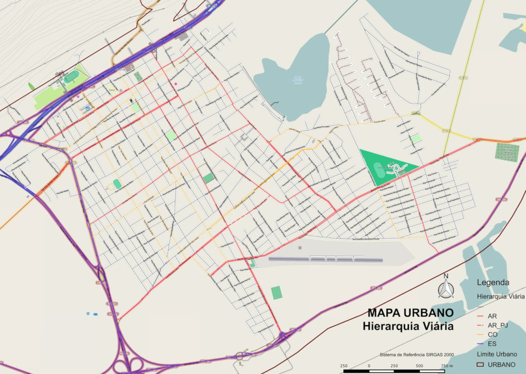
Classificação oficial segundo o plano de mobilidade, publicada em 10 de abril de 2015.
Disponível oficialmente no site da Prefeitura em Leis municipais > Decreto 80/2015 > Anexo II: Hierarquia viária.
Licensing
| Contains map data © OpenStreetMap contributors, made available under the terms of the Open Database License (ODbL).
The ODbL does not require any particular license for maps produced from ODbL data, produced maps may be subject also to other licences. |
File history
Click on a date/time to view the file as it appeared at that time.
| Date/Time | Thumbnail | Dimensions | User | Comment | |
|---|---|---|---|---|---|
| current | 12:42, 3 January 2021 | | 1,024 × 729 (151 KB) | Ftrebien (talk | contribs) | Classificação oficial segundo o plano de mobilidade, publicada em 10 de abril de 2015. Disponível oficialmente no site da [https://osorio.atende.net/ Prefeitura] em [https://leismunicipais.com.br/prefeitura/rs/osorio Leis municipais] > [https://leismunicipais.com.br/a1/rs/o/osorio/decreto/2015/8/80/decreto-n-80-2015-institui-o-plano-municipal-de-mobilidade-urbana-de-osorio-em-regulamentacao-ao-capitulo-iv-do-plano-diretor-de-desenvolvimento-municipal-lei-n-3902-2006-e-da-outras-providencias... |
You cannot overwrite this file.
File usage
The following page uses this file: