File:Cartopartie-questembert.jpg
Jump to navigation
Jump to search


Size of this preview: 800 × 600 pixels. Other resolutions: 320 × 240 pixels | 640 × 480 pixels | 1,024 × 768 pixels | 1,280 × 960 pixels | 2,560 × 1,920 pixels | 3,264 × 2,448 pixels.
Original file (3,264 × 2,448 pixels, file size: 1.74 MB, MIME type: image/jpeg)
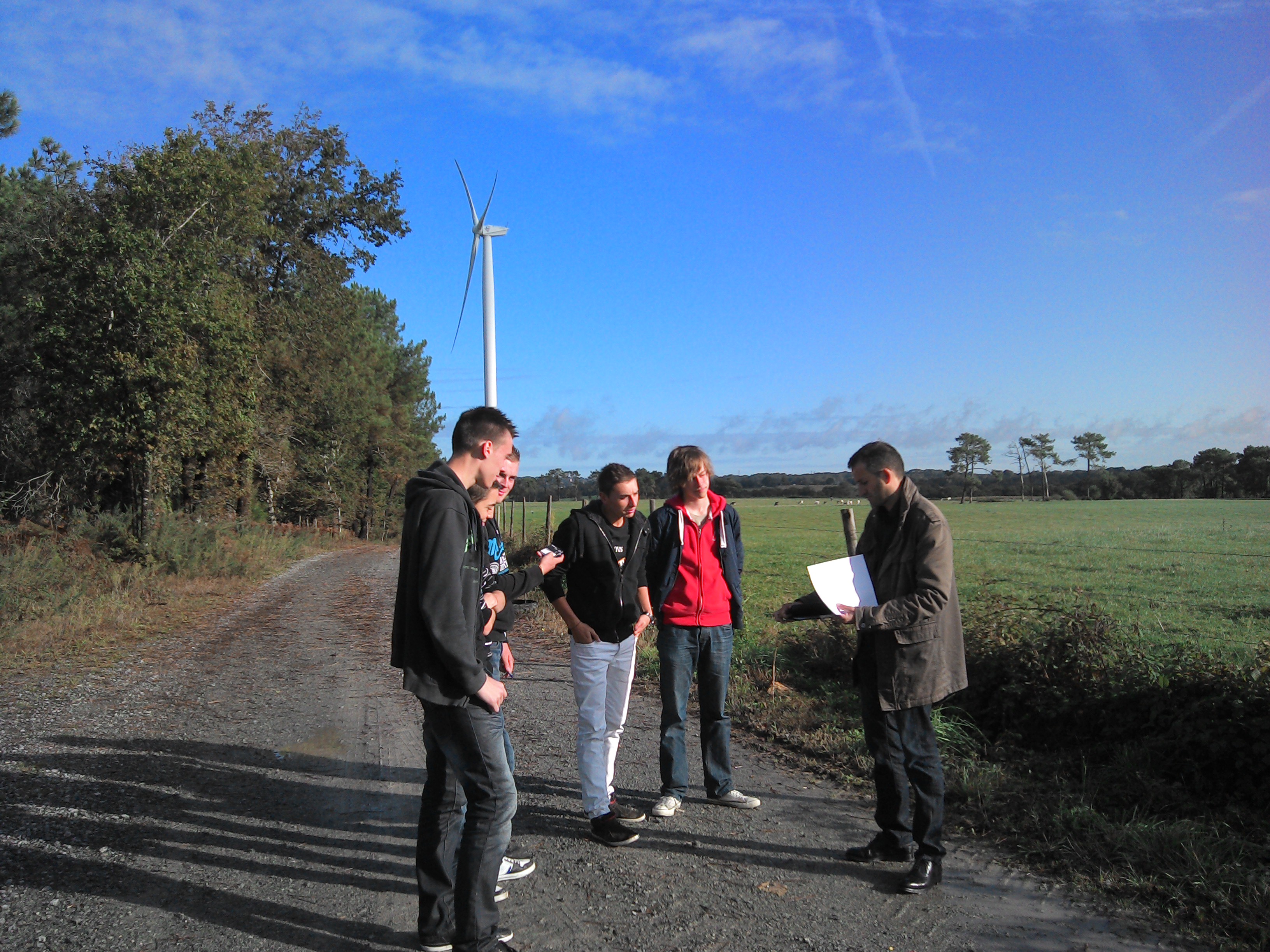
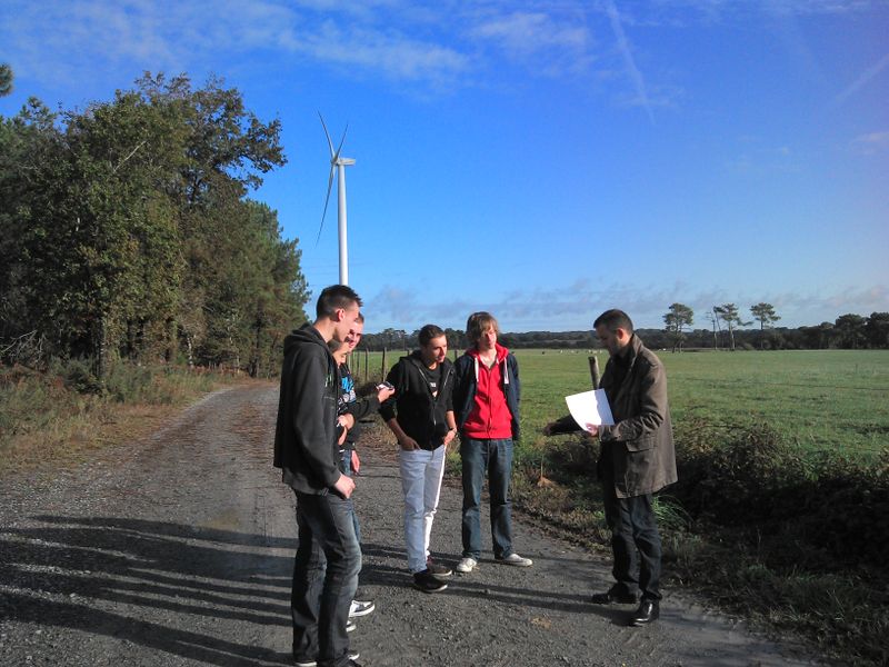
Cartopartie sur le site éolien de Questembert avec la classe de 1ère Topo du Lycée Marcelin Berthelot
This is a Featured image, which means that it has been identified as one of the best examples of OpenStreetMap mapping, or that it provides a useful illustration of the OpenStreetMap project. If you know another image of similar quality, you can nominate it on Featured image proposals.
Front-page image for week 5 of 2013 (28 Jan. – 3 Feb.).
- Image descriptions
- Deutsch : Die französische Kartografiefirma GéoBretagne nutz Openstreetmap und arbeitet mit Gymnasien zusammen, um Daten zum Projekt beizutragen. Hier sieht man wie Lehrer und Schüler gemeinsam in Lauzach die exakten Positionen der Windkraftanlagen und deren Zufahrtswege erfassen.
- English : French mapping company GéoBretagne use OpenStreetMap and are working with high schools to contribute data to the project. Here we see teachers and students mapping the exact coordinates of Lauzach wind turbines and their access roads.
- français : La compagnie de cartographie française GéoBretagne utilise OpenStreetMap et travaillent avec des lycées afin d'ajouter des données au projet. On voit ici les enseignants et les étudiants cartographiant les coordonnées exactes des éoliennes de Lauzach, ainsi que leur chemins d'accès.
- italiano : L'azienda francese GéoBretagne, che si occupa di mappe, usa OpenStreetMap e lavora con le scuole superiori per aggiungere dati al progetto. Qui si possono vedere insegnati e studenti che mappano le coordinate esatte di alcune pale eoliche a Lauzach e le loro strade di accesso.
- 中文(简体) : 法国地图公司GéoBretagne 使用开放街图资料,并且与中学合作贡献资料。这边我们看到老师和学生协调,绘制洛扎克一带的风机,以及连接道路。
- 中文(繁體) : 法國地圖公司 GéoBretagne 使用開放街圖資料,並且與中學合作貢獻資料。這邊我們看到老師和學生協調,繪製洛扎克一帶的風機,以及連接道路。
File history
Click on a date/time to view the file as it appeared at that time.
| Date/Time | Thumbnail | Dimensions | User | Comment | |
|---|---|---|---|---|---|
| current | 14:13, 9 November 2012 | | 3,264 × 2,448 (1.74 MB) | Emivi (talk | contribs) | Cartopartie sur le site éolien de Questembert avec la classe de 1ère Topo du Lycée Marcelin Berthelot |
You cannot overwrite this file.
File usage
The following 8 pages use this file: