File:Chile 20100227 earthquake epicentres with imagery boundary.png
Jump to navigation
Jump to search

No higher resolution available.
Chile_20100227_earthquake_epicentres_with_imagery_boundary.png (473 × 544 pixels, file size: 105 KB, MIME type: image/png)
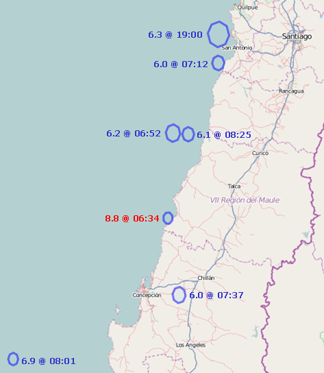
screenshot of potlatch rendering of 418723![]() 418723. Placed in public domain by author; actual copyright status may differ. Only epicentres for events of >6 magnitude have been mapped.
418723. Placed in public domain by author; actual copyright status may differ. Only epicentres for events of >6 magnitude have been mapped.
File history
Click on a date/time to view the file as it appeared at that time.
| Date/Time | Thumbnail | Dimensions | User | Comment | |
|---|---|---|---|---|---|
| current | 12:51, 28 February 2010 | | 473 × 544 (105 KB) | Ceyockey (talk | contribs) | imagery boundary removed -- leaving only annotated epicentres |
| 01:02, 28 February 2010 | 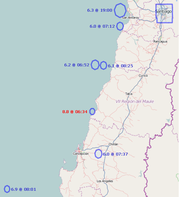 | 569 × 627 (149 KB) | Ceyockey (talk | contribs) | revised to increase font size for readability | |
| 00:57, 28 February 2010 | 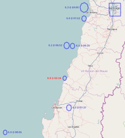 | 426 × 470 (67 KB) | Ceyockey (talk | contribs) | annotations added to image showing magnitudes and times | |
| 00:43, 28 February 2010 | 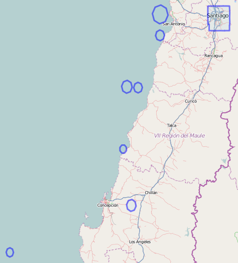 | 474 × 523 (70 KB) | Ceyockey (talk | contribs) | updated for 6.3 aftershock at 19:00 UTC 27 Feb 2010 | |
| 16:34, 27 February 2010 | 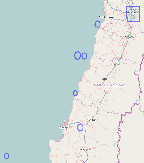 | 473 × 534 (70 KB) | Ceyockey (talk | contribs) | updated to show only >6 magnitude aftershocks | |
| 15:18, 27 February 2010 | 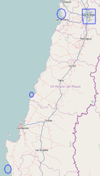 | 332 × 585 (72 KB) | Ceyockey (talk | contribs) | screenshot of potlatch rendering of {{relation|418723}}. Placed in public domain by author; actual copyright status may differ. |
You cannot overwrite this file.
File usage
The following 3 pages use this file: