File:Grenoble.png
Jump to navigation
Jump to search


Size of this preview: 703 × 600 pixels. Other resolutions: 281 × 240 pixels | 563 × 480 pixels | 900 × 768 pixels | 1,200 × 1,024 pixels | 1,719 × 1,467 pixels.
Original file (1,719 × 1,467 pixels, file size: 1.89 MB, MIME type: image/png)
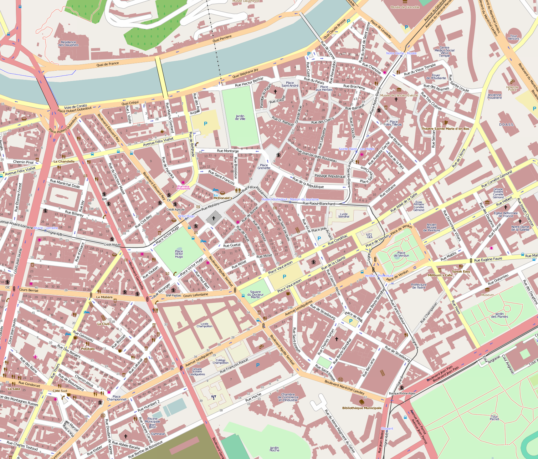
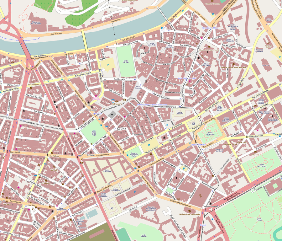
Heart of Grenoble, mapped frome the cadastre. Hight resolution mapping.
Licensing
![]()
![]()
![]()
This screenshot contains OpenStreetMap Carto rendering.
The OpenStreetMap Carto map style is made available under the Creative Commons CC-0 1.0 Universal Public Domain Dedication.
- Attribution to the map data:
![]()
Contains map data © OpenStreetMap contributors, made available under the terms of the Creative Commons Attribution-ShareAlike 2.0 (CC-BY-SA-2.0).
This is a Featured image, which means that it has been identified as one of the best examples of OpenStreetMap mapping, or that it provides a useful illustration of the OpenStreetMap project. If you know another image of similar quality, you can nominate it on Featured image proposals.
Front-page image for week 46 of 2009 (9–15 Nov.).
- Image descriptions
- Deutsch : Eine hochaufgelöste Karte von Grenoble auf Grundlage der französischen Kataster-Daten
- English : High density, high resolution mapping of Grenoble, mapped from the French Cadastre
- français : Carte à haute densité et haute résolution de Grenoble, cartographiée depuis le Cadastre français
- italiano : Mappatura ad alta densità, in alta risoluzione della città di Grenoble, realizzata tramite il catasto francese
- magyar : Grenoble nagy sűrűségű, nagy felbontású térképe, feltérképezve a francia kataszterből
- Nederlands : Grenoble is goed in kaart gebracht, de bron is het Franse Kadaster.
- polski : Mapowanie w wysokiej rozdzielczości, dokładności i gęstości w Grenoble w oparciu o francuski Kataster.
- suomi : Grenoblen kaupunki Ranskassa on piirretty kartalle tarkasti, ja kattavasti, Ranskan maarekisteristä, jonka käyttöön on saatu lupa.
- русский : Создание карты Гренобля с высокой точностью и плотностью зданий, на основе французского кадастра.
File history
Click on a date/time to view the file as it appeared at that time.
| Date/Time | Thumbnail | Dimensions | User | Comment | |
|---|---|---|---|---|---|
| current | 13:21, 24 August 2009 | | 1,719 × 1,467 (1.89 MB) | FrViPofm (talk | contribs) | Heart of Grenoble, mapped frome the cadastre. Hight resolution mapping. Category:Image from Mapnik |
You cannot overwrite this file.