File:N255.jpg
Jump to navigation
Jump to search


Size of this preview: 600 × 600 pixels. Other resolutions: 240 × 240 pixels | 480 × 480 pixels | 682 × 682 pixels.
Original file (682 × 682 pixels, file size: 291 KB, MIME type: image/jpeg)
Summary
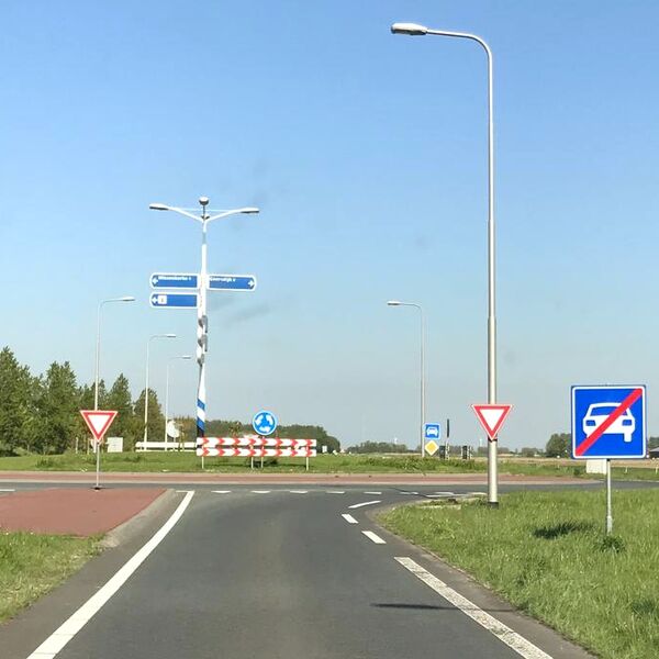
N255 at Wissenkerke, The Netherlands. Example of interruption in motorroad status to be tagged as highway=trunk + motorroad=no according to The Netherlands road tagging guidelines.
Licensing
![]()
This file comes from Mapillary, a service for sharing geotagged photos. All photos are under a CC BY-SA 4.0 license meaning the individual photographer must be credited for each image.
This template does not indicate the copyright status of the attached work. A normal copyright template is still required, typically it will be {{CC-BY-SA-4.0|HERE PUT NAME OF IMAGE AUTHOR}}.
This template does not indicate the copyright status of the attached work. A normal copyright template is still required, typically it will be {{CC-BY-SA-4.0|HERE PUT NAME OF IMAGE AUTHOR}}.
![]()
![]()
![]()
This work is licensed under the Creative Commons Attribution-ShareAlike 4.0 License.
Attribution: elton4711
Attribution: elton4711
Edited photo. Original photo published on Mapillary: user elton4711, 4 May 2018, https://www.mapillary.com/app/?lat=51.576546150804404&lng=3.7564713349054273&z=17&pKey=vXK2lU43dGSYIco4VVp6og&focus=photo
File history
Click on a date/time to view the file as it appeared at that time.
| Date/Time | Thumbnail | Dimensions | User | Comment | |
|---|---|---|---|---|---|
| current | 13:23, 18 May 2021 | | 682 × 682 (291 KB) | JeroenvanderGun (talk | contribs) | N255 bij Wissenkerke. Voorbeeld van onderbreking in autowegstatus die als highway=trunk motorroad=no getagd wordt. Bewerkte foto. Oorspronkelijke foto gepubliceerd op Mapillary: gebruiker elton4711, 4 mei 2018 13:16, https://www.mapillary.com/app/?lat=51.576546150804404&lng=3.7564713349054273&z=17&pKey=vXK2lU43dGSYIco4VVp6og&focus=photo |
You cannot overwrite this file.
File usage
The following 2 pages use this file: