File:Numeri civici 2016.jpg
Jump to navigation
Jump to search

No higher resolution available.
Numeri_civici_2016.jpg (672 × 427 pixels, file size: 25 KB, MIME type: image/jpeg)
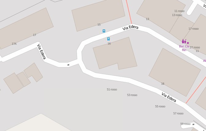
Mappatura dei numeri civici; presente nell'esempio sia l'esponente (la lettera dopo il numero) che i numeri rossi (presenti almeno a Genova e Firenze)
Licensing
![]()
![]()
This screenshot contains OpenStreetMap Carto rendering.
The OpenStreetMap Carto map style is made available under the Creative Commons CC-0 1.0 Universal Public Domain Dedication.
- Attribution to the map data:
| Contains map data © OpenStreetMap contributors, made available under the terms of the Open Database License (ODbL).
The ODbL does not require any particular license for maps produced from ODbL data, produced maps may be subject also to other licences. |
File history
Click on a date/time to view the file as it appeared at that time.
| Date/Time | Thumbnail | Dimensions | User | Comment | |
|---|---|---|---|---|---|
| current | 10:32, 19 July 2016 | | 672 × 427 (25 KB) | Ale Zena IT (talk | contribs) | Mappatura dei numeri civici; presente nell'esempio sia l'esponente (la lettera dopo il numero) che i numeri rossi (presenti almeno a Genova e Firenze) |
You cannot overwrite this file.
File usage
The following page uses this file: