File:Ph sawtooth coastlines.png
Jump to navigation
Jump to search
Size of this preview: 431 × 600 pixels. Other resolutions: 172 × 240 pixels | 556 × 774 pixels.
Original file (556 × 774 pixels, file size: 276 KB, MIME type: image/png)
Information
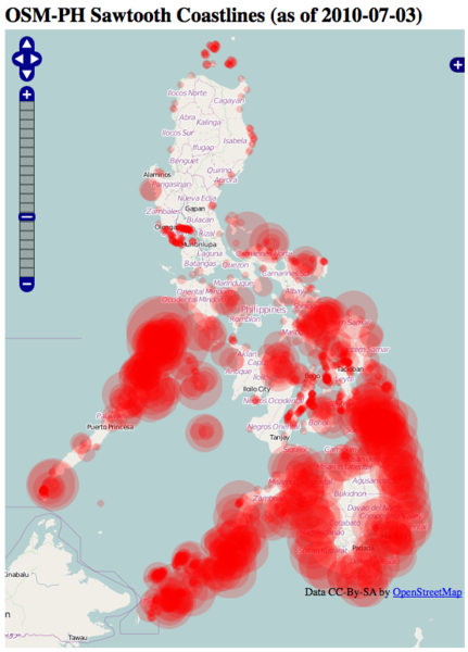
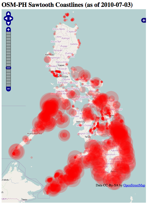
| Description | Webmap created by seav showing the location of sawtooth coastlines (i.e., coastlines derived from the SRTM dataset) in the Philippines. This webmap was created to aid the coastlines correction activity. |
|---|---|
| Author | © OpenStreetMap contributors; Screenshot taken by maning |
| Source | http://forge.codedgraphic.com/osm/sawtooth_coastlines/ |
| Date | 2010-07-06 |
Licensing
![]()
Contains map data © OpenStreetMap contributors, made available under the terms of the Creative Commons Attribution-ShareAlike 2.0 (CC-BY-SA-2.0).
File history
Click on a date/time to view the file as it appeared at that time.
| Date/Time | Thumbnail | Dimensions | User | Comment | |
|---|---|---|---|---|---|
| current | 01:34, 6 July 2010 | | 556 × 774 (276 KB) | Maning (talk | contribs) |
You cannot overwrite this file.
File usage
The following 2 pages use this file: