File:QGIS default vs OSTN02 map.pdf
Jump to navigation
Jump to search

Size of this JPG preview of this PDF file: 338 × 598 pixels. Other resolutions: 135 × 240 pixels | 271 × 480 pixels | 991 × 1,754 pixels.
Original file (991 × 1,754 pixels, file size: 593 KB, MIME type: application/pdf)
Summary
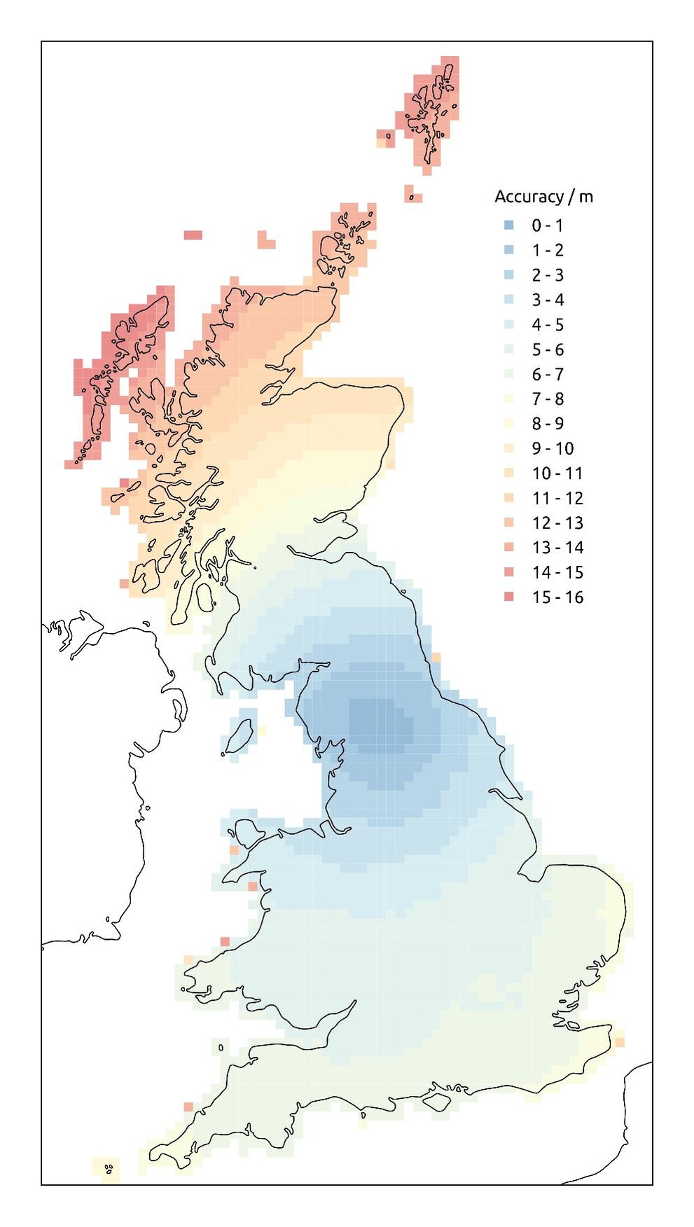
Comparison between the default transformation used by QGIS 2.8 to convert between WGS84 and British National Grid with the OSTN02 tranformation
Contains generalised coastline data from [1]
Licensing
![]()
![]()
![]()
This work is licensed under the Creative Commons Attribution-ShareAlike 3.0 License.
Attribution not specified as a parameter! THIS LICENSE ALWAYS REQUIRES ATTRIBUTION! Use {{CC-BY-SA-3.0|Attribution, typically name of author}} See Template:CC-BY-SA-3.0 for full description how this template should be used.
Attribution not specified as a parameter! THIS LICENSE ALWAYS REQUIRES ATTRIBUTION! Use {{CC-BY-SA-3.0|Attribution, typically name of author}} See Template:CC-BY-SA-3.0 for full description how this template should be used.
File history
Click on a date/time to view the file as it appeared at that time.
| Date/Time | Thumbnail | Dimensions | User | Comment | |
|---|---|---|---|---|---|
| current | 12:17, 30 August 2016 |  | 991 × 1,754 (593 KB) | Gregrs (talk | contribs) | Comparison between the default transformation used by QGIS 2.8 to convert between WGS84 and British National Grid with the [https://www.ordnancesurvey.co.uk/business-and-government/help-and-support/navigation-technology/os-net/ostn02-ntv2-format.ht... |
You cannot overwrite this file.
File usage
The following page uses this file: