File:Solent.png
Jump to navigation
Jump to search


Size of this preview: 800 × 487 pixels. Other resolutions: 320 × 195 pixels | 640 × 389 pixels | 1,147 × 698 pixels.
Original file (1,147 × 698 pixels, file size: 669 KB, MIME type: image/png)
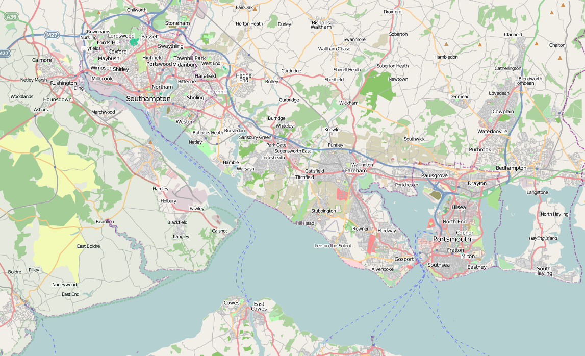
The Solent, southern UK, from the tiles@home layer showing filled sea areas for Southampton Water, Portsmouth, Langstone & Chichester harbours, and the Solent.
This is a Featured image, which means that it has been identified as one of the best examples of OpenStreetMap mapping, or that it provides a useful illustration of the OpenStreetMap project. If you know another image of similar quality, you can nominate it on Featured image proposals.
Front-page image on 12 May 2007
File history
Click on a date/time to view the file as it appeared at that time.
| Date/Time | Thumbnail | Dimensions | User | Comment | |
|---|---|---|---|---|---|
| current | 22:47, 14 May 2009 | | 1,147 × 698 (669 KB) | Iknowjoseph (talk | contribs) | (The Solent, southern UK, from the Mapnik layer showing filled sea areas for Southampton Water, Portsmouth, Langstone & Chichester harbours, and the Solent.) |
| 13:49, 22 August 2007 |  | 931 × 641 (197 KB) | Milliams (talk | contribs) | The Solent, southern UK, from the Mapnik layer showing filled sea areas for Southampton Water, Portsmouth, Langstone & Chichester harbours, and the Solent. | |
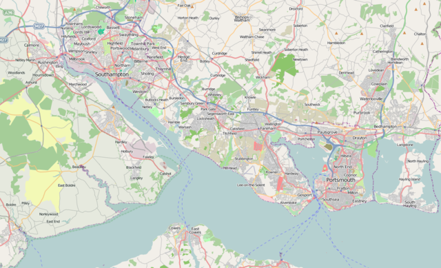
| 12:51, 5 May 2007 |  | 965 × 710 (105 KB) | Dmgroom (talk | contribs) | The Solent, southern UK, from the tiles@home layer showing filled sea areas for Southampton Water, Portsmouth, Langstone & Chichester harbours, and the Solent. |
You cannot overwrite this file.
File usage
The following 2 pages use this file: