File:World Bank Haiti Situation Room.jpg
Jump to navigation
Jump to search


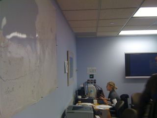
Size of this preview: 800 × 600 pixels. Other resolutions: 320 × 240 pixels | 640 × 480 pixels | 1,024 × 768 pixels | 1,280 × 960 pixels | 1,600 × 1,200 pixels.
Original file (1,600 × 1,200 pixels, file size: 500 KB, MIME type: image/jpeg)
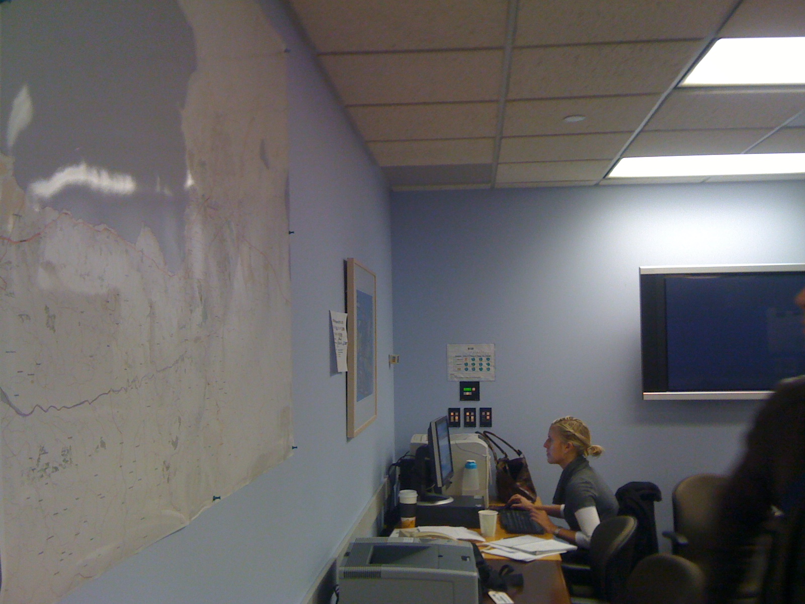
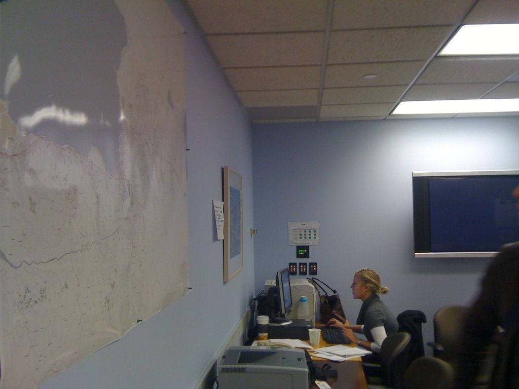
Large printouts of OpenStreetMap on the walls of the World Banks Situation Room for the Haiti Earthquake response. These maps are serving as the basic infrastructure information for response and rebuilding activities.
photo by Andrew Turner. on flickr
See WikiProject Haiti to get involved with work on these maps.
For printing maps of Haiti see WikiProject Haiti/Earthquake map resources#Printable and Static Maps
This is a Featured image, which means that it has been identified as one of the best examples of OpenStreetMap mapping, or that it provides a useful illustration of the OpenStreetMap project. If you know another image of similar quality, you can nominate it on Featured image proposals.
Front-page image for week 6 of 2010 (8–14 Feb.).
- Image descriptions
- čeština : Velké tiskové výstupy z OpenStreetMap na stěnách Situační místnosti pro zemětřesení na Haiti Světové banky. Tyto plány pomáhají zjisti základní informace o infrastruktuře a informace pro rekonstrukce měst.
- Deutsch : Große gedruckte OpenStreetMap-Karten an der Wand des Krisenzentrums der Weltbank für die Erdbebenkatastrophe in Haiti.[1] Diese Karten bieten Informationen über die Grundlegende Infrastruktur für Hilfs- und Wiederaufbaumaßnahmen.
- English : Large printouts of OpenStreetMap on the walls of the World Banks Situation Room for the Haiti Earthquake response.[2] These maps are serving as the basic infrastructure information for response and rebuilding activities.
- français : Impressions grand format d'OpenStreetMap sur les murs de la salle où la Banque Mondiale suit la réponse apportée au tremblement de terre à Haïti.[3] Ces cartes apportent des informations sur les infrastructures de base, ainsi que pour la reconstruction.
- italiano : Stampa di OpenStreetMap in grande formato sulle pareti del World Banks Situation Room per la risposta al terremoto di Haiti.[4] Queste mappe sono utilizzate come l'infrastruttura informativa di base per la risposta e le attività di ricostruzione.
- magyar : Az OpenStreetMap nagy nyomtatott térképe a World Banks Situation Room falain a haiti földrengésre válaszként.[5] Ezek a térképek szolgálnak alapvető infrastruktúra információként a reagálási és helyreállítási tevékenységekhez.
- Nederlands : Grote print-out van OpenStreetMap kaart aan de muur van de World Banks Situation Room bij de Haiti aardbeving inzet. [1] Deze kaart dient als basis infrastructuur informatie voor de inzet en herbouw activiteiten.
- polski : Wydruki z OpenStreetMap w dużym formacie na ścianach Situation Room organizacji World Bank podczas koordynacji akcji humanitarnej na Haiti. [6] Mapy te stanowią podstawowe źródło informacji o infrastrukturze przy czynnościach związanych z ratownictwem i odbudową.
- português : Large Grandes impressões do OpenStreetMap nas paredes do World Banks Situation Room, para ajuda ao terremoto no Haiti. [7] Estes mapas estão servindo como infraestrutura básica de informação nas atividades de ajuda e reconstrução.
- македонски : Големи испечатени карти од OpenStreetMap во собата за кризни ситуации на Светската банка во мисијата за справување со последиците од земјотресот во Хаити. [8] Овие карти служат како основни инфраструктурни информации за помош и реизградба.
- русский : Большая бумажная карта OpenStreetMap на стене Виртуального штаба[9] Всемирного банка[10] по ликвидации последствий землетрясения на Гаити.[11] Такие карты помогают ориентироваться в постоянно меняющейся ситуации и принимать решения.
File history
Click on a date/time to view the file as it appeared at that time.
| Date/Time | Thumbnail | Dimensions | User | Comment | |
|---|---|---|---|---|---|
| current | 21:16, 4 February 2010 | | 1,600 × 1,200 (500 KB) | Ojw (talk | contribs) | Andrew Turner, http://www.flickr.com/photos/ajturner/4329833289/ |
You cannot overwrite this file.
File usage
The following 6 pages use this file: