Haiti Earthquake 2021
| General Information | ||||||||||||||||||||
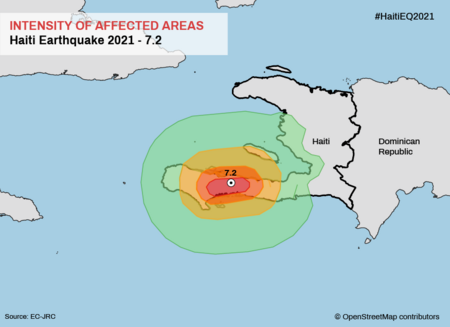
The Haiti Earthquake 2021 campaign is a concluded HOT activation organized by the Humanitarian OpenStreetMap Team in coordination with OSM Haiti to respond to a magnitude 7.2 earthquake that struck the island nation of Haiti. Disaster Services (DS) is actively working with voting members from Haiti and partners in the region. Based on mapping needs, Tiburon Peninsula in southwestern Haiti was the focus of this campaign:
Mapping focused on filling areas with little to no Buildings data to support response and recovery efforts, population estimates, and damage assessments.
| ||||||||||||||||||||
About This Disaster Mapping Project
For Mappers
How You Can Contribute
Be Part of This Activation
Volunteers are the pillar of our activations, with your contributions we can obtain more and better data. As well as helping all the entities that request it. You can start contributing now to any activation.
You don't need to be a pro, our volunteers start from the beginner level and continue their growth up to the advanced level. It's as simple as creating your HOTOSM account, be sure to check out the training videos , continue your path on our Training Center in order to be part of current and future activations.
Join Now.
- Most of our volunteer needs are for remote OSM contributors, join LearnOSM.org to get started.
- Learn to Map, you can start your journey now. You do not have to ask permission before adding or modifying existing data.
- Additional guidance for tagging in the various Activation areas can be found in the instructions of each project on the Tasking Manager.
Mapping Priority
- Head to the Tasking Manager - Please choose from highest priority first
- Go further, by contributing you will move up a level, Beginner, Intermediate and Advanced. Keep your track, experienced mappers are also asked to participate in validating completed tasks. Information on validating can be found here
- Think you know OSM well enough to feedback to others? Request the global validator role here.
| Contribute | Priority | Location | What to map | Imagery Source | Tools | Overall Progress |
|---|---|---|---|---|---|---|
| COMPLETED/ARCHIVED | ||||||
| 11281 - BUILDINGS IN SHAKING INTENSITY ZONE VIII | Completed | Nippes, Sud | Buildings | Bing | Basic Tasking Manager Projects | Stats |
| 11282 - BUILDINGS IN SHAKING INTENSITY ZONE VIII(2) | Completed | Nippes, Sud | Buildings | Bing | Basic Tasking Manager Projects | Stats |
| 11266 - BUILDINGS NEAR EPICENTER | Completed | Nippes, Sud | Buildings | Bing | Basic Tasking Manager Projects | Stats |
| 11293 - BUILDINGS IN HIGH INTENSITY SHAKING ZONE | Completed | Nippes | Buildings | Bing | Basic Tasking Manager Projects | Stats |
| 11294 - BUILDINGS IN HIGH INTENSITY SHAKING ZONE (2) | Completed | Nippes, Sud | Buildings | Bing | Basic Tasking Manager Projects | Stats |
| 11297 - BUILDINGS IN HIGH INTENSITY SHAKING ZONE (3) | Completed | Nippes | Buildings | Bing | Basic Tasking Manager Projects | Stats |
| 11299 - BUILDINGS IN HIGH INTENSITY SHAKING ZONE (4) | Completed | Nippes | Buildings | Bing | Basic Tasking Manager Projects | Stats |
| 11301 - EDGE-MATCH BUILDINGS IN IMPACTED AREAS | Completed | Nippes | Buildings | Bing | Basic Tasking Manager Projects | Stats |
| 11304 - EDGE-MATCH BUILDINGS IN IMPACTED AREAS (2) | Completed | Nippes, Sud | Buildings | Bing | Basic Tasking Manager Projects | Stats |
| 11309 - EDGE-MATCH BUILDINGS IN IMPACTED AREAS (3) | Completed | Nippes, Sud | Buildings | Bing | Basic Tasking Manager Projects | Stats |
| 11315 - EDGE-MATCH BUILDINGS IN IMPACTED AREAS (4) | Completed | Nippes | Buildings | Bing | Basic Tasking Manager Projects | Stats |
| 11331 - EDGE-MATCH BUILDINGS IN IMPACTED AREAS (5) | Completed | Sud | Buildings | Bing | Basic Tasking Manager Projects | Stats |
| 11332 - BUILDINGS WEST OF EPICENTER (1) | Completed | Nippes | Buildings | Bing | Basic Tasking Manager Projects | Stats |
| 11363 - BUILDINGS WEST OF EPICENTER (2) | Completed | Sud | Buildings | Bing | Basic Tasking Manager Projects | Stats |
| 11407 - BUILDINGS WEST OF EPICENTER (3) | Completed | Sud | Buildings | Bing | Basic Tasking Manager Projects | Stats |
| 11435 - BUILDINGS WEST OF EPICENTER (4) | Completed | Grand'Anse | Buildings | Bing | Basic Tasking Manager Projects | Stats |
| 11456 - BUILDINGS WEST OF EPICENTER (5) | Completed | Nippes | Buildings | Bing | Basic Tasking Manager Projects | Stats |
| 11457 - BUILDINGS WEST OF EPICENTER (6) | Completed | Sud | Buildings | Bing | Basic Tasking Manager Projects | Stats |
| 11536 - INTERMEDIATE DIFFICULTY BUILDINGS (1) | Completed | Sud | Buildings | Bing | Basic Tasking Manager Projects | Stats |
| 11553 - EDGE-MATCH BUILDINGS EAST (1) | Completed | Ouest | Buildings | Bing | Basic Tasking Manager Projects | Stats |
| 11557 - EDGE-MATCH BUILDINGS EAST (2) | Completed | Ouest | Buildings | Bing | Basic Tasking Manager Projects | Stats |
| 11584 - EDGE-MATCH BUILDINGS EAST (3) | Completed | Ouest | Buildings | Bing | Basic Tasking Manager Projects | Stats |
| 11595 - EDGE-MATCH BUILDINGS EAST (4) | Completed | Ouest | Buildings | Bing | Basic Tasking Manager Projects | Stats |
| 11627 - EDGE-MATCH BUILDINGS EAST (5) | Completed | Ouest | Buildings | Bing | Basic Tasking Manager Projects | Stats |
| 11628 - EDGE-MATCH BUILDINGS EAST (6) | Completed | Ouest | Buildings | Bing | Basic Tasking Manager Projects | Stats |
For Aid Organizations
Map and Data Services

Download the data
See Downloading data for instructions on getting large scale map data, or see the focused exports below:
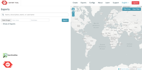
- A custom export is available on the HOT Export Tool
- Regularly updated OpenStreetMap exports are available on the Humanitarian Data eXchange (HDX)
| Country | Status | HDX | HOT Export Tool | Partners/Other |
|---|---|---|---|---|
| Haiti | Completed | Country Page | N/A |
About OpenStreetMap
OpenStreetMap offers an online map (and spatial database) that is updated by the minute. Various tools and services allow data extracts for GIS specialists, Routable Garmin GPS data, Smartphone GPS navigation, and other device-compatible downloads. With an internet connection, regular syncing is possible with open access to the community contributed data as it comes in, with OpenStreetMap's bulk data downloads ideal for use offline. In addition, maps can also be printed on paper.
Browse the (example) Activation Area to get a feel for the data that is currently available. Different map styles including a Humanitarian style can be selected on the right side, and some data may not render (appear) on the map but could be exported from the underlying database (See export section below).
Paper Maps
Poster size Maps and normal sized paper atlases of custom areas can be printed:
- For print, the World Food Programme has built the Humanitarian Topographic Atlas.
- We suggest FieldPapers Paper Maps with grid for field survey or general navigation purposes.
- See OSM_on_Paper for an overview and list of other platforms and services for printing maps.
With the availibility of Small communication devices, Navigation Offline data proves to be very useful to the humanitarians deployed in foreign countries. We support the humanitarian NGO's using navigation data and invite them to give us feedback on the utilization of these devices in the context of field deployment.
- See Software/Mobile for more information on using OSM in portable devices.
- See also Mobile Mapping on LearnOSM.org for information on mapping in the field.
Usage of OSM data for Humanitarian Missions
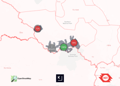
- Example CartONG Map
- Please post links/reports here...
Available Imagery
OSM Default Imagery Sources
Bing
Bing provides a global imagery data source that is the 'default' Imagery available for OSM (default option in most editors).
Mapbox
Mapbox provides a global imagery source and should be compared to Bing (typically use Bing for alignment if available and not instructed otherwise).
Alternative Imagery Sources
How to add/use Alternative Imagery
In many cases better imagery is available than the default; when possible we set up a remote link directly via the Tasking Manager, so there is nothing to do, the iD editor and (as long as enabled) JOSM will automatically add the imagery.
Additionally, with JOSM, it's relatively easy to add special imagery if the license is appropriate for tracing into OSM. For more details see JOSM Imagery Help
About the Team & HOT
About HOT
- To learn more about the Humanitarian OpenStreetMap Team (HOT), explore more of our wiki pages (root: HOT) or our website hotosm.org. We are a global community of mostly volunteers, we are also a US Nonprofit able to contract with organizations (email info at hotosm.org to contact our staff), we are also a 501-c-3 charitable organization.
Contact the Activation Team
If you have needs for data in your area, our team is standing by to assess and help generate that data. For the fastest response, send an email to Activation @ hotosm(dot)org and our volunteer Activation Working Group will respond as soon as someone is available, sometimes immediately. If your need is more sensitive you are welcome to send the email to info @ hotosm(dot)org where one of our staff will reply (typically within one or two business days).
Also, contact us if you need help utilizing OpenStreetMap for your needs!


