Indonesia/Ambon Flooding

From OpenStreetMap Wiki
Jump to navigation Jump to search
A coastal village on Ambom Island after fixing up coastline, drawing in the major island road, rivers and bridges, and rough outline of landuse=residential

There have been heavy rains and landslides on Ambon in Maluku Islands area of Indonesia.

Currently there is some hi-res bing coverage (green shown on this map) available in the Ambon area and HOT is investigating other possible imagery sources.

There is a Task Manager job set-up here.

Affected areas

  • Floods in the northern peninsula : Laha, Tawiri
  • Floods in the southern peninsula : Kel Batu Meja, Ambon, Untetu, Hative Kecil, Galala, Lateri, Passo, and South of the peninsula
  • Landslides in the south peninsula : Batu Gajah, Mangga Dua, Karang Panjang, Batu Merah, Kebun Cengkeh, Ahuru, and some others

Image : Coastline of Ambon and the mountain overlooking the city.

Mapping to do

Some squares in the ocean can be marked as done. Equally there are a lot of task squares of mountain jungle with no features to map. These can be marked as done after a quick check

Things to map

  • The major coastal road which loops around the island
  • Other residential roads where visible
  • landuse=residential areas roughly around settlements
  • Rivers - waterway=river down the centreline pointing downstream towards the ocean
  • bridges - bridge=yes + layer=1
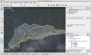
  • Coastline - There's lots of crude coastline data to fixup (PGS fixup) change the source tag from PGS to bing on stretches you've done (cutting the way if necessary)
  • man_made=pier

Use JOSM/Validator to look for possible bugs