Project of the week/2011/Feb 16
Food Bank

Sometimes we map for ourselves, other times we can map for others. The Project of the Week is to add local food banks to the map.
Tagging suggestions
A food bank may be represented as a point or an area in OpenStreetMap.
Required tags
There are two required tags for a food bank because a food bank is a sub-category of the social facility key.
amenity=social_facility# a food bank is a sub-category of social_facilitysocial_facility=food_bank
Optional tags
Add name, building and addressing information for the facility as well.
name=*building=yes# for a food bank building outline.addr:housenumber=*addr:street=*
Wheelchair accessible?
wheelchair=yes/no/limited
Results
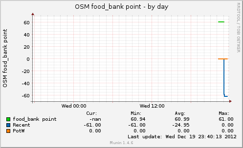
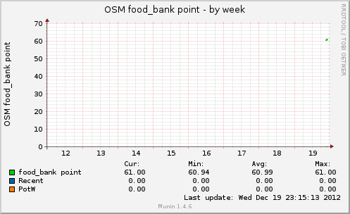
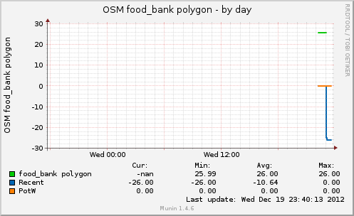
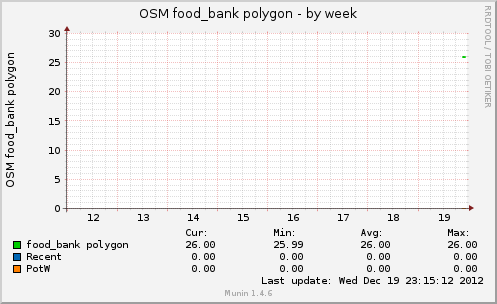
These graphs show the number of social_facility=food_bank objects* in the OpenStreetMap database and are updated approximately once per hour.
http://rweait.dev.openstreetmap.org/osmfoodbankpt-day.png http://rweait.dev.openstreetmap.org/osmfoodbankpt-week.png
http://rweait.dev.openstreetmap.org/osmfoodbankpol-day.png http://rweait.dev.openstreetmap.org/osmfoodbankpol-week.png
- The "recent" line shows the number of objects added recently. It is a rough indication of PotW activity over the last little while, nominally an hour. The "PotW" line indicates the start and end of the project period. It is imperfect and still manages to be fun.