Proposal:Refuge
| Refuge | |
|---|---|
| Proposal status: | Abandoned (inactive) |
| Proposed by: | Thomas Jarvis |
| Tagging: | highway=refuge
|
| Applies to: | |
| Definition: | An emergency refuge area on a highway. Usually a non-segregated layby that can only be used in emergency situations when no shoulder is available. |
| Statistics: |
|
| Rendered as: | None or orange symbol on highway |
| Draft started: | 2021-05-10 |
| RFC start: | 2021-05-10 |
| Vote start: | 2021-06-01 |
| Vote end: | 2021-06-20 |
Abandoned since existing tag of highway=emergency_bay already exists.
Proposal
I propose that a new tag should be introduced for positions for refuge areas on highways in substitute for a shoulder.
This would be a tag that applies to nodes only due to their small size and not being segregated from the main carriageway.
Rationale
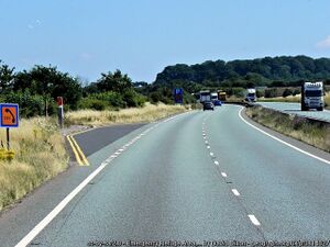
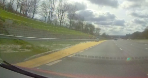
In many places around the world, shoulders are being converted permanently or temporally into running/live lanes. As a safety mitigation, refuge areas are usually located beside the main carriageway at regular intervals to ensure broken down vehicles are less likely to be stranded in live traffic. Refuge locations are safety critical and as part of making smart motorways safer in England, Highways England have distributed refuge area locations to satnav providers, however this information is not on OSM and there are currently no official tags to support it.
Tagging
Only one tag is required for a refuge area, that is highway=refuge. This tag should be placed on the highway way at the centre point of the Refuge. Since it isn't segregated from the main carriageway a second way should not be drawn entering and exiting the layby.
Other information could also be included if the mapper wished to, these could be surface=*, colour=*, width=*, lit=*, ref=* etc
A co-located emergency telephone would still be tagged as normal as its own node in its location beside a Refuge area.
Only laybys that can be used in emergency circumstances are tagged this way. For laybys that allow parking with or without an emergency telephone would remain being tagged the same. Laybys used for maintenance purposes shouldn't be tagged as an ERA either.
Examples
There are examples of ERAs used in other countries, however I do not have much information on them. They may be tagged the same way if the layby only allows stopping in emergency situations.
Rendering
ERA locations are generally not something people would look for on a map due to the urgency to get to one. Unlike SOS phone locations which can be found on a map after a breakdown. So for this reason the tagging of ERAs is more for data/navigation purposes rather than rendering.
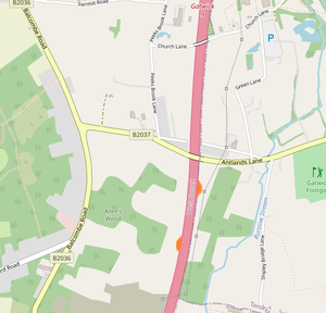
If they were to be added to the render, then a small symbol could be added to the near-side of the highway way. Maybe something like:

Features/Pages affected
This may effect the current "motorway" and "trunk" highway pages. Since ERAs (at least in the UK) are only exclusively only found on motorways and some primary routes (trunk)
External discussions
Comments
Please comment on the discussion page.

