Uploads by Matheusgomesms
Jump to navigation
Jump to search
This special page shows all uploaded files.
| Date | Name | Thumbnail | Size | Description | Versions |
|---|---|---|---|---|---|
| 09:29, 23 September 2024 | AreadeRefugio.jpg (file) |  |
59 KB | {{Information | description= | source= | date= | author=Fidelis Assis | other_versions= }} | 1 |
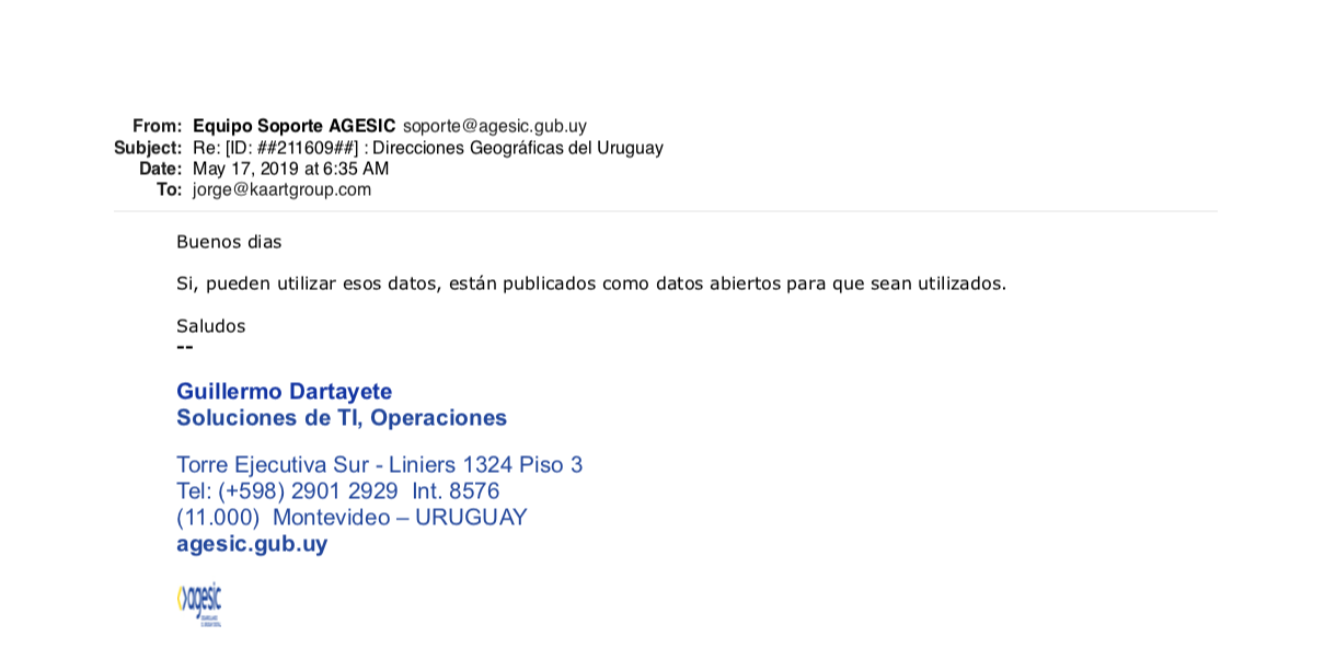
| 08:52, 9 September 2024 | AGESIC confirmation notice.png (file) |  |
102 KB | 2 | |
| 20:48, 24 March 2024 | Autorizacao MapBiomas.pdf (file) | 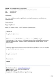 |
93 KB | {{Information | description= | source= | date= | author= | other_versions= }} | 1 |
| 20:23, 28 January 2024 | Autorizacao IPPUC.pdf (file) | 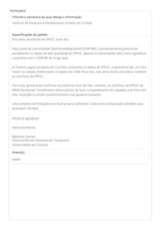 |
156 KB | {{Information | description= | source= | date= | author= | other_versions= }} | 1 |
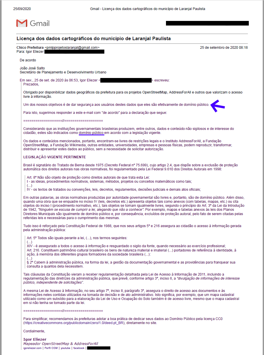
| 03:23, 26 November 2023 | Autorizacao Laranjal Paulista.png (file) |  |
217 KB | {{Information | description=Capture of the e-mail sent by the Municipality of Laranjal Paulista, where the use of their data is authorized on OpenStreetMap. | date=2020-09-25 | source=Own | author={{User|IgorEliezer|wiki=|noedits=1|m=n}} }} | 1 |
| 00:43, 26 November 2023 | Autorizacao SBC.pdf (file) | 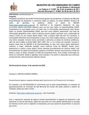 |
312 KB | {{Information | description= | source= | date= | author= | other_versions= }} | 1 |
| 22:46, 19 February 2023 | AutorizacionINECensoUy.pdf (file) | 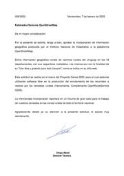 |
16 KB | {{Information | description= | source= | date= | author= | other_versions= }} | 1 |
| 18:37, 29 December 2022 | Autorizacao IPHAN.pdf (file) | 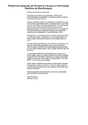 |
342 KB | == Summary == {{Information | description=Capture of the e-mail sent by National Institute of Historic and Artistic Heritage - IPHAN and Matheus Gomes, confirming that their data is authorized to be used on OpenStreetMap. | date=2022-12-05 | author={{User|matheusgomesms|wiki=|noedits=1|m=n}} | source=Own }} Category:Images of data use permissions, rejections or requests | 1 |
| 17:55, 29 December 2022 | Autorizacao Rio Branco Acre.pdf (file) | 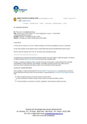 |
362 KB | {{Information | description= | source= | date= | author= | other_versions= }} Category:Images of data use permissions, rejections or requests | 1 |
| 11:46, 11 November 2022 | Autorizacao Governador Valadares.pdf (file) | 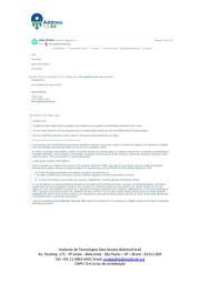 |
342 KB | {{Information | description= | source= | date= | author= | permission= | other_versions= }} | 1 |
| 12:58, 8 October 2022 | Autorizacao TSE.pdf (file) | 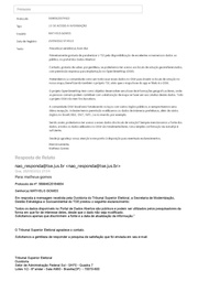 |
70 KB | == Summary == {{Information | description=Capture of the e-mail sent by IPECE (Institute of Research and Economic Strategy of Ceará), where the use of their data is authorized on OpenStreetMap. | date=2022-09-12 | source=Own | author={{User|matheusgomesms|wiki=|noedits=1|m=n}} }} == English == ''Message Transcript and translated:'' Dear Sir, First of all, I would like to congratulate IPECE for making excellent and numerous data available to the public! I would like to know, please, if w... | 1 |
| 16:56, 23 September 2022 | Autorizacao SIGLON.pdf (file) | 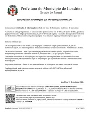 |
412 KB | {{Information | description=Capture of the e-mail sent by SIGLON (GIS of Londrina), where the use of their data is authorized on OpenStreetMap. | date=2022-05-30 | source=Own | author={{User|matheusgomesms|wiki=|noedits=1|m=n}} }} | 1 |
| 15:12, 23 September 2022 | Autorizacao IPECE.pdf (file) |  |
150 KB | {{Information | description= | source= | date= | author= | permission= | other_versions= }} | 1 |
| 19:19, 31 May 2022 | AutorizacaoSIGLON.pdf (file) |  |
140 KB | {{Information | description= | source= | date= | author= | permission= | other_versions= }} | 1 |
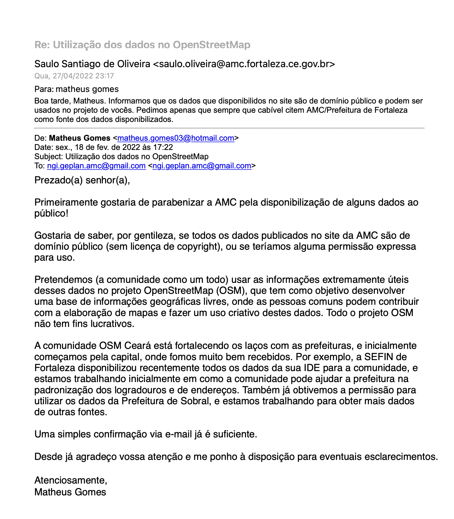
| 19:32, 28 April 2022 | Autorização AMC Fortaleza.png (file) |  |
1.25 MB | 1 | |
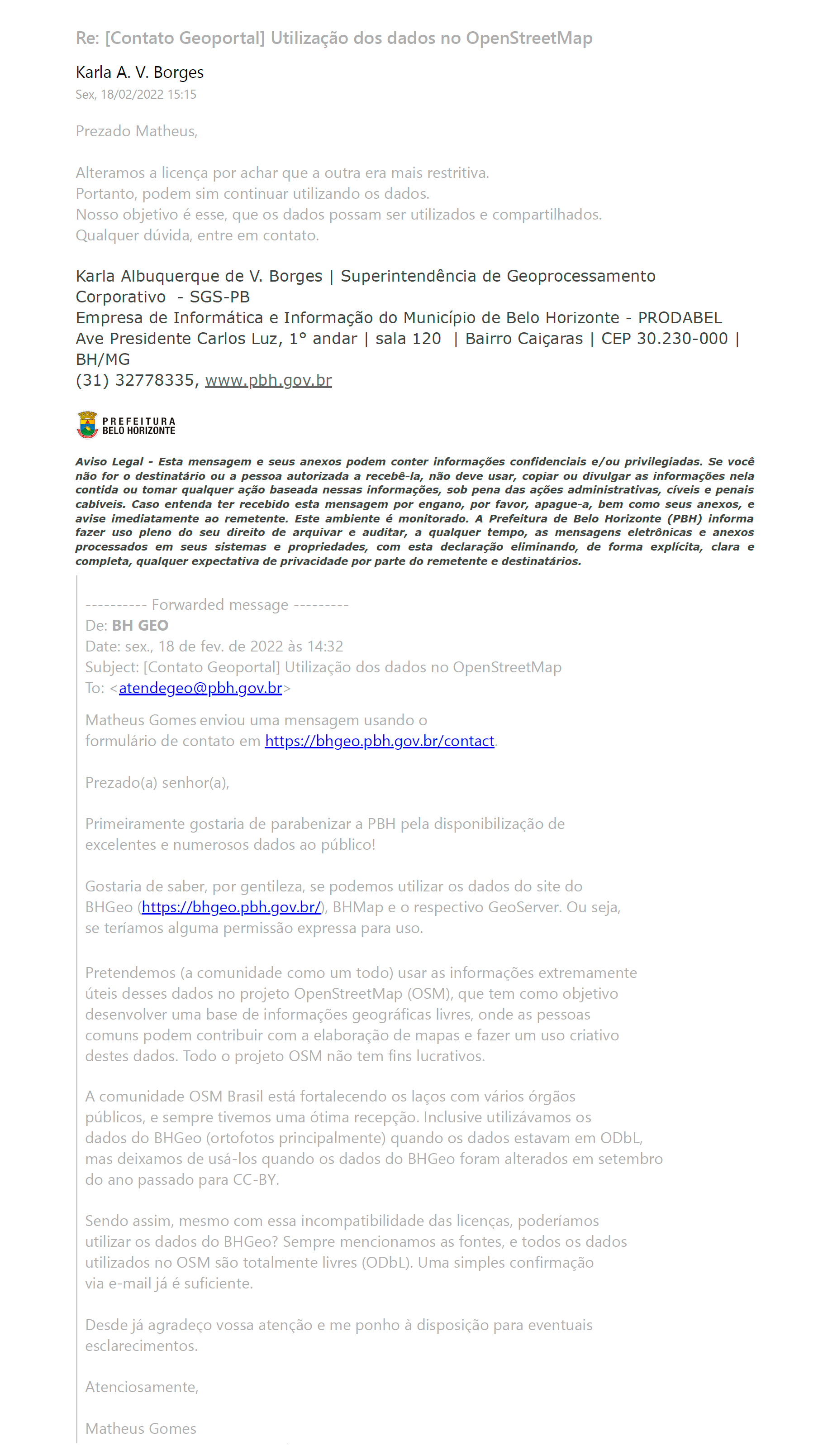
| 19:08, 18 February 2022 | Autorização BHGeo.png (file) |  |
305 KB | 1 | |
| 15:09, 20 August 2021 | Autorização Dados Sobral.png (file) |  |
352 KB | == Summary == == English: == Capture of conversation between OSM user (matheusgomesms) and the Urbanism and Environment Secretariat (SEUMA, an agency of the Municipality of Sobral), through the Municipal Ombudsman's Office, which authorizes the use of their data in OpenStreetMap. Message transcript and translated: Dear citizen, we appreciate your contact and interest in contributing to the availability of geographic information. We inform you that: The standardization of street names and... | 1 |
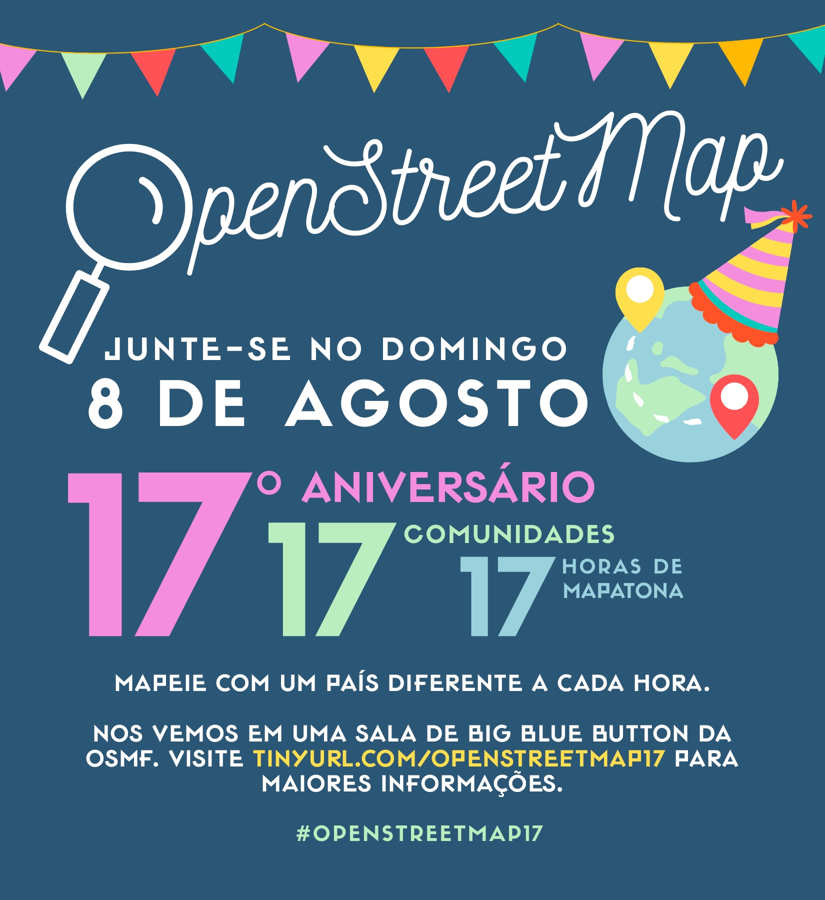
| 01:15, 9 August 2021 | Photo 2021-08-08 13-42-09.jpg (file) |  |
395 KB | Melhoria de tradução | 2 |
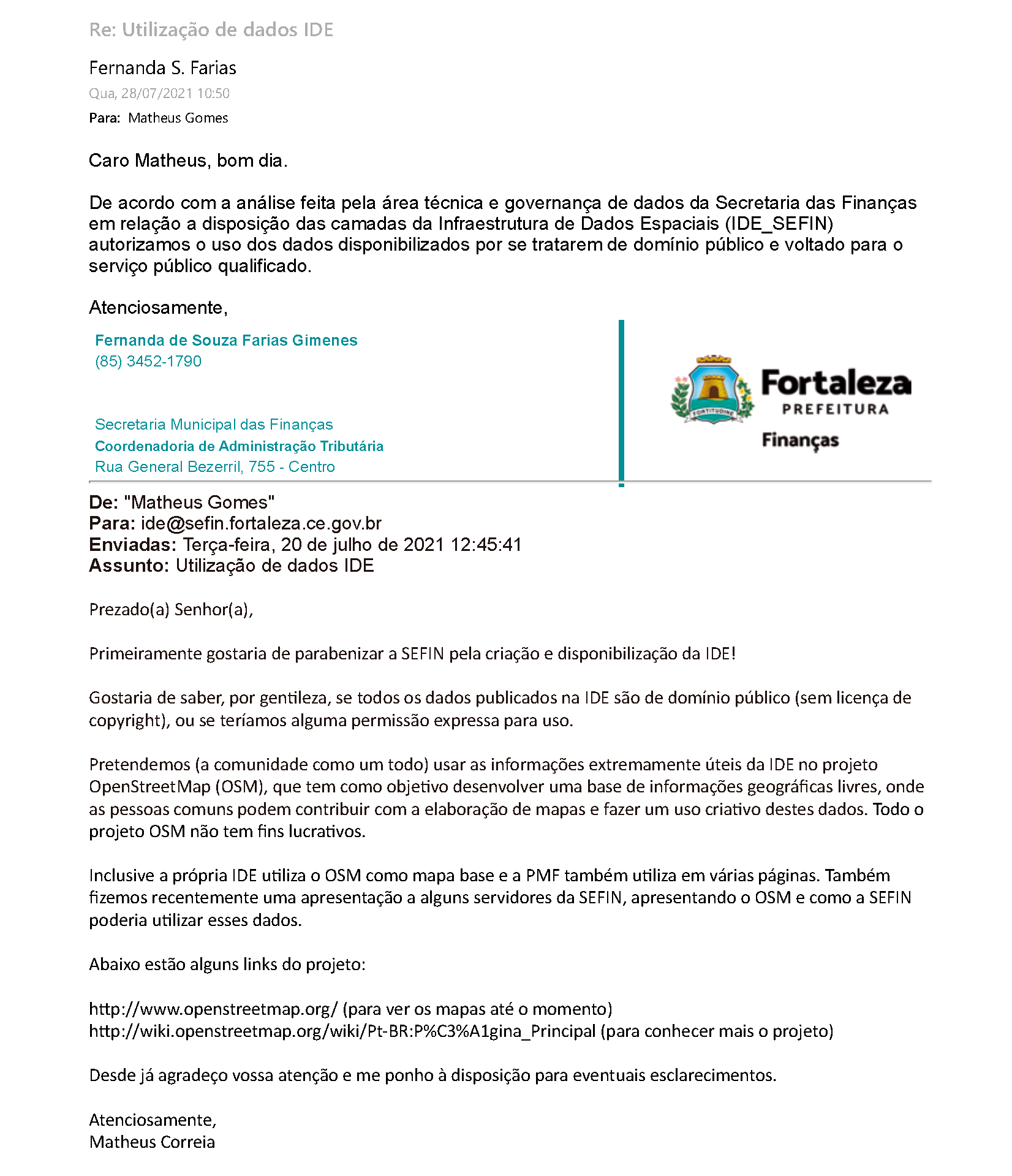
| 16:44, 28 July 2021 | Autorização IDE SEFIN Fortaleza.png (file) |  |
149 KB | 1 | |
| 15:29, 29 April 2020 | Domínio Fortaleza em Mapas.jpg (file) |  |
55 KB | English: Capture of the e-mail message sent by the Planning Institute of Fortaleza (Iplanfor, an organ of the Municipality of Fortaleza), where the use of data from the Fortaleza platform in Maps is authorized on OpenStreetMap. Message transcript and translated: October 22, 2019 11:23 AM Dear Narcelio, The data we disclose is open and can be accessed by any citizen. They may even be used by other means of dissemination and communication. If you are interested, come and visit us to talk ab... | 1 |