Uploads by Tyr
Jump to navigation
Jump to search
This special page shows all uploaded files.
| Date | Name | Thumbnail | Size | Description | Versions |
|---|---|---|---|---|---|
| 09:57, 18 November 2023 | SotM-2024-logo.svg (file) | 26 KB | {{Information | description=Logo for the State of the Map 2024 conference. | source= | date= | author=Paul H. Bushoki | other_versions= }} | 1 | |
| 08:38, 3 April 2021 | Sotm2021-logo-small.png (file) | 66 KB | Adapted version of the #sotm2021 logo (File:Sotm2021-logo.png by Julie Mattelaer.), optimized for smaller sizes/resolutions. | 1 | |
| 09:48, 22 February 2021 | Sotm2021-logo.png (file) | 843 KB | crop to content | 2 | |
| 14:41, 3 July 2020 | SotM2020-logo.svg (file) | 25 KB | (keep previous aspect ratio) | 4 | |
| 14:07, 29 November 2019 | “Ohsome” OpenStreetMap Data Evaluation- Fitness of Field Papers for Participatory Mapping.pdf (file) |  |
811 KB | Title: “Ohsome” OpenStreetMap Data Evaluation: Fitness of Field Papers for Participatory Mapping Authors: Carolin Klonner, Maximilian Hartmann, Lily Djami and Alexander Zipf Category:State of the Map 2019/Posters | 1 |
| 15:27, 26 November 2019 | Address Patterns.pdf (file) |  |
319 KB | Submission to the poster event of the State of the Map 2019. Title: Address Patterns Author: Guy Collins BSc(Hons), FRGS, CGeog License of the submitted works: CC BY-NC-ND Creative Commons Attribution-NonCommercial-NoDerivatives 4.0 Category:State of the Map 2019/Posters | 1 |
| 14:40, 26 November 2019 | Contextualizing OpenStreetMap in Mapping Favelas in Brazil.pdf (file) |  |
1.46 MB | Title: Contextualizing OpenStreetMap in Mapping Favelas in Brazil Authors: Everton Bortolini, Silvana Philippi Camboim | 1 |
| 14:27, 26 November 2019 | How knowing the purpose of mapping impacts the map and mappers themselves.pdf (file) |  |
6.13 MB | Title: How knowing the purpose of mapping impacts the map and mappers themselves Authors: Patricia Solís | 1 |
| 14:23, 26 November 2019 | Workforce development and Youthmappers- Understanding perceptions of students in humanitarian mapping.pdf (file) | 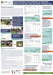 |
11.12 MB | Title: Workforce development and Youthmappers: Understanding perceptions of students in humanitarian mapping Authors: Patricia Solís and Sushil Rajagopalan | 1 |
| 15:48, 24 October 2019 | Nairobi.pdf (file) |  |
2.42 MB | Map created for the State of the Map 2019 [https://2019.stateofthemap.org/events/#main-social-dinner social event] by Adam Rousell and Sabrina Marx using OpenStreetMap data and QGIS. | 1 |
| 15:48, 24 October 2019 | Antananarivo.pdf (file) |  |
1.56 MB | Map created for the State of the Map 2019 [https://2019.stateofthemap.org/events/#main-social-dinner social event] by Adam Rousell and Sabrina Marx using OpenStreetMap data and QGIS. | 1 |
| 15:48, 24 October 2019 | Minsk.pdf (file) |  |
3.95 MB | Map created for the State of the Map 2019 [https://2019.stateofthemap.org/events/#main-social-dinner social event] by Adam Rousell and Sabrina Marx using OpenStreetMap data and QGIS. | 1 |
| 15:47, 24 October 2019 | Dakar.pdf (file) | 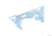 |
1.42 MB | Map created for the State of the Map 2019 [https://2019.stateofthemap.org/events/#main-social-dinner social event] by Adam Rousell and Sabrina Marx using OpenStreetMap data and QGIS. | 1 |
| 15:47, 24 October 2019 | Buenos-aires.pdf (file) | 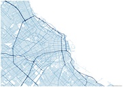 |
1.33 MB | Map created for the State of the Map 2019 [https://2019.stateofthemap.org/events/#main-social-dinner social event] by Adam Rousell and Sabrina Marx using OpenStreetMap data and QGIS. | 1 |
| 15:47, 24 October 2019 | Bratislava.pdf (file) | 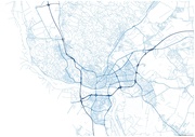 |
1.65 MB | Map created for the State of the Map 2019 [https://2019.stateofthemap.org/events/#main-social-dinner social event] by Adam Rousell and Sabrina Marx using OpenStreetMap data and QGIS. | 1 |
| 15:47, 24 October 2019 | Brasilia.pdf (file) | 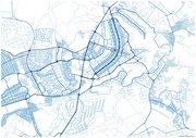 |
1.45 MB | Map created for the State of the Map 2019 [https://2019.stateofthemap.org/events/#main-social-dinner social event] by Adam Rousell and Sabrina Marx using OpenStreetMap data and QGIS. | 1 |
| 15:46, 24 October 2019 | Zagreb.pdf (file) | 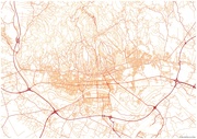 |
1.53 MB | Map created for the State of the Map 2019 [https://2019.stateofthemap.org/events/#main-social-dinner social event] by Adam Rousell and Sabrina Marx using OpenStreetMap data and QGIS. | 1 |
| 15:46, 24 October 2019 | Yamoussoukro.pdf (file) | 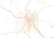 |
327 KB | Map created for the State of the Map 2019 [https://2019.stateofthemap.org/events/#main-social-dinner social event] by Adam Rousell and Sabrina Marx using OpenStreetMap data and QGIS. | 1 |
| 15:46, 24 October 2019 | Tirane.pdf (file) | 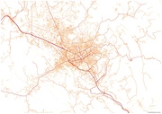 |
1.04 MB | Map created for the State of the Map 2019 [https://2019.stateofthemap.org/events/#main-social-dinner social event] by Adam Rousell and Sabrina Marx using OpenStreetMap data and QGIS. | 1 |
| 15:46, 24 October 2019 | Taipei.pdf (file) | 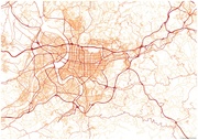 |
3.26 MB | Map created for the State of the Map 2019 [https://2019.stateofthemap.org/events/#main-social-dinner social event] by Adam Rousell and Sabrina Marx using OpenStreetMap data and QGIS. | 1 |
| 15:45, 24 October 2019 | Singapore.pdf (file) | 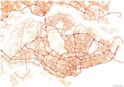 |
4.13 MB | Map created for the State of the Map 2019 [https://2019.stateofthemap.org/events/#main-social-dinner social event] by Adam Rousell and Sabrina Marx using OpenStreetMap data and QGIS. | 1 |
| 15:45, 24 October 2019 | Seoul.pdf (file) | 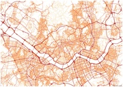 |
2.97 MB | Map created for the State of the Map 2019 [https://2019.stateofthemap.org/events/#main-social-dinner social event] by Adam Rousell and Sabrina Marx using OpenStreetMap data and QGIS. | 1 |
| 15:44, 24 October 2019 | Sarajevo.pdf (file) |  |
692 KB | Map created for the State of the Map 2019 [https://2019.stateofthemap.org/events/#main-social-dinner social event] by Adam Rousell and Sabrina Marx using OpenStreetMap data and QGIS. | 1 |
| 15:44, 24 October 2019 | Porto-novo.pdf (file) |  |
934 KB | Map created for the State of the Map 2019 [https://2019.stateofthemap.org/events/#main-social-dinner social event] by Adam Rousell and Sabrina Marx using OpenStreetMap data and QGIS. | 1 |
| 15:44, 24 October 2019 | Ouagadougou.pdf (file) | 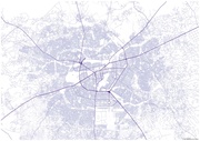 |
4.35 MB | Map created for the State of the Map 2019 [https://2019.stateofthemap.org/events/#main-social-dinner social event] by Adam Rousell and Sabrina Marx using OpenStreetMap data and QGIS. | 1 |
| 15:44, 24 October 2019 | Maseru.pdf (file) | 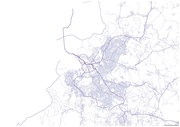 |
1.14 MB | Map created for the State of the Map 2019 [https://2019.stateofthemap.org/events/#main-social-dinner social event] by Adam Rousell and Sabrina Marx using OpenStreetMap data and QGIS. | 1 |
| 15:43, 24 October 2019 | Managua.pdf (file) | 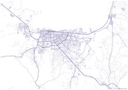 |
746 KB | Map created for the State of the Map 2019 [https://2019.stateofthemap.org/events/#main-social-dinner social event] by Adam Rousell and Sabrina Marx using OpenStreetMap data and QGIS. | 1 |
| 15:43, 24 October 2019 | Luxembourg.pdf (file) | 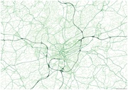 |
1.26 MB | Map created for the State of the Map 2019 [https://2019.stateofthemap.org/events/#main-social-dinner social event] by Adam Rousell and Sabrina Marx using OpenStreetMap data and QGIS. | 1 |
| 15:43, 24 October 2019 | Ljubljana.pdf (file) |  |
1.53 MB | Map created for the State of the Map 2019 [https://2019.stateofthemap.org/events/#main-social-dinner social event] by Adam Rousell and Sabrina Marx using OpenStreetMap data and QGIS. | 1 |
| 15:42, 24 October 2019 | La-paz.pdf (file) |  |
1.44 MB | Map created for the State of the Map 2019 [https://2019.stateofthemap.org/events/#main-social-dinner social event] by Adam Rousell and Sabrina Marx using OpenStreetMap data and QGIS. | 1 |
| 15:42, 24 October 2019 | Kyiv.pdf (file) |  |
2.47 MB | Map created for the State of the Map 2019 [https://2019.stateofthemap.org/events/#main-social-dinner social event] by Adam Rousell and Sabrina Marx using OpenStreetMap data and QGIS. | 1 |
| 15:42, 24 October 2019 | Kathmandu.pdf (file) |  |
2.49 MB | Map created for the State of the Map 2019 [https://2019.stateofthemap.org/events/#main-social-dinner social event] by Adam Rousell and Sabrina Marx using OpenStreetMap data and QGIS. | 1 |
| 15:41, 24 October 2019 | Kampala.pdf (file) | 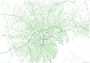 |
2.37 MB | Map created for the State of the Map 2019 [https://2019.stateofthemap.org/events/#main-social-dinner social event] by Adam Rousell and Sabrina Marx using OpenStreetMap data and QGIS. | 1 |
| 15:41, 24 October 2019 | Jakarta.pdf (file) | 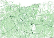 |
6.74 MB | Map created for the State of the Map 2019 [https://2019.stateofthemap.org/events/#main-social-dinner social event] by Adam Rousell and Sabrina Marx using OpenStreetMap data and QGIS. | 1 |
| 15:41, 24 October 2019 | Helsinki.pdf (file) | 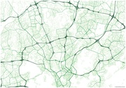 |
3.97 MB | Map created for the State of the Map 2019 [https://2019.stateofthemap.org/events/#main-social-dinner social event] by Adam Rousell and Sabrina Marx using OpenStreetMap data and QGIS. | 1 |
| 15:40, 24 October 2019 | Dodoma.pdf (file) | 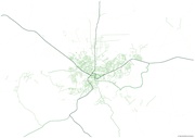 |
203 KB | Map created for the State of the Map 2019 [https://2019.stateofthemap.org/events/#main-social-dinner social event] by Adam Rousell and Sabrina Marx using OpenStreetMap data and QGIS. | 1 |
| 15:40, 24 October 2019 | Dhaka.pdf (file) | 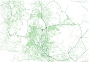 |
1.55 MB | Map created for the State of the Map 2019 [https://2019.stateofthemap.org/events/#main-social-dinner social event] by Adam Rousell and Sabrina Marx using OpenStreetMap data and QGIS. | 1 |
| 15:40, 24 October 2019 | Beijing.pdf (file) | 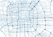 |
1,019 KB | Map created for the State of the Map 2019 [https://2019.stateofthemap.org/events/#main-social-dinner social event] by Adam Rousell and Sabrina Marx using OpenStreetMap data and QGIS. | 1 |
| 15:40, 24 October 2019 | Bangkok.pdf (file) | 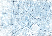 |
3.41 MB | Map created for the State of the Map 2019 [https://2019.stateofthemap.org/events/#main-social-dinner social event] by Adam Rousell and Sabrina Marx using OpenStreetMap data and QGIS. | 1 |
| 15:39, 24 October 2019 | Bamako.pdf (file) | 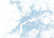 |
1.39 MB | Map created for the State of the Map 2019 [https://2019.stateofthemap.org/events/#main-social-dinner social event] by Adam Rousell and Sabrina Marx using OpenStreetMap data and QGIS. | 1 |
| 15:39, 24 October 2019 | Yerevan.pdf (file) | 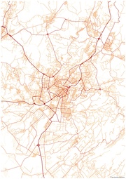 |
983 KB | Map created for the State of the Map 2019 [https://2019.stateofthemap.org/events/#main-social-dinner social event] by Adam Rousell and Sabrina Marx using OpenStreetMap data and QGIS. | 1 |
| 15:39, 24 October 2019 | Wellington.pdf (file) | 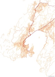 |
1.27 MB | Map created for the State of the Map 2019 [https://2019.stateofthemap.org/events/#main-social-dinner social event] by Adam Rousell and Sabrina Marx using OpenStreetMap data and QGIS. | 1 |
| 15:39, 24 October 2019 | Washington-dc.pdf (file) | 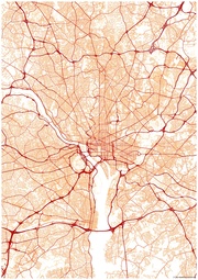 |
5.77 MB | Map created for the State of the Map 2019 [https://2019.stateofthemap.org/events/#main-social-dinner social event] by Adam Rousell and Sabrina Marx using OpenStreetMap data and QGIS. | 1 |
| 15:39, 24 October 2019 | Vienna.pdf (file) | 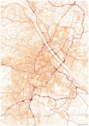 |
3.65 MB | Map created for the State of the Map 2019 [https://2019.stateofthemap.org/events/#main-social-dinner social event] by Adam Rousell and Sabrina Marx using OpenStreetMap data and QGIS. | 1 |
| 15:38, 24 October 2019 | Tehran.pdf (file) |  |
2.84 MB | Map created for the State of the Map 2019 [https://2019.stateofthemap.org/events/#main-social-dinner social event] by Adam Rousell and Sabrina Marx using OpenStreetMap data and QGIS. | 1 |
| 15:38, 24 October 2019 | Tallin.pdf (file) |  |
1.01 MB | Map created for the State of the Map 2019 [https://2019.stateofthemap.org/events/#main-social-dinner social event] by Adam Rousell and Sabrina Marx using OpenStreetMap data and QGIS. | 1 |
| 15:38, 24 October 2019 | Rome.pdf (file) | 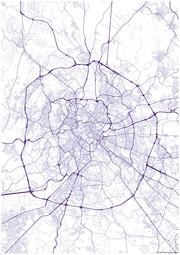 |
3.2 MB | Map created for the State of the Map 2019 [https://2019.stateofthemap.org/events/#main-social-dinner social event] by Adam Rousell and Sabrina Marx using OpenStreetMap data and QGIS. | 1 |
| 15:38, 24 October 2019 | Prishtina.pdf (file) |  |
925 KB | Map created for the State of the Map 2019 [https://2019.stateofthemap.org/events/#main-social-dinner social event] by Adam Rousell and Sabrina Marx using OpenStreetMap data and QGIS. | 1 |
| 15:38, 24 October 2019 | Prague.pdf (file) | 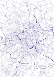 |
3.35 MB | Map created for the State of the Map 2019 [https://2019.stateofthemap.org/events/#main-social-dinner social event] by Adam Rousell and Sabrina Marx using OpenStreetMap data and QGIS. | 1 |
| 15:38, 24 October 2019 | Paris.pdf (file) | 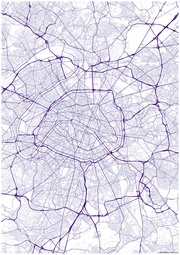 |
5.37 MB | Map created for the State of the Map 2019 [https://2019.stateofthemap.org/events/#main-social-dinner social event] by Adam Rousell and Sabrina Marx using OpenStreetMap data and QGIS. | 1 |