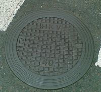
Tag:man_made=manhole
| Description |
|---|
| Hole with a cover that allows access to an underground service location, just large enough for a human to climb through |
| Group: man made |
| Used on these elements |
| Useful combination |
| See also |
|
| Status: de facto |
| Tools for this tag |
|
Hole with a cover that allows access to an underground service location, just large enough for a human to climb through.
How to map
The key manhole=* can be used to further describe the details of the type of manhole.
It may be useful to document the shape of the cover with shape=*, and additionally the dimensions with width=*, length=* or diameter=*. material=* and colour=* can also be used.
If the cover is not made of a single material, but instead is covered in the same way as the surrounding surface, the values from the surface=* tag can be used inside of the material=* key (e.g. material=paving_stones). The additional details that follow that tagging scheme can also be used (e.g. paving_stones:pattern=*), however colour=* should be used instead of surface:colour=* (see above).
Manholes occasionally act as an inlet to some piece of liquids infrastructure. It is recommended to also tag the object with the corresponding inlet=* value, where appropriate.
Incorrect use on a covered gutter
Although it may seem tempting, this tag is not to be used on long covered gutters that also act as a drain. It should only be used on manhole cover ![]() nodes. No consensus has been made on how to tag this feature but there has been some discussion on the Key:inlet talk page.
nodes. No consensus has been made on how to tag this feature but there has been some discussion on the Key:inlet talk page.
