Tag:tomb=turbe
 |
| Description |
|---|
| An Islamic tomb structure or a kind of mausoleum. |
| Group: historic |
| Used on these elements |
| Requires |
| Implies |
| Useful combination |
| See also |
| Status: in use |
| Tools for this tag |
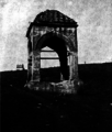
A ![]() turbe (türbe) is an external free-standing building constructed in a style using Islamic (Ottoman, Persian, etc.) architectural elements as a monument enclosing the interment space or burial chamber of a deceased sultans, nobles and notables (individual or group). A turbe can be open with a columns supporting a roof or enclosed space, big or small buildings, usually domed. A typical turbe is located in the grounds of a mosque or religious architectural complex or ensemble, often endowed by the deceased. Some turbes are more closely integrated into surrounding building(s).
turbe (türbe) is an external free-standing building constructed in a style using Islamic (Ottoman, Persian, etc.) architectural elements as a monument enclosing the interment space or burial chamber of a deceased sultans, nobles and notables (individual or group). A turbe can be open with a columns supporting a roof or enclosed space, big or small buildings, usually domed. A typical turbe is located in the grounds of a mosque or religious architectural complex or ensemble, often endowed by the deceased. Some turbes are more closely integrated into surrounding building(s).
How to map
Map the outline ![]() of the turbe or place a node
of the turbe or place a node ![]() in the middle of the turbe or where the grave within a turbe is.
in the middle of the turbe or where the grave within a turbe is.
Add historic=tomb + tomb=turbe and name=* if posible.
Tags used in combination
Tags used in combo:
To add additional details, use a description=* tag.
Possibly also useful:
inscription=*is a standard tag for recording text written on an object
historic:civilization=*- the culture which has built the gravehistoric=archaeological_sitehistoric=cemetery- to map a historic cemetery
Gallery
-
Open turbe, domed with a columns.
-
Open turbe of the Bosnian Princess Katarina, squared roof with a columns.
-
Enclosed turbe, domed.
-
Enclosed turbe, hexagonal with coned roof
-
Enclosed turbe, coned
-
Enclosed turbe, domed with a columns.
-
Open turbe, domed with a columns.
-
Open turbe, domed with a columns.
-
Graves with Muslim tombstones called nishan under the domed turbe with columns
-
Modern style turbe
These are just a few examples of great variety of architectural style and elements included in design and construction of turbes from Islamic Spain to Chine.


