User:BubbaJuice/Survey Points Rendering

From OpenStreetMap Wiki
Jump to navigation Jump to search

Survey points are things that are all across the world, from the most isolated places of America, to the sidewalk of your local town square.

The svgs I have on here aren't the best as I made pngs in GIMP and then converted them to svgs. They need some touch ups.

Image Tags Description Photo
Triangulation Stations
Triangulation Station Triangle with Circle in Middle.svg
man_made=survey_point

survey_point:triangulation=yes

survey_point:purpose=both or survey_point:purpose=horizontal

A control point that at one point in time had two reference marks, and often an azimuth mark in order to triangulate the exact position of the main control point. (Coordinates and possibly Elevation)
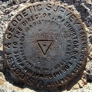
USC&GS Triangulation Station from 1936, "SUMMERHAVEN"
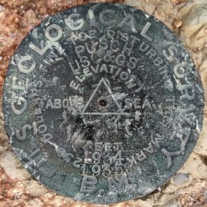
USGS Triangulation Station from 1903, "PUSCH"
Vertical and Horizontal Control Points
man_made=survey_point

survey_point:purpose=both

A control point that is not a triangulation station yet serves as a vertical and horizontal control. (It lacks ever having two reference marks.) (Coordinates and Elevation)
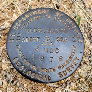
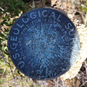
USGS Control Point from 1976, "9 MDC"
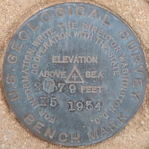
USGS Control Point from 1934, "K 5"
Horizontal Control Points
Triangle Horizontal Point.svg
man_made=survey_point

survey_point:purpose=horizontal

A control point that serves as horizontal control. (Coordinates)

Reference marks and azimuth marks.

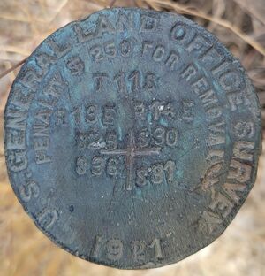
GLO Section Corner Control Point from 1921
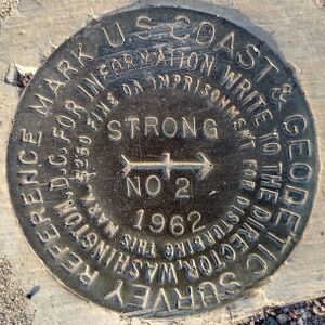
USC&GS Reference Mark from 1962, "STRONG NO 2"
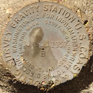
USC&GS Gravity Station from 1937, "TUCSON B"
Vertical Control Points
Vertical Control Point Plus.svg
man_made=survey_point

survey_point:purpose=vertical

A control point that serves as vertical control. (Elevation)
USGS Control Point from 1946, "NOGLS 4503"
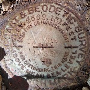
USC&GS Control Point from 1933, "TUCSON"
Default Control Points
Default Survey Point.svg
man_made=survey_point

without survey_point:purpose=*

A control point that does not have survey_point:purpose=*.

Examples

Triangulation Station Control Point in Pima County, Arizona, United States:
man_made=survey_point
survey_point:triangulation=yes
survey_point:purpose=both
survey_point:structure=medallion
name=SUMMERHAVEN
ref=CZ1857
monumentor=United States Costal and Geodetic Survey
operator=National Geodetic Survey
start_date=1936
ele=2462.0

node 9657502870

"SUMMERHAVEN" USC&GS Benchmark.jpg
Triangulation Station Control Point in Pima County, Arizona, United States:
man_made=survey_point
survey_point:triangulation=yes
survey_point:purpose=both
survey_point:structure=medallion
name=PUSCH
ref=CZ1865
monumentor=United States Geological Survey
operator=National Geodetic Survey
start_date=1903
ele=1635.5

node 8980777335

USGS Triangulation Station "PUSCH".jpg
Vetical and Horizontal Control Point in Pima County, Arizona, United States:
man_made=survey_point
survey_point:purpose=both
survey_point:structure=medallion
name=9 MDC
monumentor=United States Geological Survey
operator=United States Geological Survey
start_date=1976
ele=832

node 9662142098

USGS Vertical and Horizontal Control Point "9 MDC".jpg
Vetical and Horizontal Control Point in Pima County, Arizona, United States:
man_made=survey_point
survey_point:purpose=both
survey_point:structure=medallion
name=K 5
monumentor=United States Geological Survey
operator=United States Geological Survey
start_date=1934
ele=847

node 9662142097

USGS Control Point from 1934.jpg
Horizontal Control Point in Pima County, Arizona, United States:
man_made=survey_point
survey_point:purpose=horizontal
survey_point:structure=pipe_cap
monumentor=United States General Land Office
operator=Bureau of Land Management
start_date=1921

node 9662187348

GLO Pipe Cap from 1921.jpg
Horizontal Control Point in Maricopa County, Arizona, United States:
man_made=survey_point
survey_point:purpose=horizontal
survey_point:structure=medallion
name=STRONG RM 2
ref=DV0651
monumentor=United States Costal and Geodetic Survey
operator=National Geodetic Survey
start_date=1962

node 9662142096

STRONG RM 2.jpg
Horizontal Control Point in Pima County, Arizona, United States:
man_made=survey_point
survey_point:purpose=horizontal
survey_point:structure=medallion
name=TUCSON B
ref=DE5834
monumentor=United States Costal and Geodetic Survey
operator=National Geodetic Survey
start_date=1937

node 9662142090

"TUCSON B" USC&GS Gravity Station.jpg
Vertical Control Point in Pinal County, Arizona, United States:
man_made=survey_point
survey_point:purpose=vertical
survey_point:structure=pipe_cap
name=NOGLS 4503
ref=CC8280
monumentor=United States Geological Survey
operator=United States Geological Survey
start_date=1947
ele=4514.321

node 9662142087

NOGLS 4503 USGS Vertical Control.png
Vertical Control Point in Pinal County, Arizona, United States:
man_made=survey_point
survey_point:purpose=vertical
survey_point:structure=medallion
name=TUCSON
ref=CZ0276
monumentor=United States Costal and Geodetic Survey
operator=National Geodetic Survey
start_date=1933
ele=719.585

node 9662142086

TUCSON USC&GS 1933 Vertical.jpg