User:Daveloper/indoor-stairs-mapping
Proposed Techniques for Indoor Stairs Mapping
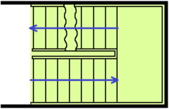
The most common type of stairs are straight lines (I-shape) or turning staircases (U-shape). The U-shape is the more complex case and considered below, mapping I-shaped stairs can be derived.
For indoor purposes we want at least two information from mapped stairs:
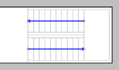
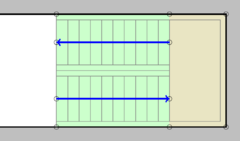
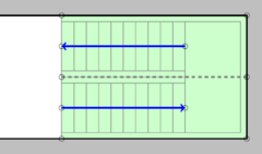
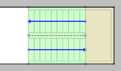
- A distinct walking path orthogonal to the steps as ![]() (shown in blue) - necessary for navigation
(shown in blue) - necessary for navigation
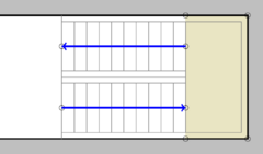
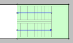
- The complete stairs area as ![]() (shown in green) - necessary for detailed maps and indoor navigation
(shown in green) - necessary for detailed maps and indoor navigation
There are several possible ways of mapping stairs summarized in the following table.
It is to be discussed which method fit the mentioned criteria best.
| Type | Draft | Comments | Suitability |
|---|---|---|---|
| Ways Only | - common way of mapping simple stairs Outdoor - low mapping effort |
- I-shape and spiral staircases only - missing necessary area for details | |
| Ways + half Floor | - more relatable to reality for more complex staircases | - covers U-shaped stairs - missing necessary area for details | |
| Simple Area | - fits the minimum criteria for detailed indoor purposes - unsuitable for routing |
- covers most shapes - missing details of half floor and different stair parts area | |
| Simple Area with half Floor | - mostly relatable to real world physical objects - high mapping effort |
- covers all shapes - missing details of different stair parts area | |
| Multiple Area | - fits the minimum criteria for detailed indoor purposes - high mapping effort - unsuitable for routing |
- covers most shapes - missing details of half floor | |
| Multiple Area with half Floor | - fully relatable to real world physical objects - high mapping effort |
- covers all shapes - contains all possible information |
Proposal
Since it contains all information for all use cases, "Multiple Area with half Floor" should be the way to map stairs inside buildings. If there is no half floor, the way and area can be bent around corners so that only one larger piece of contiguous steps emerges.
Tagging
The walking path ![]() should be tagged as common with highway=steps, and e.g. level=0;0.5.
should be tagged as common with highway=steps, and e.g. level=0;0.5.
For the area ![]() covered by the stairs tags like area:highway=steps with e.g. level=0;0.5 should be used.
covered by the stairs tags like area:highway=steps with e.g. level=0;0.5 should be used.
The floor in between is represented as an indoor=area on e.g. level=0.5.
