South Sudan
| V・T・E |
| latitude: 7.6, longitude: 29.6 |
| Browse map of South Sudan 7°36′00.00″ N, 29°36′00.00″ E |
| Edit map |

|
|
External links:
|
| Use this template for your locality |
South Sudan is a country in Africa at latitude 7°36′00.00″ North, longitude 29°36′00.00″ East.

South Sudan became an independent state on 9 July 2011 following a referendum. Its borders are still conflictuous (see the Borders section below).
Community resources
- OpenStreetMap South Sudan, South Sudan's mapping community
 @OSMSouthSudan
 OSMSouthSudan
- GIS data via Humanitarian OpenStreetMap specific locations, create your own export
South Sudan crisis - HOT Monitoring - mapping goals
Highlights
In June 2013, President Kiir dismissed his Cabinet including Vice-President Riek Machar. Violence erupted in Juba on December 15 said to be a coup attempt by Machar loyalists and has quickly spread, dividing the country along ethnic lines between the Nuer and the Dinka (Machar is from the Nuer tribe while Kiir is Dinka). Bor, the Capital City of Jonglei, one of the most volatile States in South Sudan, has been taken down by a rebellion on December 19. Bentiu the capital city of Unity, has been taken down on December 23 by the rebels. Unity is a highly strategic state in South Sudan as it encompasses oil fields and pipelines going up through the North for export. The governmental forces are heading to these cites to take them back. The UN have decided to expedite troop reinforcements.
- ReliefWeb page for South Sudan gathers all the maps and reports made by the humanitarian organizations
- OpenCrisis list of data and information related to the South Sudan violence in December 2013
- Regarding the reasons of the crisis, this article (in French) is quite informative, explaining that the potential ethnic fights have basic political grounds
- Regarding South Sudan internal conflict, you can also consult the dedicated Wikipedia page
Severin Menard is coordinating this OpenStreetMap Response to the South Sudan Crisis.
email contact : activation@hotosm.org
Ongoing: Mapping of affected cities and towns
Access to this umap to have an overview of the affected cities to be mapped and access the Tasking Manager jobs.
Contributing
If you would like to start mapping right away, please visit this list of current South Sudan Mapping Projects.
Projects related to this Activation are listed in this sub-page:
South Sudan/HOT Activation tasks.
General advice for mapping
Also interesting for experienced user are the Good practice, Armchair mapping and Help:Editing wiki pages.
Since OpenStreetMap relies heavily on a highly distributed workflow involving many happy mappers around the globe please be sure to always indicate the source of the nodes, ways and areas you create so other mappers can estimate their validity, accuracy and smoothly familiarize themselves with the previous work of others. For example if you see a river tagged:
waterway=river
name=Nairobi river
source=landsat
then you know that if bing imagery is available (check) it will probably be more precise so you can edit or delete the way.
Another scenario are highways which are newly constructed and not yet available on bing. If you don't see a source=gps,survey,bing,undp tag you first have to contact the user in order to request information about the currentness.
Borders
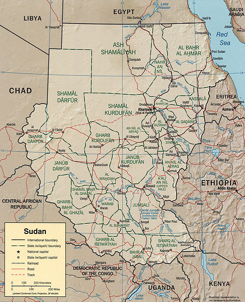
The current border on OSM is a very rough approximation based on an old CIA map: http://upload.wikimedia.org/wikipedia/commons/a/aa/Sudan_political_map_2000.jpg This was rectified using the geothings warper with the existing Sudan border for reference, and traced with JOSM. Disputed territories with Sudan have not been included.
State Dept
These Shapefiles details the border, and disputed border, with Sudan.
- http://rockburger.com/tmp/New_Abyei_non-56_line_part.zip
- http://rockburger.com/tmp/U_SU_1956_N_S_line_revised_.zip
Notes from State...
"Attached is our shapefile for that line and for Abyei; we do not recognize the southern line over near CAR that you see now in Google Earth, since that’s a 1960 line, and the Comprehensive Peace Agreement signed by the two countries specifies that the line as of 1956 is to be used…..it was a miscommunication with Google Geo folks on that front that resulted in their current display of two lines there, including the invalid southern line."
This textual report also available to inform mapping.
- File:SudanBoundaryReport.pdf - Report detailing the South Sudan Boundary.
Newest version, there is permission to use it.
Unosat
We are uncertain on the license of this data.
There is a list compiled by various UN agencies which details airports, settlements and roads available in *.shp and *.kml files.
I spoke with mister motioned above and he give permission if source of data are mentioned, additionally he pointed out better link.
http://www.cern.ch/unosat-sdn/data/vector/shp/undp_ss_county.zip
The zip file contains a shp file. To convert the shp file to osm use Shp2osm
For JOSM there is as well plugin opendata which allow you direct opening of *.shp files with this mapping program.
GIS data
- This HOT Export job encompasses all South Sudan. Check also the HOT Activation tasks tables to get links to specific jobs for each city.
- Open Data for Africa for South Sudan
- Common and Fundamental Operational Datasets provided by UNOCHA.
Available imagery
388 OrbView-3 images of South Sudan (and encompassing polygon) are available. See OrbView-3#Available_in_editors.