Armchair mapping (also known as remote mapping) means contributing to OpenStreetMap without leaving your chair. Armchair mapping contributions do not involve a surveying phase where the user physically visits the place they are mapping. Without this, armchair mapping workflows will typically cover a larger area more rapidly, but with disadvantages in terms of data accuracy, detail, and community building.
Outdoor mapping involves going out and looking at the real world. The process does, in fact, involve sitting at home and working on the map, but in areas where you have been out surveying, where you are already familiar from day-to-day life, or perhaps where you are intending to go surveying in the near future.
Armchair mapping
Armchair mapping is modifying or sketching in new data in areas unconnected with any surveying work, and where you are basing your contribution on aerial imagery or other data sources.
By querying a contact=* of a given POI (phone, website, e-mail, Facebook, Instagram or others), extend the tags on the POI, or even ask about neighboring ones
Correct, extend or create wiki pages describing keys and tags or even propose new ones (Wiki Help)
Register on WiGLE and zoom in on their maps to find network names that could indicate potential POI or missing internet_access=*, cross check with a website or open map notes to investigate on the ground
It is better to have some understanding of the area you are mapping via your armchair. If you know the area, it's not "armchair mapping" in the strictest sense.
It is very important to follow these guidelines when contributing to an area where data already exists in OpenStreetMap, and where local people have been contributing. In general, you can be more relaxed about armchair mapping in areas of the world which are more remote or otherwise have less pre-existing data.
Learn to recognise valuable data. There are various tools and techniques, some more complex than others, for figuring out who's done what within the OpenStreetMap data. These are all valuable skills to avoid doing damage while armchair mapping.
Specify what sources you are using. Add the proper source=* in the changeset comment, to say whether you are mapping from aerial imagery, or other map sources, or from a survey, or from a combination of these.
Check imagery alignment. Imagery is very frequently misaligned from reality with an offset in one particular direction. If you notice that all of the data is off to one side, don't move the data, try to re-align your background imagery layer to match. Offset imagery Bing in Pskov(Russia) If you see this, do not start moving all the data Although armchair mapping often involves moving roads to match with imagery, you should not go shifting large areas of data where that shift is all in one particular direction, at least not unless you have reason to believe that existing data is from a less accurate source than your imagery. See also Roof modelling for techniques for drawing buildings and avoiding errors in alignment or the interpretation of roof geometry from aerial images.
Things change. Imagery gets old. Road layouts change. Buildings get knocked down and rebuilt in different places. Imagery can be many years old. Armchair mapping involves blindly copying this information but in an area where locals have contributed, you should be very careful about this. Look out for tell-tale signs. If the whole area has building outlines drawn in, and you see just one missing, or one drawn in completely the wrong shape, don't just "fix" it. Alarm bells should be ringing. One approach would be to just leave a fixme=* tag. (Conversely mappers could leave a note=* tag on elements or on a standalone node to warn of recent real-world changes and out-of-date imagery. We have no firmly established routine for this)
when buildings get removed in real life, but are still visible on aerial imagery, people should consider using lifecycle prefix - i.e. tagging the removed buildings as removed:building=yesinstead of removing its polygon. That way, wasteful "add - remove - add - remove" cycle (and a lot of frustration on both sides) can be avoided.
If in doubt, assume that existing data has been mapped by local people on the ground. Sometimes you will be able to tell this by seeing source tags or just by contacting users to ask!
You can gain a better understanding of the reasoning behind these guidelines with the 'Disadvantages and controversy' section below.
Guidelines for event organisers
Coordinated armchair mapping events are not something we have experimented with often. When organizing an intensive en-masse armchair mapping event, organizers have the opportunity to teach users about these guidelines and ensure that they are followed. They also have the opportunity to screw this up. Organizers should be acutely aware of all of the guidelines and their reasoning seen in the following section. In addition, there are several steps which should be taken in advance of an event.
Organisers must take steps to inform all participants about these guidelines and the issues around armchair mapping. This should include linking to this page from any publicity about the event (e.g. from a wiki page about the event) and perhaps copying or summarising sections of this page.
Organisers should think carefully about target regions for armchair mapping, selecting areas where there is less pre-existing valuable data, and communicating these selected regions to the participants. Providing rigid indicators for regions to map, using tools such as MapCraft or the HOT tasking server, may be a good way to direct participants to map in sensible areas; however, the set-up of these regions is then all the more important. Where participants are to be given more choice of where to do their armchair mapping, this increases the need for them to be educated about the guidelines and issues on this page.
Organisers should take steps to contact the local mapping community and consult with them on target regions for armchair mapping. Where there is pre-existing contributed data, this means identifying key contributors and seeking their buy-in to the idea. In the absence of pre-existing data, community contact channels at the regional or country level should still be used to inform locals however possible. This includes local wiki pages under List of territory based projects, country-level Mailing Lists and whatever Contact channel is most heavily used by locals.
Advantages
You can map from your armchair. If you are not able to get out to do mapping on the ground you can still contribute to the project.
Speed, quicker to get coverage and fill in blank areas of the map. You can get many, many times more basic coverage (road and building outlines) mapped doing armchair versus normal mapping.
Some areas have very little coverage mapped. There are likely no mappers in some remote area. Humanitarian mapping for disasters, HOT mapping, is often done entirely as an armchair mapping process, with only smaller scale mapping projects achieved by people on the ground. In other projects, remote mappers add the basics like buildings and roads, and local mappers fill in the details like type of building, type of road, and so on. This allows local mappers to spend more time on details and less on just adding features.
Safety. You might not feel safe/comfortable in some areas to go manual street mapping; therefore armchair mapping is a sensible option.
Access. Some areas you cannot get access. Locked estates, restricted areas, schools, etc. For these mapping via aerial imagery is often the only option.
Many things, like roads and buildings, don’t change for decades and can be mapped with reasonable confidence.
(When comparing armchair mapping with aerial imagery to mapping with GPS, you could also say that armchair mapping requires no expensive equipment and that it allows you to draw more detailed road centrelines or building outlines; but these are really properties of "aerial imagery vs GPS mapping" and are orthogonal to the question of whether you go out to survey or not. Most on-the-ground mappers will use aerial imagery in addition to what they have surveyed on the ground.)
Disadvantages and controversy
OpenStreetMap treasures the contributions of local people who go out and map their neighbourhood. We love people to do that, and we would love more people to do that. In this way, we can create a truly uniquely valuable map of the world. There is a sense in which this represents the heart and soul of OpenStreetMap. We create maps where people care about the data enough to go out and collect it. Our dataset comes with a community of mappers who support it. In areas where we don't have that community yet, we should do what we can to attract and build the mapping community. Nothing should be allowed to discourage this, and unfortunately, armchair mapping is widely believed to do so. Several reasons are argued:
Although going out surveying isn't always convenient, there's some truth in saying that time spent on armchair mapping is time which could have been spent on survey-based mapping by those able to. What's more, every mailing list post or blog post or wiki page describing armchair mapping could steer new visitors towards this approach and away from the more valuable process of mapping their own neighbourhood if they are able to do so.
It can be argued that even if armchair mapped data is not interfering with existing surveyed data, its sudden rapid arrival discourages people from doing the better survey-based mapping in a particular area. If OpenStreetMap feels like a dumping ground for low-quality data gathered by means of easy quick shortcuts, this does not encourage people to work on the map in the way we would really like them to. (Note that similar arguments are made about imports. Perhaps armchair mapping can be regarded as a step on a sliding scale towards the damaging effects of mass data imports)
Armchair mapping often tends to favour quantity and speed over quality; it is "easy to fill in the blank spots" and easy to get carried away with adding sub-par data. See below for quality issues that occur even if the armchair mapper is trying their best.
Armchair mappers have occasionally been found to be damaging or undoing the hard work of surveying mapping contributors.
The first two points are rather philosophical, based on the psychology of users who may or may not become new contributors. They're difficult to prove or disprove, and whether you view them as a major problem will depend on how you weigh against the considerations of the value of armchair mapped data. For a given area of data, armchair mapped data can be less valuable than painstakingly gathered on-the-ground surveyed data, but how much less valuable is debatable.
The last point is a problem we can try to mitigate by laying down some armchair mapping guidelines and trying to educate new users about what is accepted practice for armchair mapping.
Specific practical problems with mapping from aerial imagery
In addition to the issues of imagery being out of date or misaligned, some common mistakes result from armchair mapping from aerial imagery without a corresponding survey. Armchair mappers should be alert to these issues and try to avoid them if possible, but mostly they are unavoidable and will always be an issue with armchair mapping.
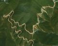
Connecting roads that don't connect. Fences, gates, and gutters all stop features from connecting. Tree cover, an obscured view, or bad resolution at the end of roads can often make it difficult to see if one road connects to another or if there is a connection.
The view can be obscured by trees, tunnels, clouds, pergolas, and so on.
Many POIs cannot be mapped. You cannot know a shop name from above.
Many important smaller objects cannot be seen. Drinking water spots, etc.
You can see buildings, but you don't know what's inside. Hard to map important amenities e.g. restrooms.
Something green and leafy from the air isn't always a park or a wood on the ground.
Mapping private features. Private backyard tennis courts and swimming pools are probably best left unmapped. Is that a cut-thru between streets, or really just a driveway of a house that connects to the house in front and behind?
Available imagery may differ between different imagery providers dependent on the satellites' position when the photo was taken (see gallery below)
Take particular care before attempting to map hiking trails from your armchair. Someone who follows a noexit=* mapped road in their car, will likely just curse their GPS and take another route. However, some serious obstacles in forest areas are easy to miss from aerial imagery. Remember the map user can't tell that one trail has been mapped by a hiker who has done it, and another trail may have been mapped by a virtual hiker who may have never been near the trail.
 Raster map sources (where these are available for us to use e.g. scans of Out-of-copyright maps)

 1
1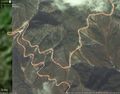 2
2 3
3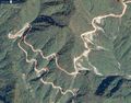 4
4


