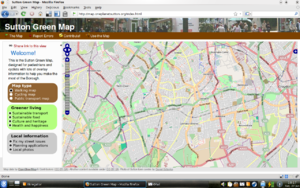
WikiProject Sutton England/OPL map
BioRegional are producing a slippy map of Sutton and the surrounding area for our One Planet Sutton project.
Work in progress URL: http://map.oneplanetsutton.org
Aim

The idea is to make a slippy map suitable for pedestrians and casual cyclists, focussing more on what's available in the area than how to navigate major roads from Sutton up to Hackney. We would also like to show info relevant to the project, so helping people to (for example) walk to nearby parks and shops.
Why don't you just use the London Green Map?
- We can use custom cartography to make it look much nicer than icons overlayed on Google maps (which is very car-centric)
- We can produce nice printed maps and generally be more flexible with our work with local venues, groups, etc.
- Working with web sites like Sutton Active, the Sutton CVS and others we can bring in overlays for community venues automatically, as well as flickr photos, etc.
- This one can be tightly integrated into our One Planet Living in Sutton web site more easily, and better.
But I'm open to integrating them or running both in parallel where it makes sense, I'd love to see L21's Green Map start using OSM and offer people the tools to integrate it into their web sites in the way that we plan for the One Planet Living in Sutton web site.
TODO list
Completed items are struck through.
Get the maps to work with Internet Explorer again!
- POI Layers
- Set-up automated weekly import of POIs from OSM data (see below)
- Grab weekly dump of data
- Import this data into PostgreSQL
- Provide this data through Feature Server
- Display this data with Open Layers
Add a close button to popups- Investigate popup sizing bug. - Worked around, but still not perfect.
- Add more data to the POI layers
Bring them out of the OpenLayers widget into the sidebar, with nice icons, colour codingand some way of giving more info (e.g. Fix My Street issues are from this web site, do add more on that web site, etc.)- Merge the photo layers (geograph & flickr) into one
- Add a Wikipedia articles layer (using wikipedia=tag? or something like Geonames?)
- Set-up automated weekly import of POIs from OSM data (see below)
- Routing
- Render long distance paths ala the cycle map, maybe as an overlay or separate layer. (Wandle Trail, London Loop etc)
Research integrating OpenStreetBugs, or at least linking to it clearly
- Integrate map with One Planet Sutton web site
- Write CakePHP model, controller etc. for maps
- Put map on user profile page with all POIs turned on and link to bigger map
- Add location for events, with UI for user to mark it on map, and to show this to web site visitors (all POIs on, link to bigger map)
- Add routing overlay to events from user location if logged in (by default show nice walking/cycle route)
New technical proposal
The POI layers that aren't pulled in from an external service (such as Planning Alerts) will switch to the following set-up:
- Grab a weekly dump of these POIs from OSMXAPI including this data:
- Coordinates
- Name
- Description
- Website
- Basic tagging to determine a category (e.g. transport) and type (e.g. train station)
- addr:*
- Wikipedia article
- Put that into the PostgreSQL database
- Configure Feature Server to pull this data out in the right way
- Configure Open Layers to display the popups with this data
This will enable us to maintain the data in the main OpenStreetMap database, improving the quality and quantity of data and reducing duplication.
Current technical details
We use the standard OSM Mapnik rendering. For our POI layers, we use a mix of OSM and 3rd party data imported into PostGIS database, which is then served up nicely by FeatureServer. We also proxy several third-party layers such as FixMyStreet, Planning Applications, Geograph, and the OPLS Flickr feed.
OpenLayers Bugs Discovered Through this
Ticket is: closed, awaiting review, needs more work.
#1467- iconOffset of 0,0 cannot be used with text layer#1537- WFS Layer sends wrong SRS#1575- WFS Layer does not allow non-XML formats#1576- Inline KML styles extracted even though extractStyles:false#1578- extractStyles:true on KML format conflicts with inline styles#1600- getChildValue() on GeoRSS format is slow