List of OSM-based services: Difference between revisions
Jump to navigation
Jump to search
Candid Dauth (talk | contribs) (Restructured, added several projects.) |
(→Slippy Map based: remove multilingual map) |
||
| Line 20: | Line 20: | ||
|[http://www.petschge.de/projekte/mobilemap/ mobile map] || {{#language:en}} || Map optimized for mobile devices with small screens, resolution adjustable. Upload and displaying of GPX-files implemented. || || [http://www.petschge.de/projekte/mobilemap/mobilemap.tgz Yes] || |
|[http://www.petschge.de/projekte/mobilemap/ mobile map] || {{#language:en}} || Map optimized for mobile devices with small screens, resolution adjustable. Upload and displaying of GPX-files implemented. || || [http://www.petschge.de/projekte/mobilemap/mobilemap.tgz Yes] || |
||
|- |
|- |
||
| |
|<s>multilanguage OSM Map</s>|| 42 || Experimental Slippy Map with captions in forty languages - which are rendered and displayed as far as they exist in OSM-db. (Now gone)|| || It was || |
||
|- |
|- |
||
|[http://opencyclemap.org/ Open Cycle Map] || {{#language:en}} || Slippy map with contours, hill shading, cycle routes, bicycle parking and cafes that do fryups. || ||No|| |
|[http://opencyclemap.org/ Open Cycle Map] || {{#language:en}} || Slippy map with contours, hill shading, cycle routes, bicycle parking and cafes that do fryups. || ||No|| |
||
Revision as of 18:40, 30 April 2009
Alphabetically sorted list of services and projects using maps and/or data from OpenStreetMap
Slippy Map based
| Name, Weblink | Language | Description | On the wiki | Source Code Available | Image |
|---|---|---|---|---|---|
| CCTV Map | Overlay that visualizes CCTV cams, natural monuments and playground items | ? | |||
| cdauth’s map | English | Layers for different OSM-, Google Maps- and Yahoo renderings, searchable using the OSM Namefinder | User:Candid Dauth/Map | Yes | |
| Geofabrik-Tools | English | Map: A full-screen Slippy Map with several different map views. Map Compare: two maps side by side. Several OpenStreetMap and Google maps are available. OSM Inspector: offers different views on the OpenStreetMap data. Can be used to get a better idea how the data in the database looks like and can point out omissions or errors. | ? | ||
| Hike&Bike Map | English | A Slippy Map for hiking and biking with hillshading, contours and route symbols; limited to the Elbsandsteingebirge in Saxony | User:Colin Marquardt/Hike & Bike Map | yes | 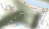
|
| Information Freeway | English | Slippy map with tiles from Tiles@home, several sources, interface for rerender requests | Yes, OpenLayers + HTML Source | ||
| keep right! | English | Displays mapping errors | ? | ||
| mobile map | English | Map optimized for mobile devices with small screens, resolution adjustable. Upload and displaying of GPX-files implemented. | Yes | ||
| 42 | Experimental Slippy Map with captions in forty languages - which are rendered and displayed as far as they exist in OSM-db. (Now gone) | It was | |||
| Open Cycle Map | English | Slippy map with contours, hill shading, cycle routes, bicycle parking and cafes that do fryups. | No | ||
| OpenPisteMap | English | Slippy map highlighting ski pistes and lifts. | OpenPisteMap | Yes | |
| Open Route Service | Deutsch | Route navigation based on osm data | OpenRouteService | ? | |
| OpenStreetBrowser | Browse not only the map but also the contained information. ATM beta-state. | OpenStreetBrowser | Coming Soon | ||
| OpenStreetBugs | English | Website for easily marking errors in the OSM data | OpenStreetBugs | ? | |
| ÖPNV-Karte | Deutsch | Map displaying routes of local public transportation (PSV) in Germany | ? | ||
| OSMC Reit- und Wanderkarte | Deutsch | Riding and hiking map with shaded hills and signs of hiking trails from Nop. Due to lack of Serverpower limited to Germany ATM | DE:OSMC Reitkarte | ? | 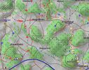
|
| OSMdoc | English | A new fast tagwatch using Ajax | ? | ||
| osmpoint | Shows POIs from the osm database on the Slippy Maps overlay | ? | |||
| SlippyMap Generator | English Deutsch | Create comfortably a SlippyMap based on OpenLayers and OSM-Tiles with markers and different layers. | ? | ||
| t@h Browse Map | - | Simplistic map, running w/o javascript/AJAX; trouble-free on less advanced browser (e.g. mobile devices) or behind restrictive firewalls. | ? | ||
| Transparent Map Comparison | Compare two selectable Slippy Maps displayed over each other. | ? | |||
| YOURS | English | Yet another OpenStreetMap Route Service. Goal is to use OpenStreetMap data to make a routing website utilizing as much other (opensource) applications as possible. | YOURS | Yes | |
| FreieTonne | Slippy Map with POI Overlay representing Seamap Information like Ports, Buoys and other seamarks | ? |
Other web-based tools
| Name, Weblink | Language | Description | On the wiki | Source code available |
|---|---|---|---|---|
| Geofabrik | Deutsch, English | Offers services, tools, maps and data from and related to OSM | ||
| OpenStreetMap Links | English Deutsch | Collection of Slippy Maps and selected tools addressable from Permalinks | ||
| osm mapper | English | Very detailed statistics on OSM users, edit sessions, registration needed | ||
| OSM Relation Analyzer | Deutsch | Analyze relations and find errors (optimized to find errors in the route relations) | Relation Analyzer | |
| OSM Restriction Analyser | English | Visualize restriction relations | ||
| OSM Route Manager | English, Deutsch | Analyze route relations, find gaps and export GPX files. | OSM Route Manager | Yes |
| Relation Check | English | Relation analyzer | Relation Check | Yes |
| Relation Diff | English | Lists and shows recent changes in relations. | Relation Diff | Yes |
Others
| Name, Weblink | Language | Description | On the wiki | Source code available | Image | Platform |
|---|---|---|---|---|---|---|
| Kosmos | English,... | Lightweight OpenStreetMap (OSM) map rendering platform for rendering, displaying and printing maps | Kosmos | 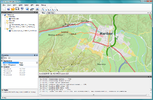 |
MS Windows (.NET 2.0), Sourcecode available | |
| Marble | a lot | A KDE globe program and widget for displaying or editing geographic data in other KDE applications | Marble | 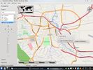 |
Linux, Mac OS X, MS Windows, Sourcecode available | |
| OSM Composer | Deutsch (partial translation in English) | Java-tool with graphical user interface to create topographic maps with route marking. Results can be used on mobile devices (Garmin) or in MapSource | OSM Composer | 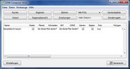 |
all PC and Mac Hardware able running Java | |
| Osmdiff | English | Perl script to visualize the difference between two OSM files. | Osmdiff | Yes | All platforms running Perl | |
| Traveling Salesman | English,Deutsch,русский,... | Extendable routing-program with "edit"-button | Traveling salesman | 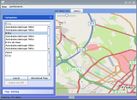 |
Java, Sourcecode available |
Companies offering OpenStreetMap Services / Support / Consulting
| Company Name | Languages | Regions? | Brief Description |
|---|---|---|---|
| CloudMade | English, українська | Europe, USA | - |
| Geofabrik | English, Deutsch | Europe | - |
| Itoworld | English | Europe | - |