EuYoutH OSM
European YoutHumanitarian OpenStreetMap - euYoutH OSM

What are the aims of euYoutH_OSM?
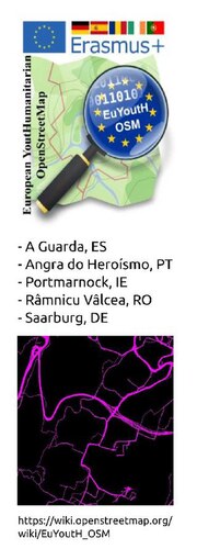
Five schools from five European countries (Ireland, Portugal, Spain, Romania and Germany) have set themselves the task of introducing as many pupils as possible to OpenStreetMap at their schools and to get them interested in mapping. The students will be introduced carefully and concentrated to differentiated mapping. We will use existing material as far as possible (such as LearnOSM) and, if necessary, create additional training material. (maybe screenscast)
It is not our goal to produce "nodes en masse", but to train responsible mappers who can also help with humanitarian mapping. Not quantity, but quality matters.
Results and products of the euYoutH_OSM project
Partner Schools 2018-2020
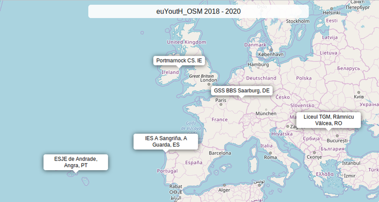
We build young mapper for humanitarian tasks
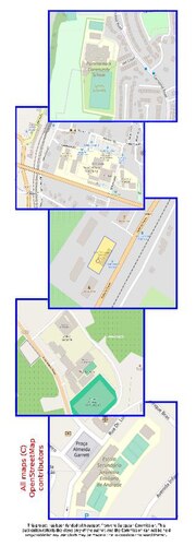
Map by MapBBCode - Map data © OpenStreetMap Contributors

Our schools in OSM & Contat
- For a closer look see below ... browse map
Spain browse map
Contact
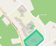
IES A Sangrinha
Avenida Paseo de Portugal
21 36780 A Guarda - Galicia
Phone +34 886110060
E-Mail: ies.sangrina@edu.xunta.es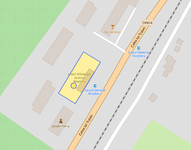
Romania browse map
Contact
Liceul Tehnologic General Magheru
Calea lui Traian 43
Ramnicu Valcea 240011
Phone: +40 350401627
Email: madalinaionescu79@gmail.com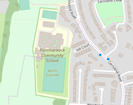
Ireland browse map
Contact
Portmarnock Community School
Carrickhill Road Portmarnock Co.Dublin
Phone +353 1 803 8096
E-mail: office@portmarnockcommunityschool.ie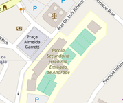
Portugal browse map
Contact
Escola Secundária Jerónimo Emiliano de Andrade
Praça Almeida Garrett
9700-016 Angra do Heroísmo
Phone +351 295401230
E-Mail: es.jea@azores.gov.pt
Germany browse map
Contact
Geschwister-Scholl-Schule Berufsbildende Schule Saarburg/Hermeskeil
Schulzentrum
54439 Saarburg
Phone +49 6581 914050
E-Mail: info@bbs-saarburg.de


Downloadable Files with teaching material
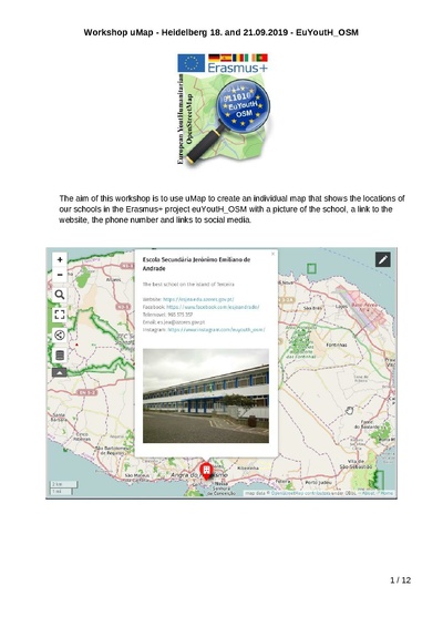
| Website with many links for Beginners | Workshop uMap | Sharing Experiences (Attention pdf ~28 MiB) |
|---|---|---|
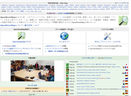
| OpenStreetMap is more than a map. It is a free database around which an ecosystem has formed for maps of all kinds - including for humanitarian purposes.
It is not possible to explain OSM in 10 steps. On this website we tried to put together a small collection of links for beginners. Content
|
|
|
Mapping Event Teaching Materials
| Doctors without Borders | Firehydrants | Buildings and streets | ErasmusDays |
|---|---|---|---|
|
|
|
|
| OSM Geography Awareness Week | Mapping with UN Mappers in Central African Republic | Finishing our mapping in Terceira Mapping with UN Mappers in Mali |
Appendix (all .PDF) |
|---|---|---|---|
|
|
|
|
Problems and solutions
As one partner from the UK left after the approval of the project, the tasks had to be redistributed between the remaining partners.
Tasks and responsibilities of each partner school in the new framework
| PT | Coordination of Dissemination, StreetComplete, WikiPages. |
|---|---|
| RO | LearnOSM, OSM Tracker, Wiki-Website, Evaluation and Statistics via HDYC, Preparation, execution, evaluation of surveys and communication of the results. |
| EI | JOSM Training, QGIS Training, OSMOSE, KEEPRIGHT, OSM Inspector, MapBox. |
| ES | weeklyOSM, Preparation of Press Release. |
| DE | Project Management Spreadsheet, JOSM Training, QA-Editor, uMap, Overpass, OSMBC |
Time Tables
- - work plans -
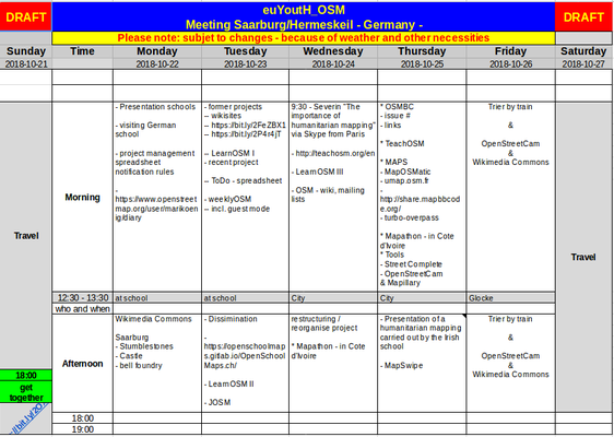
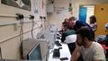
Teach the Teachers GSS BBS Saarburg
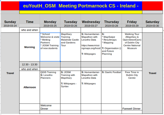
JOSM, Mapillary, MapSwipe Portmarnock Comunity School
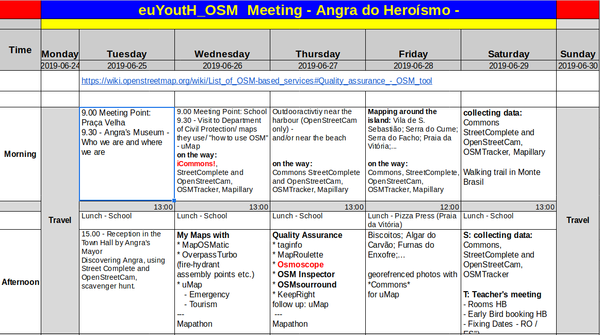
Quality Assuarance - Mapathons ESJE de Andrade
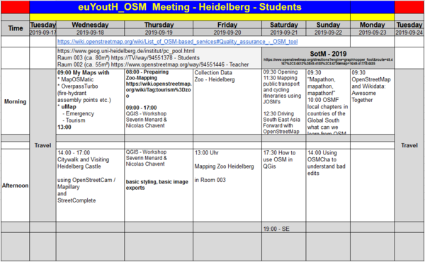
Overpass - uMap - QGIS - SotM2019 SotM2019 Venue
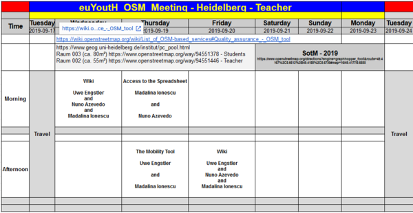
Wiki - Project-Management-Spreadsheet - Mobility Tool SotM2019 Program
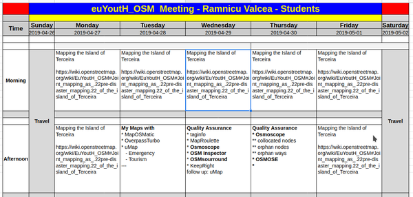
Mapathon predesaster mapping Terceira and QA Our task Not realised because of SARS-CoV-2
Virtual Mobility Râmnicu Vâlcea Information and Training papers

Virtual Mobility Angra do Heroísmo Information and Training papers


Possible Logos


The project's bookmark
| Front | Back |
|---|---|
|
|
The project's rollup in action
| Heidelberg | Saarbrücken | Youth Hostel | SotM2019 |
|---|---|---|---|

|

|

|

|
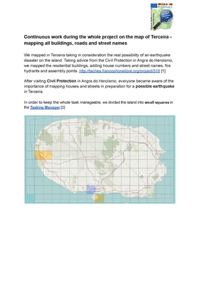
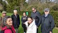
Joint mapping as "pre-disaster mapping" of the island of Terceira

|
After visiting Civil Protection in Angra do Heroísmo, everyone became aware of the importance of mapping houses and streets in preparation for a possible earthquake in Terceira. | |
|---|---|---|

|
For this reason, we decided to map the island of Terceira in the best possible way. | |

|
In order to keep the whole task manageable, we divided the island into small squares in the Tasking Manager | |
| - Here you go directly to our tasks: Direct access to the our tasks | ||

|
If the task is still too big ... Split it! | |

|
Contribute - Task too big? Split - Are you sure to split this task? - YES! ;-) | |

|
Best satellite images by Maxar Premium Imagery (Beta). | |

|
We shared the work between our partners. | |
| The Tasking Manager allows mapping together and/or on different places without the mappers hindering each other. | ||
 
|
The task for each team is to map buildings and highways. | |

|
The Portuguese team also has the task of determining the street name on site and entering it in OpenStreetMap. | |
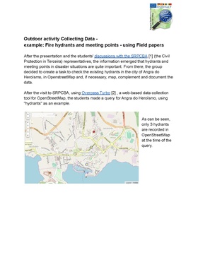
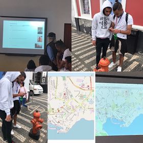
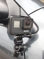
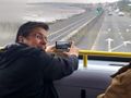
| By using Field Papers and some mobile apps (like GoMap!; StreetComplete; KeyPadMapper; OSMTracker; ...) we map the street names and housing numbers in Angra do Heroísmo. | ||

|
Two types of Field Papers | |

|
||

|
Mapping Angra's street names and housing numbers.Confirmation and adjusting the results by using JOSM. | |
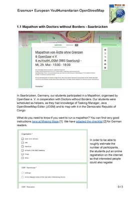
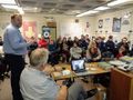
Preparing a Mapathon in Saarbrücken, Germany - together with Doctors without boarders Germany
- We prepared our students to work with the Tasking Manager - and the same in German
- Handout for participants at a mapathon.
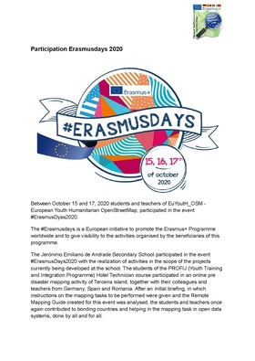
Participation Erasmusdays 2020
The text below is a translation of the documentation of our Portuguese partners
| We participate in Erasmusdays 2020 | |||
|---|---|---|---|
| Between October 15 and 17, 2020 students and teachers of EuYoutH_OSM - European Youth Humanitarian OpenStreetMap, participated in the event #ErasmusDyas2020.
The #Erasmusdays is a European initiative to promote the Erasmus+ Programme worldwide and to give visibility to the activities organised by the beneficiaries of this programme. The Jerónimo Emiliano de Andrade Secondary School participated in the event #ErasmusDays2020 with the realization of activities in the scope of the projects currently being developed at the school. The students of the PROFIJ (Youth Training and Integration Programme) Hotel Technician course participated in an online pre disaster mapping activity of Terceira island, together with their colleagues and teachers from Germany, Spain and Romania. After an initial briefing, in which instructions on the mapping tasks to be performed were given and the Remote Mapping Guide created for this event was analysed, the students and teachers once again contributed to bonding countries and helping in the mapping task in open data systems, done by all and for all. |

| ||

| |||
| A nossa atividade de mapeamento foi notícia no semanário WeeklyOSM #535, tendo sido publicada em 9 idiomas diferentes. | 
| ||
| A atividade de mapeamento foi, igualmente, acompanhada através da ferramenta "OSM Changesets" que identifica a atividade realizada no mapa nos últimos 30 dias.
|

| ||


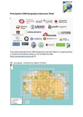
Participation "OSM Geography Awareness Week" 2020-11-15 until 2020-11-21
We are in good company
| We participate in OSM Geography Awareness Week 2020 | ||
|---|---|---|
https://osmgeoweek.org/ 
|
Organisation
| Question | And here are your links ;-) | Example |
|---|---|---|
| How to proceed? | Click on the link and read the the "Howto" ;-) | 
|
| Where to find the tasks? | Click on the link and open the task. | 
|
| Where to book date and time with a teacher? | Click on this link and mark your appointment. | 
|
| Where do we meet? | At each appointment a teacher will be present at our BBB-Videoconference offered by OpenSaar e.V. | 
|
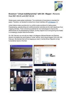
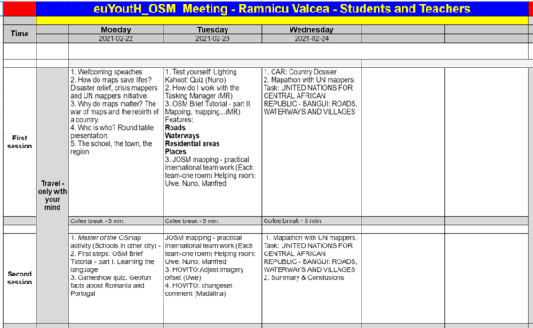
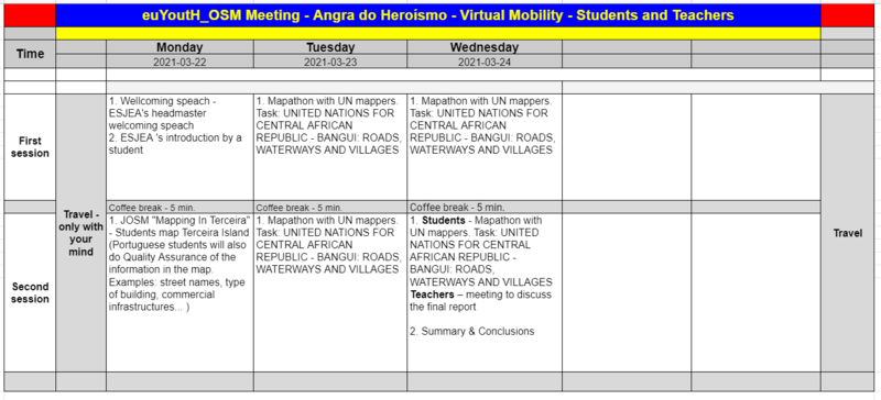
Erasmus+ "virtual mobility/activity" 2021-02-22 until 2021-02-24 together with UN Mappers
| Erasmus+ "virtual activity" (2021-02-22 until 2021-02-24) with UN Mappers | ||
|---|---|---|

|
Global peace needs global contribution. The contribution of everybody is important for peace.
United Nations helps countries torn by conflict create conditions for lasting peace. Peacekeeping, peacebuilding and conflict prevention activities are the main objectives of our mapping activities. There is enormous potential for new technologies to improve the effectiveness of UN peacekeeping missions, as they respond to an ever-growing list of tasks in increasingly complex field environments. |
|
Preparatory meeting
| Question | And here are your links ;-) | Example |
|---|---|---|
| Preparatory meeting with UN Mappers 15th February | On 15th February we met with two italian UN Mappers (Michael Montani and Rachele Amerini) to prepare the next Erasmus "virtual "activity, which will happen 22nd until 24th February. We decide that we'll be mapping an area in Central African Republic to help humanitarian teams in the field.
|
 
|


What are we going to do?
| Question | And here are your links ;-) | Example |
|---|---|---|
| What are we going to do? | [Time Table] Click on this link to see the time table for this Erasmus+ virtual activity. | 
|
Romania hosts Portugal in February 2021
The school, the town, the region
| The School that organizes this activity | The school, the town, the region | Example |
|---|---|---|
| Liceul Tehnologic General Magheru
Calea lui Traian Râmnicu Vâlcea Romania |
The school, the town, the region
|

|
Where do we meet?
| Question | And here are your links ;-) | Example |
|---|---|---|
| Where do we meet? | This activity will be present at our BigBlueButton-Videoconference, offered by OpenSaar e.V. | 
|
UN peacekeeping missions?
| Question | And here a links ;-) | UN MAPPERS - Mapping the World - Supporting Peace and Serving Humanity | |
|---|---|---|---|
| Short video of United Nations peacekeeping | You can watch here a short video of United Nations peacekeeping. |

|
|
| Central African Republic: Portuguese military personnel receive praise for "courage, bravery, excellent attitude" and "professionalism". | You can read here an article about the participation of the portuguese Blue Helmets in the peacekeeping mission in Central African Republic. |  Copyright - Lusa Copyright - Lusa
|
Master of the OSMap
| Question | A link to download the padlet ;-) | |
|---|---|---|
|
Master of the OSMap | 
|
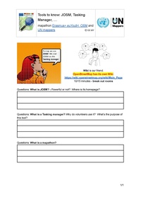
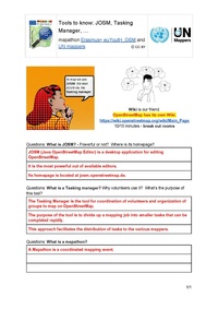
Tools to know. Using the OSM-Wiki
| Question | And here are your links ;-) | Tasking Manager | Question for students | Question & Answers |
|---|---|---|---|---|
| Using the OpenStreetMap-Wiki to explore important Tools like: JOSM and the Tasking Manager | 
|
|
|
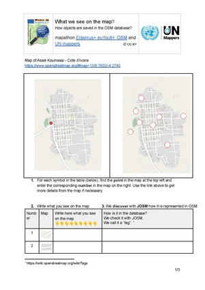
What is on the map? What is a tag?
| Question | And here are your links ;-) | Explore a map | Questions and Answers |
|---|---|---|---|
|
Learning material: This part in OpenStreetMap: This part in the Tasking Manager:
|
|
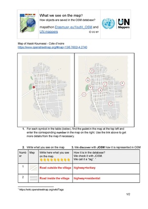
|
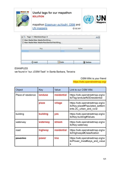
Useful tags for our mapathon
| Question | And here the link ;-) | Useful tags | with answers |
|---|---|---|---|
| What are the useful tags for our mapathon? |
|
|
|

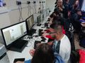
My first building in OSM 2021-02-23
| How do we proceed today? | The material and the links ;-) | Region to map opened in JOSM via Tasking Manager with Bing satellite image |
|---|---|---|
. Some steps:
... After these steps ... you start mapping - by choosing a task in the tasking manager an you have the time to map about 45 minutes buildings in Terceira |
Teaching material: . Collection of tags for our mapathon: . . The Link in OpenStreetMap: The Link in the Tasking Manager: |

|
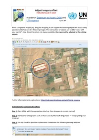
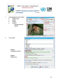
Just in case ;-)
| Question | And here are your links ;-) | Adjust_imagery_offset | First_upload | |
|---|---|---|---|---|
.
|

|
|
|
Check your knowledge
| Question | And here are your links ;-) | Example |
|---|---|---|
| Check your knwoledge ;-) You have been challenged to play a kahoot called "Mapathon Erasmus+ euYoutH_OSM and UN Mappers"! |
|

|
What are the most important Keys and Values in OSM you need to know?
| Question | And here are your links ;-) | Example |
|---|---|---|
| What's the most importan Keys and Values in OSM you need to know? | 
|
LINK - Collection: Which part of the world we are working on ... and where to find the tasks?
| And here are your links ;-) | Example | |
|---|---|---|
| We will use the following links: | OpenStreetMap Links ... | 
|
| We will use the follwoing tasks | Tasking Manager
Task 1 - Ivory Coast, Assié-Koumassi (roads, landuse, buildings,...) Task 2 - Terceira Island (buildings) Task 3 - Terceira Island (special task) Task 4 - Central African Republic - North Bangassou (roads, waterways and villages. |

|
Homework First day
| Homework | And here is your link ;-) | Example |
|---|---|---|
| Please read the text "10 steps" about OpenStreetMap and prepare 10 questions and anwers for a Wordwall / Kahoot | The incomplete attempt to explain OSM in about 10 steps | 
|
Our Mapathon with UN Mappers in Social Media
| Twitter @UN_Mappers | Twitter @kmkpad | Twitter @UN_Mappers |
|---|---|---|

|

|

|
Erasmus+ "virtual mobility/activity" 2021-03-22 until 2021-03-24 together with UN Mappers
| Erasmus+ "virtual activity" (2021-02-22 until 2021-02-24) with UN Mappers | ||
|---|---|---|
|
|
Global peace needs global contribution. The contribution of everybody is important for peace.
United Nations helps countries torn by conflict create conditions for lasting peace. Peacekeeping, peacebuilding and conflict prevention activities are the main objectives of our mapping activities. There is enormous potential for new technologies to improve the effectiveness of UN peacekeeping missions, as they respond to an ever-growing list of tasks in increasingly complex field environments. |
|
What are we going to do?
| Question | And here are your links ;-) | Example |
|---|---|---|
| What are we going to do? | [Time Table] Click on this link to see the time table for this Erasmus+ virtual activity. | 
|
Portugal hosts Romania in March 2021
| The School that organizes this activity | The school, the town, the region | Example |
|---|---|---|
| Escola Secundária Jerónimo Emiliano de Andrade
Praça Almeida Garrett Angra do Heroísmo Ilha Terceira - Açores Portugal |
|

|
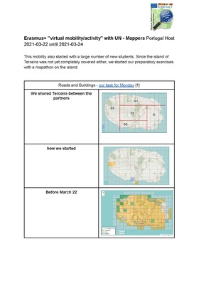
Mapathon Monday, March 22
| Read more ;-) | Shared work | how we started | Before March 22 | After March 22 | |
|---|---|---|---|---|---|
|
Roads and Buildings |
We shared Terceira between the partners |
|

How it looked before 2021.03.22 |

How it looks after our mapping activity |
Mapathon Tuesday 23 and Wednesday 24
| Read more ;-) | Impressions | |
|---|---|---|
|
UN Medal awarded to Romanian soldiers for their involvement in UN-led missions in Mali | 
The area ... psssst - still a secret - The curtain will not rise until 23 March ;-) |
|
|

here the link again https://tasks.hotosm.org/projects/10563/ |
Interesting issues and tags
Interesting issues
| Issue | Solution | |
|---|---|---|

|
* highway=path or waterway=stream?
|
|

|
.
| |

|
It lacks a tag to clarify how the waterway and the highway interact. ford=yes in this example, as the roads are passable when there is no or low water. | |

|
| |

|
| |

|
|

Interesting tags
| interesting tags | interesting tags - solution |
|---|---|

|

|
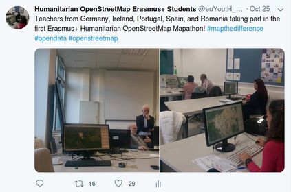
Our Mapathon with UN Mappers in Social and Traditional media

|

|

|

|

|

Twitter UN Mappers |

|

|

Portuguese newspapper Diário Insular 2021-03-24 |

Jornal Escolar Vid'Académica march 2021 |
Communication, Dissimination and Visibility
The project in the media
Traditional media
- Presence in traditional media
Diário Insular Jornal Diário - Açores
School Newspapper Jornal Escolar Vid'Académica dezember 2018
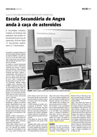
Portuguese Newspapper Diário Insular 2019-04-02
School Newspapper Jornal Escolar Vid'Académica april 2019
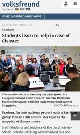
German Volksfreundtrier 2019-04-11
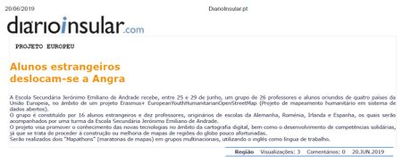
Portuguese Newspapper Diário Insular 2019-06-20
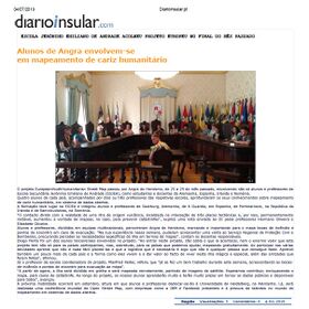
Portuguese Newspapper Diário Insular 2019-07-04
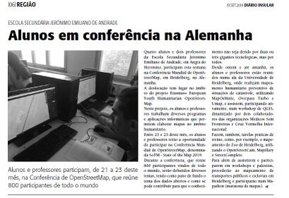
Portuguese Newspapper Diário Insular 2019-09-19
Portuguese Newspapper Diário Insular 2021-03-24
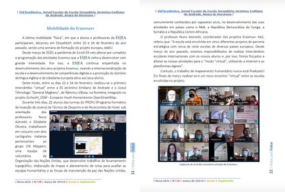
School Newspapper Jornal Escolar Vid'Académica march 2021


Social Media
Our Accounts - Twitter, Facebook, Instagram


Social Media - some activities on Twitter, Facebook, Instagram, other websites
First tweet with 29 likes ;-) see it online
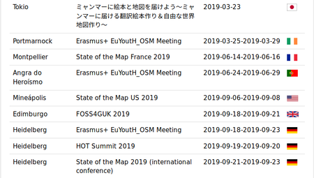
Meetings visible in the OSM Calendar
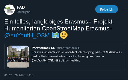
"A great, sustainable Erasmus+ project: Humanitarian OpenStreetMap Erasmus+ @euYoutH_OSM" a Tweet by the German National Agency


weeklyOSM - the news from and for the community - a spin off from a former Comenius project
- Present on Social Media
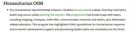
The Humanitarian OpenStreetMap Erasmus+ Students announced in a tweet, that they had held a week-long course called teaching the teachers. The programme had broad scope with topics including mapping, Overpass, OSM Wiki, communication channels and others, plus Wikimedia-related education. This program has highlighted OSM’s possibilities for humanitarian response and economic development support and pioneering leaders (who are volunteers) on this front. weeklyOSM #433
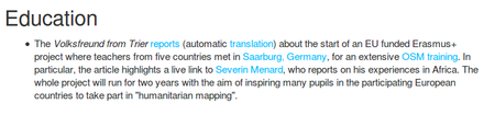
The Volksfreund from Trier reports (automatic translation) about the start of an EU funded Erasmus+ project where teachers from five countries met in Saarburg, Germany, for an extensive OSM training. In particular, the article highlights a live link to Severin Menard, who reports on his experiences in Africa. The whole project will run for two years with the aim of inspiring many pupils in the participating European countries to take part in “humanitarian mapping”. weeklyOSM #434
Our mapping activity was featured in WeeklyOSM #535 and published in 9 different languages. weeklyOSM #535


Image(s) of the Week - euYoutH_OSM representing OpenStreetMap on the main wiki page for one week ;-)
- proud to be image of the week
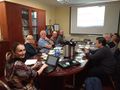
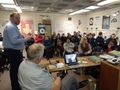
![Teachers from Ireland, Portugal, Spain, Romania and Germany met in Saarburg, Germany for week-long training session in humanitarian mapping and a first hackathon, to kick off a two year Erasmus+ project] * week 44 - from Monday 29 October 2018 to Sunday 4 November 2018](/w/images/thumb/5/5b/Sarting_euYoutH_OSM.jpeg/450px-Sarting_euYoutH_OSM.jpeg)
Teachers from Ireland, Portugal, Spain, Romania and Germany met in Saarburg, Germany for week-long training session in humanitarian mapping and a first hackathon, to kick off a two year Erasmus+ project] * week 44 - from Monday 29 October 2018 to Sunday 4 November 2018
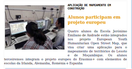
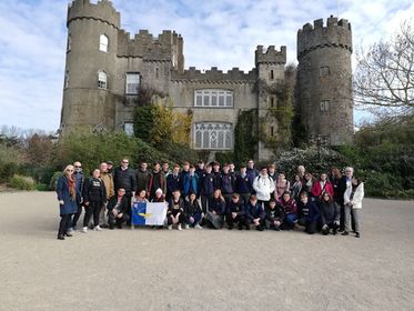
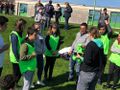
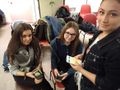
European Youth Humanitarian OSM Erasmus+ Students EuYoutH OSM from Portugal, Spain, Romania, Germany and Ireland during a Mapathon in Portmarnock Community School, Ireland, mapping Lesotho and Mozambique.
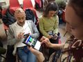
At the Libre Graphics Meeting in Saarbrücken, OpenSaar e.V. organised the first mapathon in Saarland together with Doctors Without Borders. Students of the Erasmus+ project EuYoutH OSM helped newcomers to map with JOSM. Link text
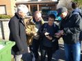
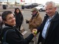
EuYoutH OSM/Angra do Heroísmo - Portmarnock Community School, Saarburg, Râmnicu Vâlcea, Angra do Heroísmo and A Guardia students of the EuYoutH OSM project mapping the hydrants and meeting points of Angra do Heroísmo, Terceira Island, Azores. Link text
![Teachers from Ireland, Portugal, Spain, Romania and Germany met in Saarburg, Germany for week-long training session in humanitarian mapping and a first hackathon, to kick off a two year Erasmus+ project] * week 44 - from Monday 29 October 2018 to Sunday 4 November 2018](/wiki/File:Sarting_euYoutH_OSM.jpeg)


Examples "Image of the week" in different languages
Japanese
English
Romanian


Published presentations
| First Page | View and/or Download |
|---|---|
| - Handout for a Mapathon / Ärzte ohne Grenzen - Saarbrücken? | |
| - Workshop: How to create a personal uMap? | |
| - How to contribute to weeklyOSM via the OSMBC? |


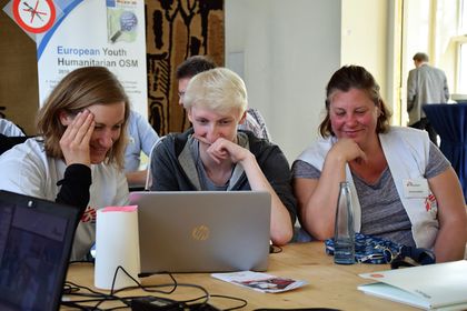
In person meetings
Impressions
- Group meetings
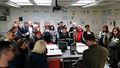
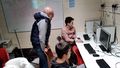
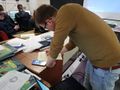
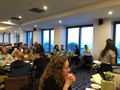
Teachers training at BBS Geschwister-Scholl-Schule Saarburg
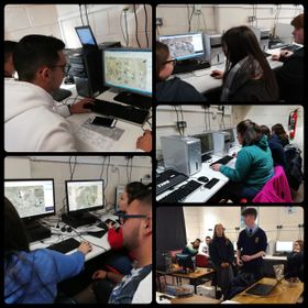
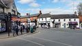
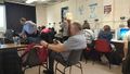
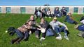
JOSM, Mapillary & Lesotho Mapathon at Portmarnock CS School
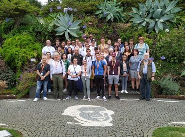
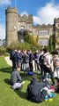
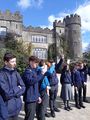
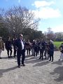
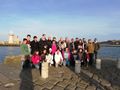
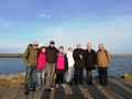
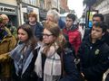
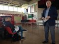
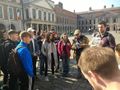
Visiting Angra do Heroísmo and Duke of Terceira Garden
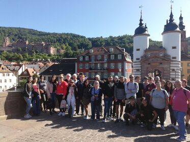
Visiting Heidelberg


Galleries
Gallery Portmarnock


Gallery Portmarnock - Slideshow


- MapSwipe 04.jpg.jpg

Gallery Angra


Gallery Angra - Slideshow
Gallery Heidelberg


Gallery Heidelberg - Slideshow
Gallery Virtual Mobility


