Highway link

|
| Description |
| Family of highway tag values used to identify link roads |
| Group |
| Tags |
The _link tags are used to identify slip roads/ramps and "channelised" (most commonly physically separated) at-grade turning lanes connecting the through carriageways/through lanes of highways to other roadways of all types. _link tags should also be used for physical channelization of turning traffic lanes at traffic signal junctions and in roundabout designs that physically separate a specific turn from the main roundabout.
The link classifications are:
- highway=motorway_link
- highway=trunk_link
- highway=primary_link
- highway=secondary_link
- highway=tertiary_link
Tagging
Try not to split up the link into one part belonging to one road and one to the other with different classifications. This makes it more difficult to find out which roads a link is supposed to connect.
Link roads normally do not have names. Please use the destination=* and its extensions tag to give the cross-street's ref=* and signed destinations such as a city or the name of the destination street, so that routing engines can correctly announce the exit to the "name or ref of the destination street" as you enter the _link. Slip roads/ramps in the UK and USA do not usually have names, and very few of them have route refs. (If they have refs it is usually where an overlap begins or ends, such as US 30 jumping onto I-80 for a concurrent section[1].)
Grade-separated interchanges
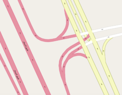
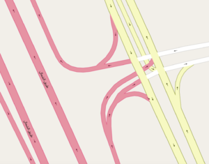
At a grade-separated interchange, some major traffic movements pass above or below the others. This usually eliminates cross traffic from one of the intersecting highways (typically the motorway). At motorway to motorway interchanges, all at-grade cross-traffic conflicts are usually eliminated (though in the UK, a roundabout may sometimes connect two motorways). There are a very few grade separated interchanges in which both highways have at-grade turning traffic.[2]
The slip roads/ramps are usually considered to "belong" to the through highway they exit and enter. This is usually the higher classification of the intersecting highways because on and off ramps almost always have the same kind of restrictions as the main road [2], but in some cases this may be reversed.
Some communities (e.g. Russian) do not make distinction between links and main roads in status selection. It usually results in a link tagged by a lower classification of the intersecting highways, though in some cases link status can be even lower.[3]
At-grade intersections
The most common type of _link cuts the corner at an intersection, leaving a small triangular "island" between it and the through carriageways/through lanes.
Internal turning lanes
Other common types of _link roads are also physically separated turning lanes in the central reservation/median of dual carriageways/divided highways.[4] They should be tagged with the _link classification of the highest classified road they connect to.
Preexisting Roads as Links
Sometimes, more complicated arrangements of links connect highways to each other, much like an interchange without bridges. Usually these eliminate direct left turns (see jughandle). Standard at-grade junctions in Spain require vehicles to exit right before making a left turn. Here too it probably makes more sense to consider the links as "belonging" to the more major highway.
Note that a regular surface road may be used for the same purpose. A preexisting street used to connect two major highways is not a link. Instead it should be tagged as the normal highway it previously was, probably equivalent to the lower classification of the ones it connects. This also applies where otherwise minor streets connect highways at an interchange.[5]
Similarly, a minor road that intersects a dual-carraigeway road with a higher classification is not a link between the two major road halves, and should be tagged as normal.[6]
Roundabouts

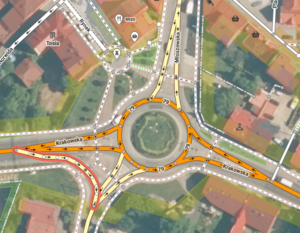
Links are also used in roundabout designs that physically separate a specific turn from the main roundabout. Note that it applies to additional carriageways present on some roundabouts, not standard split on a typical roundabout.
Special considerations for motorways
In some countries (such as the United Kingdom, but not always in the United States), motorway has a legal implication: certain classes of vehicles (such as bicycles) and drivers (such as learners) cannot use motorways. The same restrictions apply to their motorway_links. So only the motorway_link tag should be used on connecting roads that have these restrictions.
Elsewhere, ramps that can only be accessed by using a part of the motorway should be motorway_links. Also, collector/distributor roads are motorway_links when they collect and distribute motorway traffic.[7]
A motorway may have a short ramp of the turning lane type normally seen at a surface intersection, either because the motorway has a right-in/right-out junction, or because it ends just beyond at the road these ramps connect. Either way, these should be motorway_links, wherever they provide motorway access or egress.
In the United States, motorway links are applied all the way up to where they meet a surface street, and are different from the lower classifications in that they explicitly relate to the physical characteristics of a motorway ramp. Demotions of motorway links, even on ramps that may have a specific use or unusual features like sidewalks, are reliably reverted in the US on this basks.
Also note that - unlike highway=motorway - highway=motorway_link does not imply oneway=yes, and so oneway=* should always be used for clarity. A two-way motorway_link should be tagged oneway=no.
Parallel carriageways
Section missing, please expand
See also
- Frontage road - a minor road running parallel to a higher-speed more major road, often in an urban setting.
Notes
- ↑ An off-ramp from I-80 where US 30 leaves the shared section, near Granger, WY. The double-banded section arrives from the east, US 30 continues NW, I-80 continues SW.
- ↑ US 35 and SR 32 near Jackson, Ohio
- ↑ Mozhayskoe shosse and Moscow Ring Road intersection
- ↑ [1] for example
- ↑ I-4 and Kaley Street in Orlando, Florida: the portions of Tallokas Avenue that connect the I-4 ramps to Kaley Street are tertiary to match Kaley
- ↑ discussion on the Dutch forum linking to examples
- ↑ I-295 and Rancocas Mount Holly Road in New Jersey: traffic eastbound on Rancocas Mount Holly Road can take the ramp to I-295 north, and then take exit 45B from the C/D road back onto westbound Rancocas Mount Holly Road, without using I-295, but these two loop ramps and the C/D _link between them should be motorway_links, not primary_links
| ||||||||||||||||||||||||||||||
