Morocco
| V・T・E |
| latitude: 28.337, longitude: -9.400 |
| Browse map of Morocco 28°20′13.20″ N, 9°24′00.00″ W |
| Edit map |
|
|
External links:
|
| Use this template for your locality |

|
Morocco Mapping Project, the home of Morocco on the OpenStreetMap wiki. |
| Hello! Welcome to the project for mapping efforts in Morocco! You can find here national events, ongoing projects, map status and mapping guidelines, as well as links to other pages directly related to the mapping of Morocco. You may also find a list of contacts and mappers involved with the OpenStreetMap community in Morocco. |
This page is to coordinate mapping in Morocco (North West Africa).
The official languages are Arabic and Tamazight (ⵜⴰⵎⴰⵣⵉⵖⵜ). French is used for administrative purposes.
Contact
The easiest way to communicate with other members of the OSM community near you is by sending a message to any active mappers by checking the edit history of an area
- OpenStreetMap Morocco email list: https://lists.openstreetmap.org/listinfo/talk-ma
OSM Maroc website (www.openstreetmap.ma)
- Twitter:
 @OsmMaroc
Public Transport
This page is for collaborating the mapping of public transport routes (Buse,train,etc.) in Major Cities of Morocco
Administrative divisions
| Country (admin_level=2) | admin_level=* | ||||||||
|---|---|---|---|---|---|---|---|---|---|
| 3 | 4 | 5 | 6 | 7 | 8 | 9 | 10 | ||
(See: [[1]]) |
N/A | Regions (Wilayah) (جهات المغرب)(ولاية) | Provinces (الأقاليم) Prefectures (العمالات) |
(Districts) Cercles (الدائرة) Pashalik (باشوية) Préfectures d'Arrondissements (عمالات المقاطعات) |
Caïdats (القيادة) Arrondissements (المقاطعات) |
Urban Municipalities (الجماعات الحضرية) Rural Communes (الجماعات القرويةا) |
N/A | quartiers | |
Roads
Roadways - classified roadways in Morocco
Guidelines
How tagging the routes/ways?
In Morocco we have 5 classified routes:
- A - highway=motorway (Autoroute toll blue color)
- RN - highway=primary (National Routes (kilometre posts:red color))
- RR - highway=secondary ( Regional Routes(kilometre posts:yellow color))
- RP - highway=tertiary ( Provincial Routes(kilometre posts:lightblue color))
- by name - highway=residential (streets in cities,towns,villages)
Outside this classification:
- top end - highway=trunk several express routes (2x2 routes) have such an important role in their area that we recognize them as highway=trunk routes. These routes can be national, regional or provincial route and have no different official reference.
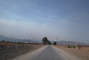
- low end - highway=unclassified minor routes that have not been classified, they have no reference and provide connections between minor dwellings. most are unpaved, some barely recognizable. in the dry season you can use them with a sedan or by bike.
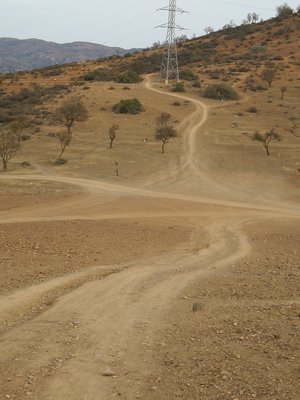
- agricultural - highway=track roads which provide access to agricultural land, conservation areas, forestry for wood and pulp production. They do not provide other service.
- In the cities - highway=service especially in old medinas: challengingly narrow streets where vehicles are officially allowed. They are tagged mostly as service routes. This should not be abused, because we could end up tagging for the renderer, but access roads that lead nowhere except to properties, these are quite correctly tagged as highway=service, and that's generally how roads in medinas work: they lead to properties and there's no way back other than the way in.
| Roads | Comments |
|---|---|
| highway=motorway | |
| highway=trunk | |
| highway=primary | RN(National) routes tag as highway=primary |
| highway=secondary | RR(Regional) routes tag as highway=secondary |
| highway=tertiary | RP(Provincial) routes tag as highway=tertiary |
| highway=unclassified | others small roads as highway=unclassified |
| highway=track | others small roads as highway=track (note that it conflicts with how highway=track is defined) |
| highway=residential | Roads with no reference in cities and villages tag as highway=residential |
| reference: | https://wiki.openstreetmap.org/wiki/Key:highway |
| Country | motorway | trunk | primary | secondary | tertiary | unclassified |
|---|---|---|---|---|---|---|
has speed limits of 120 km/h. |
speed limit varies from 40 to 100 km/h. |
Nationale (N) linking cities |
Regionale (R) secondary | Provinciale(P) tertiary | Small routes paved or not Minor roads |
Mapping names
The preferred order for names is French - Tamazight - Arabic.
See Multilingual_names#Morocco
How tagging the places?
List of_municipalities, communes and arrondissement
| Settlement | Description | Comments |
|---|---|---|
| place=city | A municipality having a population of at least 100,000 people and larger than nearby towns. | Like Rabat, Casablanca, Tanger... |
| place=suburb | A dependent municipality within a city, or an independent municipality next to a much bigger city. | |
| place=town | A municipality having a population of at least 10,000 people and good range of local facilities including schools, medical facilities etc and traditionally a market. | Like Skhirat, Tamesna, Sidi Kacem... |
| place=village | A municipality having a population less then 10,000 people, larger than an hamlet, and with a significant infrastructure. | Rural or urban Comunne |
| place=quarter | A populated urban part of a suburb, town, or village, larger than a neighbourhood. | Not a municipality. |
| place=neighbourhood | A populated urban part of a suburb, town, quarter, or village. | Not a municipality. |
| place=hamlet | A rural community less than 100-200 inhabitants, few infrastructure except a public access road or path. | Not a municipality. Mostly douars. |
| place=isolated_dwelling | A rural named place with a single inhabited building or farm, almost no infrastructure except a nearby road or a private access path. | Not a municipality. |
| place=locality | Other small named place without clearly defined borders and an unspecified number of buildings around. | Not a municipality. Only nodes, for example, a crossroad with a locally known name, or a former hamlet, or just some facilities (possibly disused). |
| Reference: Key:place |
Links
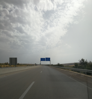
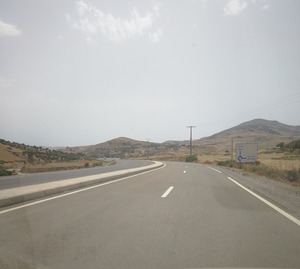
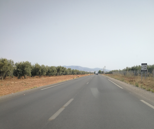
Street view using OSM carte
Street view for few cities in Morocco using openstreetmap: http://carte.ma/
They confirmed the imagery can be used for OpenStreetMap.[2]
Quality control
Data
Morocco Open Data Site
Here you can find all information about post offices,postcode,embassies,etc in Morocco
Roads
- http://www.equipement.gov.ma/Infrastructures-Routieres/Reseau-Routier-du-Royaume/Pages/Cartes-routieres.aspx : existing roads, from the Ministère de l’Equipement et du Transport.
- Note:although the road maps are recent, the road numbers are still not up to date
see:https://wiki.openstreetmap.org/wiki/Morocco/Roads#Primary_ways
Tracks
- http://rockburger.com/openstreetmap/morocco/ (last update 2011)
Kaart groundwork
Kaart conducts ground surveys for improvements to OSM data. A list of editors can be found on Kaart wiki page.
Tangier Province (April 2018)
- Ground Focus - Visual Collection of Street Names, Verification of Oneway Streets in Tanger, Gueznaia, Tétouan, Martil, M'Diq, Chefchaouen
- Issues - Many streets were unnavigable due to size of road (walkway/residential), Missing geometry
- Post Processing - Street Name Consistency, Turn Restrictions, Turning Lanes, Pedestrian Crossings, Surface Types and Lanes, Additional Geometry
Community Editing Suggestions - Medina geometry improvements, footpaths should be determined for length and continuity.
Casablanca (April 2018)
- Ground Focus - Visual Collection of Street Names, Verification of Oneway Streets in Metro Casablanca, El Jadida, Mohammadia
- Issues - Many streets were unnavigable due to size of road (walkway/residential), Missing geometry, Missing/Removed roundabouts
- Post Processing - Street Name Consistency, Turn Restrictions, Turning Lanes, Pedestrian Crossings, Surface Types and Lanes
Community Editing Suggestions - Medina geometry improvements
Marrakesh (April 2018)
- Ground Focus - Visual Collection of Street Names, Verification of Oneway Streets in Marrakesh, Agadir, Barrachid, Settat
- Issues - Many streets were unnavigable due to size of road (walkway/residential), Missing geometry, Missing/Removed roundabouts
- Post Processing - Street Name Consistency, Turn Restrictions, Turning Lanes, Pedestrian Crossings, Surface Types and Lanes
Community Editing Suggestions - Medina geometry improvements
Oujda (May 2018)
- Ground Focus - Visual Collection of Street Names, Verification of Oneway Streets in Oujda, Saïdia, Berkane, Nador, Imzouren, Al Hoceima
- Issues - Many streets were unnavigable due to size of road (walkway/residential), Missing geometry, Missing/Removed roundabouts
- Post Processing - Street Name Consistency, Turn Restrictions, Turning Lanes, Pedestrian Crossings, Surface Types and Lanes
Community Editing Suggestions - Medina geometry improvements, adding missing street names
People involved
- Martin: I would like to get some agreement on how to tag the main roads. Please see the discussion page. --23 October 2009
- Alilo I have extra GPSs 1 USB GPS, 2x PDA GPS, 1x Bluetooth GPS, If you are in Morocco and do not have a GPS contact me I might lend one.
- Hello Alilo,
- I'm standing the up to the second week in June in Agadir (for 10 days). Can you contact me!
- --Helmut K 06:56, 12 June 2009 (UTC)
- nickb: I am interested in organizing mapping parties in Marrakech – if anyone in Morocco would like to be involved, please contact me.
- memch: I implemented a background-tileserver for out-of-copyright maps of Morocco. Just visit here, select useful background, zoom to your area and click once to open potlatch here. See my page memch for details. Feel free to contact me here.
- SN74LS00: My focus is mainly on extreme South of Morocco and Western Sahara.
- Sinplomo: I've been doing some work mapping Tetouan (north of Morocco). Contact me if you are interested in helping with Tetouan. I could help with motorways, primary and secondary ways, ask me !
- Johnparis: I mostly work on Oujda and Oriental, but I also use Osmose for quality control, so we have zero Level 1 or 2 errors.
- TomTom company is driving the MapRoulette challenge "Morocco - Data Improvements"
| ||||||
See also
- 2023 Morocco Earthquake (english)


