Tag:highway=road
| Description |
|---|
| Road with unknown classification. |
| Rendering in OSM Carto |

|
| Group: highways |
| Used on these elements |
| Implies |
|
fixme=* |
| Useful combination |
| Status: approved |
| Tools for this tag |
|
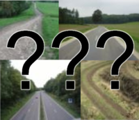
This tag is used for a road/way/path/street/alley/motorway/etc. with an unknown classification. This tag is intentionally vague: Anything which has been tagged highway=road can basically be any kind of “road” from the smallest footpath to the largest motorway (see it as a “wildcard” for highway=* values). Warning: This tag should only be used temporarily until the road/way/etc. has been properly surveyed. Do not use this tag when the type of road/etc. is known. As soon the road type is known, use one of the more specific values of highway=*.
Treat it as an error
Mappers and mapping software should treat it as an error when a way is tagged with highway=road. Mapping software can issue warnings to make sure the mapper really does not know the road type. The error is fixed by using the correct road classification.
When this tag is used it also implies a fixme=*. So you do not need to add a todo=FIXME, fixme="Unknown classification", etc. It's just duplicate work for the next person to change the highway type AND remove the fixme tag.
Roads added without local knowledge
While local knowledge is always preferred for new data, the highway=road tag may serve as a temporary placeholder for road geometries added without it, such as from imports or satellite imagery. This ensures only verified, properly classified roads are made available to end users, while guiding mappers to survey and validate new roads.
Roads with no name
Often this tag is used also in case the road most likely has a name, nonetheless the survey done hasn't properly determined what it is, or no survey was done at all. If the road indeed has no name, that is survey has determined that there are no signs indicating its name, etc., then see this proposed feature to indicate the road has no name.
Rendering
Since this tag is so vague, it is hard to recommend a particular rendering for end users. When in doubt, don't render this tag. If it is decided for a particular map to render this tag anyway, then it is recommended to make it look distinct from all other rendered ways, in order to avoid ambiguity.
Standard tile layer
On the Standard tile layer, it is rendered like this:
Other usage implications
Mappers should not expect that ways tagged like this will be useful to the end-user in any form. The ambiguity makes this rarely useful for data consumers. This has the following implications:
- Do not expect highway=road to be rendered
- Do not expect highway=road to be routable
- Do expect highway=road to be ignored by applications directed at end users
Possible tagging mistakes
Rendering Support
Here’s a list of commonly used renderers and their compliance with the rendering guidelines mentioned above. Feel free to expand the list, submit a report, or increase the visibility of existing reports.
| Status | Provider / Renderer | Hidden by default | Distinct Style | Report |
|---|---|---|---|---|
| ✅️ | openstreetmap.org (openstreetmap-carto) | No | Yes | |
| ✅️ | tracestrack.com (base/topo) | No | Yes | |
| ✅️ | komoot.com | Yes | - | |
| ✅️ | locusmap.app | Yes | - | |
| ✅️ | maps.me | Yes | - | |
| ✅️ | caltopo.com | Yes | - | |
| ✅️ | opencyclemap.org | Yes | - | |
| ✅️ | thunderforest.com (Transport Map) | Yes | - | |
| ✅️ | strava.com | Yes | - | 2024-07-27: solution deployed
2024-07-20: submitted support ticket form |
| ✅️ | mapy.cz | Yes | - | 2024-07-28: submitted support ticket form
2024-07-30: solution deployed |
| ✅️ | ridewithgps.com | Yes | - | 2024-08-24: solution deployed
2024-08-22: emailed bug report |
| ⏳ | cyclosm.org | Yes | - | https://github.com/cyclosm/cyclosm-cartocss-style/issues/6862024-08-10: solution committed |
| ⏳ | gurumaps.app | No | No | 2024-08-13: emailed bug report + solution committed |
| ⏳ | osmand.net | No | No | https://github.com/osmandapp/OsmAnd/issues/203572024-08-24: solution being working on |
| ❌ | hotosm.org | No | No | https://github.com/hotosm/HDM-CartoCSS/issues/339 |
| ❌ | organicmaps.app | No | No | https://github.com/organicmaps/organicmaps/issues/8735 |
| ❌ | gaiagps.com | No | No | 2024-07-20: submitted support ticket form |
| ❌ | opentopomap.org | No | No | https://github.com/der-stefan/OpenTopoMap/issues/366 |
| ❌ | windytv.com | No | No | 2024-08-22: emailed bug report |
| ❌ | wikiloc.com | No | No | 2024-08-22: emailed bug report |
| ❌ | drivemodedashboard.com | No | No | https://github.com/johnkeel-thork/DMD2/issues/200 |
| ❌ | mapz.com | No | No | 2024-09-27: communicated in the forum |
| ❌ | Mapbox (used by alltrails.com, rever.co) | No | No | https://github.com/mapbox/mapbox-gl-js/issues/13285 |
See also
| ||||||||||||||||||||||||||||||
