Zh-hans:Applications of OpenStreetMap
这个页面介绍了到目前为止,OpenStreetMap是如何被人们实际用于生产生活的。如果你只是想看OpenStreetMap的使用说明,请看使用OpenStreetMap这个页面。

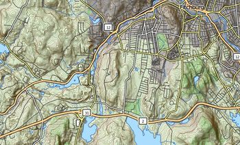
OpenStreetMap实际上就是地图数据的集合,这些地图数据可用于方方面面。你可以看看OpenStreetMap首页上的世界地图,说不定你可以迸发什么奇思妙想。你看地图的时候,可以在地图的右边点击“图层”按钮,通过切换不同的图层,你可以看到不同格式的地图。这说明了OpenStreetMap的数据用途广泛。
每个人都可以使用OpenStreetMap的数据,没有什么限制,所以很多第三方服务都是基于OpenStreetMap的数据。OpenStreetMap的价值就是这样体现出来了。百花齐放,百家争鸣。通过他们,你可以看到更多由OpenStreetMap数据产生的信息,这些在OpenStreetMap世界地图上是看不到的。
另外,我们只讲了地图数据,但OpenStreetMap除了地图,还有别的用处。
地图
很多人都是通过自带的世界地图第一次听说OpenStreetMap。人们可以很容易地将这个地图集成到自己的网站,然后给地图添加自己的功能(由于中国大陆的《地图管理条例》第三十二条的限制,几乎没有国内网站使用OpenStreetMap的地图服务)。维基百科和其他很多人都这样做。另外,OpenStreetMap还提供原始地图数据,用户可以从头开始创建自定义地图。许多第三方在线地图也是用OpenStreetMap的数据。你也可以在电脑和手机上,甚至是用索尼PSP使用离线地图。有些工具和在线服务可以用来制作高清晰度的纸质地图。
Maps can be used in very different ways. With OpenStreetMap, people get artistic or help on humanitarian activity. Within the OpenStreetMap Community, people focus on mapping a variety of particular topics, from accessibility to Special Populations. Third party services provide maps specialised on accessibility (wheelchair, blind, ...), on sports (hiking, biking, canoeing, skiing, ...), on History and many more. List of OSM based Services tries to give a comprehensive collection.
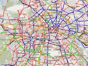
Many projects continuously improve their maps. Since they are all limited by the available information in the OpenStreetMap data collection, contributing map data is a good way to support them. ÖPNVkarte, a free public transport map, is a good example. The picture on the right shows the well mapped public transport system of Berlin. You can visit the project's page to discover regions of the world with less public transport information available in the OpenStreetMap data collection.
3D maps
- 主条目:3D
The third dimension is a growing topic at OSM. It's already possible to add detailed buildings and a lot of minor objects, which results in a 'feeling like home'.
Routing
- 主条目:Routing
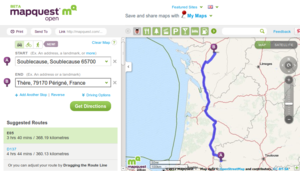
Many different routing services (see also this list of routing services) are built on OpenStreetMap data, not only for cars. Based on OpenStreetMap, you can find your way in wheelchair, on bike or horse, during your next hike, using public transport, ...
The Look and Listen Map provides an online map and routing service for blind, visually impaired and sighted persons. While still in a development status, the project already won some prizes.
GIS software
- 主条目:GIS software
Many available GIS software is proprietary, closed source, and quite expensive. Often they operate with data in a proprietary data format. OpenStreetMap data, in contrast, is open. To achieve interoperability, there is a whole bunch of tools converting map data from/ to OpenStreetMap data, including support for the popular ESRI Shapefiles and PostGIS format. We try to document any special interoperability with OpenStreetMap for each GIS software. Try a search with the form on the top right of this page for your particular GIS software, or browse our GIS software category (use Category:Software as long as the previous doesn't exist). There is also open source GIS software working together with OpenStreetMap.
Education

- 主条目:Education
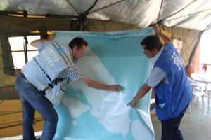
OpenStreetMap is being used within education, in schools, universities and colleges in a wide range of disciplines. Some projects involve only the use of existing OpenStreetMap data, while others result in additional data within the OpenStreetMap data collection. The OpenStreetMap project is used in teaching geography, mathematics, ecology, community planning and technology.
Research
- 主条目:Research
OpenStreetMap data is being used for research all round the world.


