State of the Map U.S. 2015

From OpenStreetMap Wiki
Revision as of 10:08, 15 April 2022 by Nw520 (talk | contribs) (use image from Commons)
(diff) ← Older revision | Latest revision (diff) | Newer revision → (diff)
Jump to navigation Jump to search

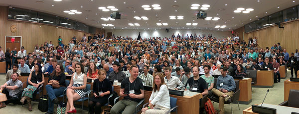
State of the Map U.S. 2015 was held at the United Nations building in New York City, June 6-8

SOTMUS 2015 audience.jpg

stateofthemap.us

and tweet with the Twitter hashtag#SOTMUS hashtag
(Open licensing your flickr photos is also a good idea)

Main conference June 6 and 7

Saturday June 6 and Sunday June 7 are 2 full days of three tracks of sessions from and for mappers, non profits, governments and businesses - everyone involved in and around OpenStreetMap and everyone who wants to learn more about OpenStreetMap.

Hack day June 8

Mon June 8 is the hack day with code sprints, documentation sprints, Missing Maps mapping party and a Maptime summit. Share your ideas and coordinate your activities for the hack day on the Wiki here:

State_Of_The_Map_U.S._2015/Hack_day

I'm Going!

And everyone on the list on the registration page.

Room Sharing

Name Offer or Ask Details
Eric Brelsford Offer A couch in Brooklyn. You'll have to be okay with being in an apartment with a cat.
Brian DeRocher Offer Room to share at The Roosevelt Hotel, $115 per night, free wifi, 15 minute walk to conference. Email me brian@derocher.org.

Ride Sharing

Name Offer or Ask Details

Slides

Day Track Speaker Title Video Slides Notes
1 2 Lauren Budorick Cycling Directions with OpenStreetMap and OSRM YouTube Logo [1] source
1 panel Government & OpenStreetMap: Landscapes, Perspectives and the Horizon YouTube Logo quote, transcript
1 Drew Dara Abrams, Diana Shkolnikov Peripheral Data in OpenStreetMap YouTube Logo Icons-mini-file acrobat.gif [2] quote, transcript
1 Duane Gearhart Quality Route Guidance YouTube Logo quote, transcript, Valhalla@Mapzen
1 panel Vector Rendering Panel YouTube Logo quote, transcript
1 3 Various Lightning Talks Saturday (L.T.Sat.) YouTube Logo
1 3 Diana Shkolnikov L.T.Sat.: Mapzen is building Fences... and knocking down barriers Icons-mini-file acrobat.gif [3] quote, transcript, Borders@Mapzen, Keynote early version
1 3 Christopher Fricke L.T.Sat.: Pedestrian Routing [4]
1 3 Alex de Sherbinin L.T.Sat.: Validation of OpenStreetMap Icons-mini-file acrobat.gif [5]
2 3 Minh Nguyễn Tickling locals into action YouTube Logo [6]
2 Harish Krishna State of the Geocoder YouTube Logo transcript, Pelias project
2 Kathleen Danielson Improving Diversity in OpenStreetMap YouTube Logo quote, transcript, Ada Initiative
2 3 Randy Meech O.S.M.B.A. The history and future of companies in OpenStreetMap YouTube Logo quote, transcript, syllabus
2 Various Lightning Talks Sunday (L.T.Sun.) YouTube Logo
2 Patricio Gonzalez Vivo L.T.Sun.: Open data anywhere for everyone, using OSM data on a RaspberryPi quote, transcript, Tangrams on Raspberry Pi 2 project
3 Diana Shkolnikov and Indy Hurt Extracting interesting data from OSM Icons-mini-file acrobat.gif [7] quote, transcript
3 Drew Dara-Abrams, Meghan Hade, Ian Rees A hands-on tour through open transit data: OpenStreetMap, GTFS, Transitland, and Onestop IDs quote, transcript, Transit Land
3 Peter Johnson Geocoder-in-the-box Geocoder-in-the-box slides quote, transcript, Pelias project

Approximate transcripts of all sessions, one text file per room per day, are available in a zip bundle.
See also