WikiProject Georgia Abkhazia South-Ossetia
- For the U.S. state, see Georgia (U.S. state).
Due to political conflicts, the countries that have been in the Republic of Georgia are merged together here. As soon as the conflict there is solved - either way - the Projects will be split into separate Pages or be merged in one page.
| V・T・E |
| latitude: 42.12, longitude: 44.22 |
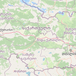
| Browse map of Georgia 42°07′12.00″ N, 44°13′12.00″ E |
| Edit map |
|
External links:
|
| Use this template for your locality |
Georgia is a Country in Central Asia at latitude 42°07′12.00″ North, longitude 44°13′12.00″ East.
Communication
There are four channels where mappers of Georgia can communicate:
Aerial Photos
There are several global and local map data suppliers. For the city of Tbilisi, you can use their open data (TMS-like data layers). It's very high-res data which is in open access (we don't have an allowance either). Also, there are a bulk of data from National Agency of Public Registry, but the local community have received neither approve nor disprove from this facility. Due to this, we can't use their data. Alas, for remaining regions, we can use either Bing's or Maxar's satellite shots.
Also, time to time, some photos appear at OpenAerialMap. And for on-ground photos, use Mapillary.
Map Features
Names
Georgian mappers decided to put only Georgian in the main name field. Names in other languages should be put in name:en, name:ru, etc tags. Please add name:ka with Georgian name as well, and name:sva for Svanian name.
Example:
Consider also adding:
Streets
Do not abbreviate street names. It is easy for a computer to shorten "Street" to "St" and "ქუჩა" to "ქ" but harder to go the other way. For example, "St" can mean both "Street" and "Saint".
Types of Streets, Translations, and Abbreviations (don't use abbreviations)
- ქუჩა - Street - Улица (ქ, St, Ул)
- გამზირი - Avenue - Проспект (გამზ, Ave, Просп)
- ბულვარი - Boulevard - Бульвар (ბულვარი, Blvd, Бул)
- ჩიხი - Lane - Тупик (ჩიხი, Ln, Тупик)
- შესახვევი - Alley - Переулок (შეს, Aly, Ал)
Numbered Lanes For Lanes and Alleys, there are often numerous offshoots from main roads such as
- Rustaveli Avenue
- Rustaveli 1st Lane
- Rustaveli 2nd Lane
- Rustaveli 3rd Lane
The way these are written on signs varies widely. In Georgian, Roman numerals should be used. In English use 1st, 2nd, etc.
- რუსთაველის I ჩიხი
- Rustaveli 1st Lane
Note that you should write the full form of street names (no matter what language you write them in). For example: Shota Rustaveli Avenue, not Rustaveli Avenue. This allows us to create a complete geodatabase.
Do not translate street names. თამარ მეფის ქუჩა is Tamar Mepe Street, not Queen Tamar Street.
Note that the buildings must have a specified number. We do not write any sign in front of the number, e.g. № or #. Only the building number is written. To find out the building number, if it is not indicated on the building, use the Internet, search the website of the organization and find out the address of the building from the contact info. If it's a school, you can get a list of schools, with addresses, from your local municipality. It is most reliable to ask someone who is onsite, in the building, or lives there for the building number, although sometimes it is necessary to verify the information.
Do not use abbreviations. For non-locals, TSU means nothing. Use abbreviations only(!) in the case of globally and locally known organizations - UNDP, UNICEF, UNHCR, GYLA, etc.
Keep in mind, that we use mkhedruli (მხედრული) alphabet in names. It means there are no capital letters. For fast typing and autocorrection in-fly, it's recommended to use keyboards with predictive input: Google Keyboard or Yandex Keyboard.
Disputed place names
- Please see Disputes and WikiProject Cyprus#Disputed place names for more information
South Ossetia and Abkhazia are disputed territories and all the place names there are disputed. These countries are recognized by Russia and some other members of the UN. In South Ossetia they use Ossetic and Russian, in Abkhazia they use Abkhazian and Russian place names[1]. So we have Ossetic, Russian and Georgian place names as variants for the tag name in South Ossetia. The same we have in Abkhazia with Abkhazian instead of Ossetic.
- The convention
IF there is no consensus on which variant to use for name tag please follow the following rule.
IF place is in South Ossetia
- THEN use Ossetic or/and Russian place name
ELSE IF place is in Abkhazia
- THEN use Abkhazian or/and Russian place name
ELSE
- use Georgian place name
Administrative Divisions
Georgia is divided into various divisions. There is a proposal for including the Autonomous Republics, Regions, Districts, and Disputed Territories here. Feel free to discuss and to contribute on that page: Administrative Divisions of Georgia
Street Network
User moszkva ter is working on a page Road Tagging in Georgia, where the following content will be expanded. Afterwards, it will be deleted from this page.
categorization
- E-Roads (European roads):
As of 25th August, 2011, all E-roads through Georgia are completely tagged according to the WikiProject Europe/E-road network. Maybe someone wants to check this?
- E 60: Poti-Senaki-Samtredia-Kutaisi-Khashuri-Gori-Mtskheta-Tbilisi-Rustavi-Tsiteli Khidi-Azerbaijan
- E 70: Sarpi-Batumi-Supsa-Poti
- E 97: Same as E 70 but continuing Poti-Senaki-Zugdidi-Sokhumi-Gagra-Russia
- E 117: Russia-Stepantsminda-Gudauri-Mtskheta-Tbilisi-Marneuli-Bolnisi-Armenia
- E 001: Tbilisi-Marneuli-Sadakhlo-Armenia
- E 691: Armenia-Ninotsminda-Akhaltsikhe-Vale-Turkey
- E 692: Supsa-Samtredia
- AH-Roads (Asian Highways): These are not signposted, but several routes throughout Georgia are defined:
- AH 5: Like E60 from Tsiteli Khidi to Poti, then like E70 to Turkey.
- AH 81: Like E117 from Russia to Marneuli, then like E001 to Armenia.
- AH 82: Like E97 between Russia and Senaki, then like E60 to Khashuri, then via Borjomi to Akhaltsikhe, then like E691 to Armenia.
As of October, 2011, all AH-routes are included as relations according to the Asia/Asian Highway Network.
All E- and AH-routes also have a national number ს.
- ს[number]-Roads
Georgian letter San (S): Stands for a long-distance-route, some are marked as Euro-Route. This is not necessary a dual-carriageway-route but there are Sx-Ways that fit into a highway/motorway. highway=motorway or highway=trunk if dual carriageway / highway=primary else. Currently (Aug. 2011) The Route ს 1 between the northern exit of Tbilisi and Gori has a Motorway designation, the motorway is about to be extended further west, there are constructions going on between Gori and Khashuri. So keep an eye on it. There are only very few stretches of dual carriageway in Georgia outside of Tbilisi, but maybe some ს-roads will be upgraded in the future.
- შ[number]-Roads
Georgian letter Shin (Sh): Secondary highways, maintained by the state. Some are in very good condition, some are unpaved and only passable with a 4x4-vehicle. numbers შ 1 to 44 seem to be more important and connect important cities and remote regions over longer distances. But only according to the number, it is not possible to determine the general condition. Tag as highway=secondary if several of the following conditions apply:
- they connect regions and/or bigger cities to the network of ს-roads,
- they provide shortcuts or attractive alternative routings to ს-roads,
- they are in relatively good condition - not necessarily paved but at least driveable with a normal car, during most weather conditions,
- they are somehow signposted,
- they have significant amount of non-local traffic.
Tag as highway=tertiary if they do not qualify as a secondary highway.
- Unnumbered Roads (rural):
Tag as highway=tertiary if they connect to several villages, else as highway=unclassified. It is difficult to make a definite classification scheme, but you can judge by general state of the road, signposting, amount of traffic and so on. Use common sense. Also, tertiary routes (and higher) should form a network, they should have dead-ends only in exceptions, e.g. valleys without exit.
Please use the keys smoothness=*, surface=*, smoothness=*, or tracktype=* to describe the condition and usability of roads, especially the bad ones.
- Unnumbered Roads (Tbilisi and other major cities):
Major throughways (connecting primary highways) are classified as primary. Other important roads that interconnect bigger neighbourhoods are classified as secondary. Local collector roads are classified as tertiary. Primary roads that are dual carriageway and do not have many 4-way-crossings, traffic lights and access to private properties can be upgraded to trunk highway. Note, that in Tbilisi, and probably also in other big cities, city roads don't wear numbers, so use common sense for classification.
Preset
Local community created a preset compatible with JOSM and Vespucci with common organizations in this region. You can take it here
Statistics Data
You can use Saqstat (Geostat) data by link
Roads Coverage

Some roads are currently unmapped. You can help the project with this task.

Whole list of highways you can see here[1]. Highways' traces you can find on the same page, especially in Kartuli wiki.
| Local name | Road name in latin | Highway trace | Length (km) | Somehow represented in OSM |
|---|---|---|---|---|
| ს-1 | S1 | Tbilisi - Senaki - Leselidze (Gyachrypsh) - RU | 542.7 | Yes |
| ს-2 | S2 | Senaki - Poti - Sarpi - TR | 119.5 | Yes |
| ს-3 | S3 | Mtskheta - Stepantsminda - Larsi - RU | 139.0 | Partially[4] |
| ს-4 | S4 | Tbilisi - Tsiteli Khidi - AZ | 57.0 | Partially[4] |
| ს-5 | S5 | Tbilisi - Bakurtsikhe - Lagodekhi - AZ | 160.0 | Partially[4] |
| ს-6 | S6 | Ponichala - Marneuli - Guguti - AM | 98.0 | Partially[4] |
| ს-7 | S7 | Marneuli - Sadakhlo - AM | 34.0 | Partially[4] |
| ს-8 | S8 | Khaluri - Akhaltsikhe - TR | 97.0 | Partially[4] |
| ს-9 | S9 | Tbilisi - North-East-Bypass | 49.0 | Partially[4] |
| ს-10 | S10 | Gori - Tskhinkali - Gufta - Java - Roki - RU | 92.5 | Partially[4] |
| ს-11 | S11 | Akhaltsikhe - Ninotsminda - AM | 112.0 | Partially[4] |
| ს-12 | S12 | Samtredia - Lanchkhuti - Grigoleti | 56.2 | Partially[4] |
| ს-13 | S13 | Akhalkalaki - Kartsakhi - TR | 36.5 | Partially[4] |
City coverage
Data from OSMLanduse, calculated approximately
| City:int | City:ge | Landuse Coverage |
|---|---|---|
| Tbilisi | თბილისი | ~70% |
| Kutaisi | ქუთაისი | ~70% |
| Batumi | ბათუმი | ~80% |
| Rustavi | რუსთავი | ~50% |
| Sokhumi | სოხუმი | ~50% |
| Zugdidi | ზუგდიდი | 100%[5] |
| Gori | გორი | ~80% |
| Poti | ფოთი | ~65% |
| Tskhinvali | ცხინვალი | ~50% |
| Samtredia | სამტრედია | ~80% |
| Khashuri | ხაშური | 100%[5] |
| Senaki | სენაკი | 100%[5] |
| Zestaponi | ზესტაფონი | 100%[5] |
| Telavi | თელავი | 100%[5] |
| Marneuli | მარნეული | 100%[5] |
| Kobuleti | ქობულეთი | ~50% |
| Tkvarcheli | ტყვარჩელი | 100%[5] |
| Ozurgeti | ოზურგეთი | ~40% |
| Akhaltsikhe | ახალციხე | 100%[5] |
| Tzkaltubo | წყალტუბო | ~50% |
| Ochamchire | ოჩამჩირე | 100%[5] |
| Kaspi | კასპი | 100%[5] |
| Borjomi | ბორჯომი | 100%[5] |
| Tkibuli | ტყიბული | 100%[6][5] |
| Chiatura | ჭიათურა | 100%[6][5] |
| Sagarejo | საგარეჯო | 100%[5] |
| Gali | გალი | 100%[6][5] |
| Gudauta | გუდაუთა | 100%[5] |
| Gardabani | გარდაბანი | 100%[5] |
| Khoni | ხონი | 0% |
| Surami | სურამი | 100%[5] |
References
- ↑ Ossetian and Russian are official languages in South Ossetia, Abkhazian is state language in Abkhazia, Russian is a language of state and other institutions in Abkhazia and is widely used there: there are signs in Russian, the most of population know Russian, Russian is a language of interethnic communication between Abkhazians, Armenians, Russians and Gergians (Megrelians) and other ethnic groups, the main official paper "Республика Абхазия" (Russian: Republic of Abkhazia) is printed in Russian, almost all official documentation is written in Russian - see, for example, this article
- ↑ From Wikipedia
- ↑ By Roads Department of Georgia
- ↑ Jump up to: 4.00 4.01 4.02 4.03 4.04 4.05 4.06 4.07 4.08 4.09 4.10 As ref on road
- ↑ Jump up to: 5.00 5.01 5.02 5.03 5.04 5.05 5.06 5.07 5.08 5.09 5.10 5.11 5.12 5.13 5.14 5.15 5.16 5.17 Whole city is covered as a big one landuse
- ↑ Jump up to: 6.0 6.1 6.2 A city currently doesn't have borders and represented as a node