Cantabria
| V・T・E |
| latitude: 43.2, longitude: -4.0 |
| Browse map of Cantabria 43°12′00.00″ N, 4°00′00.00″ W |
| Edit map |
|
External links:
|
| Use this template for your locality |
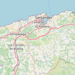
Cantabria is an autonomous community in Spain at latitude 43°12′00.00″ North, longitude 4°00′00.00″ West.
More information on the Spanish page.
Description
Cantabria is a spanish province and autonomous community with Santander as its capital city. It is bordered on the east by the Basque Country (province of Biscay), on the south by Castile and León (provinces of León, Palencia and Burgos), on the west by the Principality of Asturias, and on the north by the Cantabrian Sea (Bay of Biscay). To learn more about Cantabria you can visit this article of Wikipedia.
Who are mapping?
You can see on this map which users have been mapping Cantabria in recent months.
State of the map
We began to map the region in early 2007. At present a manual import of buildings is being carried out based on data from the Cadastre with CatAtom2Osm, incorporating addresses and portal numbers for the municipalities.