DE:Featured images/Jul-Sep 2016
Jump to navigation
Jump to search


Hier sind die vorgestellten Bilder zu sehen. Die Bilder wurden als Vorzeigebeispiele des OpenStreetMap-Projektes auserwählt.
Wenn du ein Bild hast, welches als Bild der Woche sein könnte, dann kannst du es hier auf der (en) Vorschläge des ausgewählten Bildes-Seite vorschlagen.
| ← von Juli bis September 2015 | ← von April bis Juni 2016 | von Oktober bis Dezember 2016 → | von Juli bis September 2017 → |
Galerie der vorgestellten Bilder, von Juli bis September 2016
-
 2016, Woche 27
 -
 2016, Woche 28
 -
 2016, Woche 29
 -
 2016, Woche 30
 -
 2016, Woche 31
 -
 2016, Woche 32
 -
 2016, Woche 33
 -
 2016, Woche 34
 -
 2016, Woche 35
 -
 2016, Woche 35
 -
 2016, Woche 37
 -
 2016, Woche 38
 -
 2016, Woche 39
Details und Beschriftungen
Woche 27 (von Montag, 4. Juli 2016 bis Sonntag, 10. Juli 2016) [Edit]

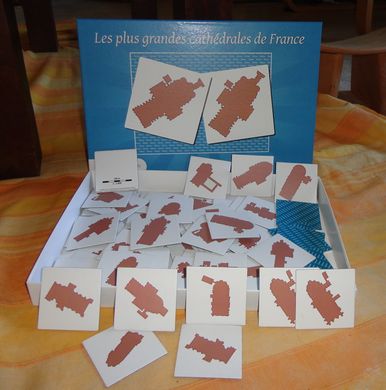
- English : Board game using OSM data: memory game of the French largest cathedrals. JBacc created this by filtering of the Geofabrik extract with Osmosis, area calculation with QGIS, data processing and rendering with Maperitive/Maperipy.
Woche 28 (von Montag, 11. Juli 2016 bis Sonntag, 17. Juli 2016) [Edit]

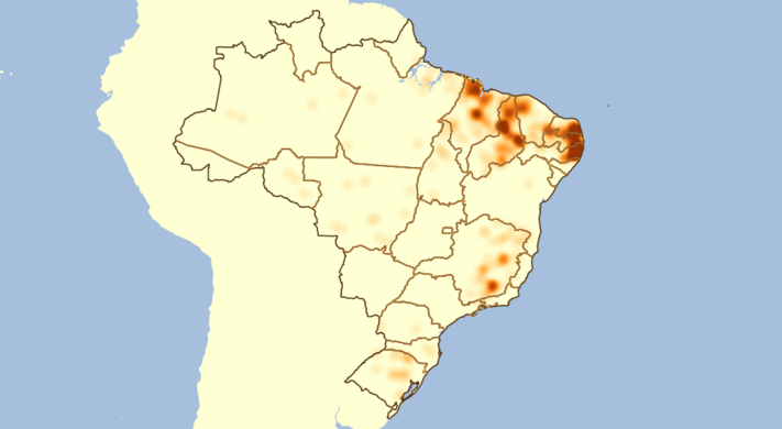
- English : Luc Freitas analysed mapping progress of Brazilian cities (diary entry in Portuguese). He looked at the size of cities based on municipal boundaries data (already imported from IBGE), and correlated this with the amount of residential roads data in OpenStreetMap. This image and the tabular output helps guide further mapping efforts by the Brazilian community.
Woche 29 (von Montag, 18. Juli 2016 bis Sonntag, 24. Juli 2016) [Edit]

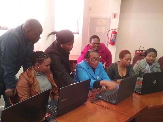
- English : Throughout June there was a big series of MapLesotho mapping events (involving modem equipment travelling around the country!), culminating in this final mapping session with a visit from the Lesotho minister for local government. Read more on the MapLesotho blog.
Woche 30 (von Montag, 25. Juli 2016 bis Sonntag, 31. Juli 2016) [Edit]

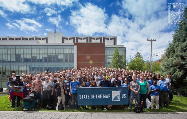
- English : State Of The Map U.S. 2016 took place last weekend in Seattle with a packed program of talks, workshops, hacking & mapping.
Woche 31 (von Montag, 1. August 2016 bis Sonntag, 7. August 2016) [Edit]

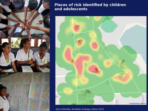
- English : In Bluefields, Nicaragua, the local OSM community and UNICEF worked with school children to help them empower themselves through the use of maps.
Woche 32 (von Montag, 8. August 2016 bis Sonntag, 14. August 2016) [Edit]

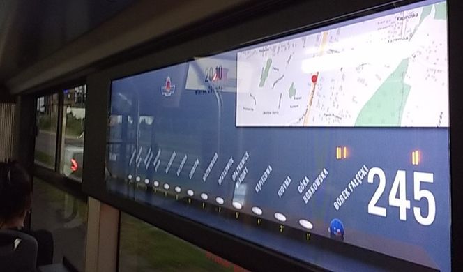
- English : OpenStreetMap spotted on board a bus in Kraków, Poland.
Woche 33 (von Montag, 15. August 2016 bis Sonntag, 21. August 2016) [Edit]

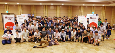
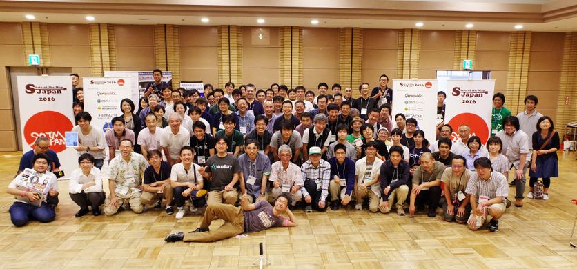
- English : State of the Map Japan 2016 was held in Tokyo last week.
Woche 34 (von Montag, 22. August 2016 bis Sonntag, 28. August 2016) [Edit]

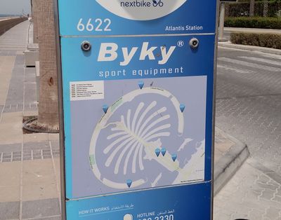
- English : The ByKy bike share system in Dubai (UAE) has signposts at each docking station, featuring OpenStreetMap!
Woche 35 (von Montag, 29. August 2016 bis Sonntag, 4. September 2016) [Edit]

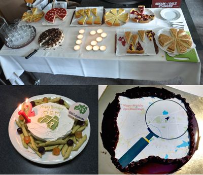
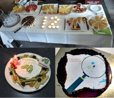
- English : The OpenStreetMap 12th Anniversary Birthday party was celebrated around the world, including cake in Japan, India and Germany!
Woche 36 (von Montag, 5. September 2016 bis Sonntag, 11. September 2016) [Edit]

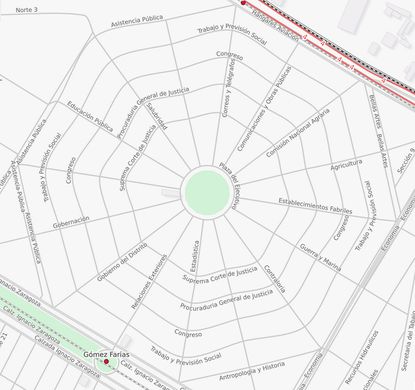
- English : A spiderweb of streets around the Plaza del Ejecutivo, in Mexico City.
Woche 37 (von Montag, 12. September 2016 bis Sonntag, 18. September 2016) [Edit]

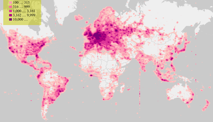
- English : Visualising tool created by the Martin Raifer allows us to explore the stats about OpenStreetMap.org map views. Read more on his diary.
Woche 38 (von Montag, 19. September 2016 bis Sonntag, 25. September 2016) [Edit]

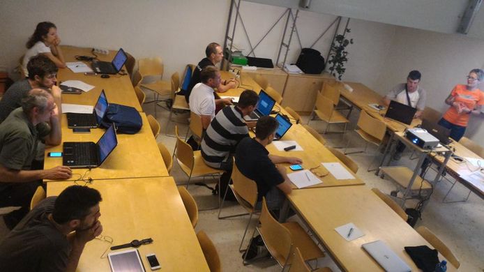
- English : A collaborative emergency mapping event organized by the Wikimedia and OpenStreetMap communities in the City of Trento, Italy.
Woche 39 (von Montag, 26. September 2016 bis Sonntag, 2. Oktober 2016) [Edit]

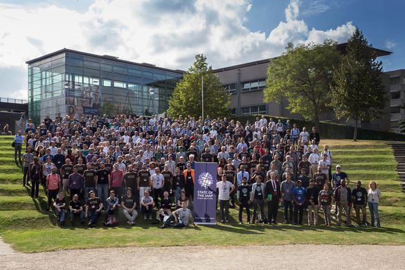
- English : Group photo at the international OpenStreetMap conference State Of The Map 2016 in Brussels.