Error categories
Jump to navigation
Jump to search
This page contains a list of typical geometric errors, how you can find those errors and how to correct them.
Table
| Picture | Category | Problem | How to find | How to correct | ||||||||||||
|---|---|---|---|---|---|---|---|---|---|---|---|---|---|---|---|---|

|
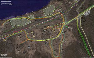
Use of satellite images without offset correction. | Roads are offset away from tracks | Manually - download map and GPS data | Shift imagery until tracks will be matched.) Use an area with a high number of tracks for average things out, and spot GPS traces which had a bad fix. Then place objects according to the shifted imagery. | ||||||||||||
| Unconnected highway (touching) | This is a severe error when looking at routing applications. Connected roads are not connected in OSM data. | WayCheck by gary68 | Connect nodes in JOSM with merge function | |||||||||||||
| Unconnected highway (open) | This may be a severe error when looking at routing applications. Is the highway really just ending there? | WayCheck by gary68 | Connect nodes in JOSM with merge function. Or extend map. | |||||||||||||
|
Crossing on same layer without common node | Either bridge or tunnel and layer is missing or a common node is missing. Either reality is not reflected correctly or routing cannot be done correctly because roads are not connected in data. | Add layer information and bridge/tunnel information. Or create common node:
| |||||||||||||

|
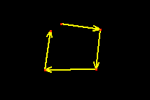
Open areas | Reality is not reflected correctly and maybe some programs might have problems using those polygons. | areacheck.pl by gary68 | Close areas by prolonging the way. Last node has to be the same as the first. | ||||||||||||

|
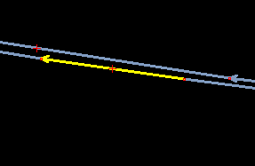
Oneway errors on motorways | Imaging you are sitting in a car navigated by OSM using this data... | MotorwayCheck by gary68 | Correct tagging and/or direction of way. Josm reverse way i.e. | ||||||||||||
| Doubled nodes in ways | checkdouble.pl by gary68 | good question... | ||||||||||||||

|
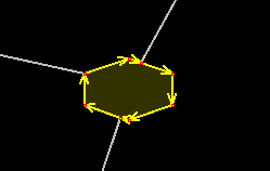
Roundabouts with wrong direction | checkround.pl by gary68 | Reverse way with i.e. Josm or add oneway=-1 tag. | |||||||||||||


