FacilMap/OSM Analysis Tools
FacilMap has some hidden functionality to help mappers analyze OpenStreetMap data, in particular changesets and route relations. Thus functionality is the successor of OSM History Viewer and OSM Route Manager. In particular, the following functions are available:
Functionality

Analyse changeset
Typing changeset <id> (for example changeset 6798641) into the search field will visualize the geographical and tag changes that the given changeset has caused.
The current geographical locations of all nodes and of all segments (sections of ways between two nodes) created, modified and deleted by the changeset are analyzed and compared to their respective versions before the changeset. Nodes and segments that were removed are rendered in red, created in green, unchanged (but their feature received tag changes) in blue. Nodes and segments that were moved have their old position rendered in red and their new position rendered in green. If a node was moved and this node is part of a way, that way is rendered as well, even if it was not directly modified by the changeset. Like this, you can see how the changeset has actually geographically affected the map. Relations are not rendered on the map.
In the sidebar on the left (on small screens such as smartphones on the bottom) a list of changed features is rendered. You can zoom to a specific feature by clicking on it. By clicking on the arrow on the right, you can inspect the tags of the feature. Unchanged tags are shown normally, but deleted values are shown with a red and added values with a green background. For relations, their members (and which ones were added/removed) are also shown. The arrow to the right is faded when there are no tag changes (meaning that there is not much to see in the feature details).

Analyse relation
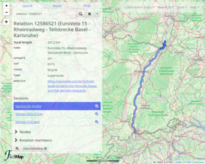
Typing relation <id> (for example relation 12586521) will render the given relation on the map. If the relation is a super-relation, its nested relations are rendered as well.
In addition to the tags of the relation itself and the total length of all its ways (including nested relations), three lists are shown:
- Sections shows those parts of the route whose ends are either connected to no other section or to two or more other sections. Loops with a maximum 1 km circumference (please give feedback on this value) are guessed to be roundabouts and not considered as separate sections. With these sections, you can do the following:
- Coming soon: By selecting specific sections and then clicking the export button, you can generate a GPX trace that contains your desired variants and excursions of the route.
- If a section is shown as separate despite not being a variant or excursion of the route, this indicates a mapping error. Zoom to the ends of the section to see how the sections are not connected. You can open the map position on OpenStreetMap by clicking “Map style” and then “OpenStreetMap”. (Pro tip: Enable the “OpenStreetMap Editor” map style link in the user preferences to jump straight into the editor.)
- Nodes lists all individual nodes that are members of the relation or its nested relations. These can for example be stops (for a bus route) or signposts along the route. Since these tend to clutter the map and are usually less important, they are only rendered if the nodes list is expanded.
- Relation members lists all the direct member nodes, features and relations. If a member has a role, it is shown next to its ID/name. By clicking the right arrow of a member, you can display its tags. If the member is a relation, clicking the right arrow will switch to the analysis of that sub-relation.

Blame way/relation
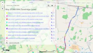
Typing blame relation <id> (for example blame relation 12586521) or blame way <id> will render the given relation/way (including support for nested relations) and give details who added which parts of its ways/nodes as part of which changeset.
Please note that this is a very complex operation that not only takes a long time, but also causes a lot of requests to the OpenStreetMap API. Use it sparingly, and wherever possible try to use it on individual ways rather than whole relations.
Each segment (section of a way between two neighbouring nodes) is analyzed individually, and the point in time is calculated where the segment first appeared as part of the relation.
The results are grouped by changeset (ordered newest first) so that you can see when exactly a change happened. Each user gets assigned a unique colour so that you can quickly see who is to blame. By clicking on the right arrow next to a changeset, you can see details about the changeset and about which feature(s) in the feature hierarchy of the relation was actually changed.
View way/node
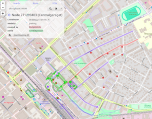
Typing way <id> or node <id> will display the corresponding OpenStreetMap feature on the map.
View trace
Typing trace <id> will render the given OpenStreetMap trace. This only works for traces whose visibility is configured as public.
Shortcuts for mappers
Search results, POIs, and the position details that opens when you long click somewhere on the map are coming directly from OpenStreetMap. If you discover an error in the data, you can click the “OpenStreetMap” button to open the underlying feature directly on OpenStreetMap and correct it there.
In the “Map style” menu there is an “OpenStreetMap” item that will open the current map position directly on OpenStreetMap. By clicking on “Tools” → “User preferences” and then switching to the “Map style” tab, you can also enable an additional “OpenStreetMap Editor” link that will take you straight to the editor.
GreaseMonkey script
On Greasy Fork you can find a script to use with GreaseMonkey, TamperMonkey or Violentmonkey. It will add “Open on FacilMap” and “Blame on FacilMap” links to the left sidebar when you are browsing nodes, ways, relations or changesets on OpenStreetMap.