File:Flowchart for Tagging Barrier Access- r6a-v2.pdf
Jump to navigation
Jump to search

Size of this JPG preview of this PDF file: 800 × 565 pixels. Other resolutions: 320 × 226 pixels | 640 × 452 pixels | 1,024 × 723 pixels | 1,280 × 904 pixels | 2,481 × 1,752 pixels.
Original file (2,481 × 1,752 pixels, file size: 49 KB, MIME type: application/pdf)
Summary
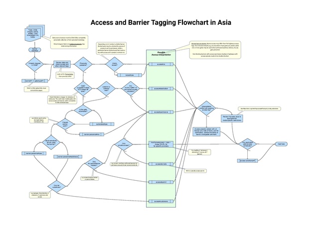
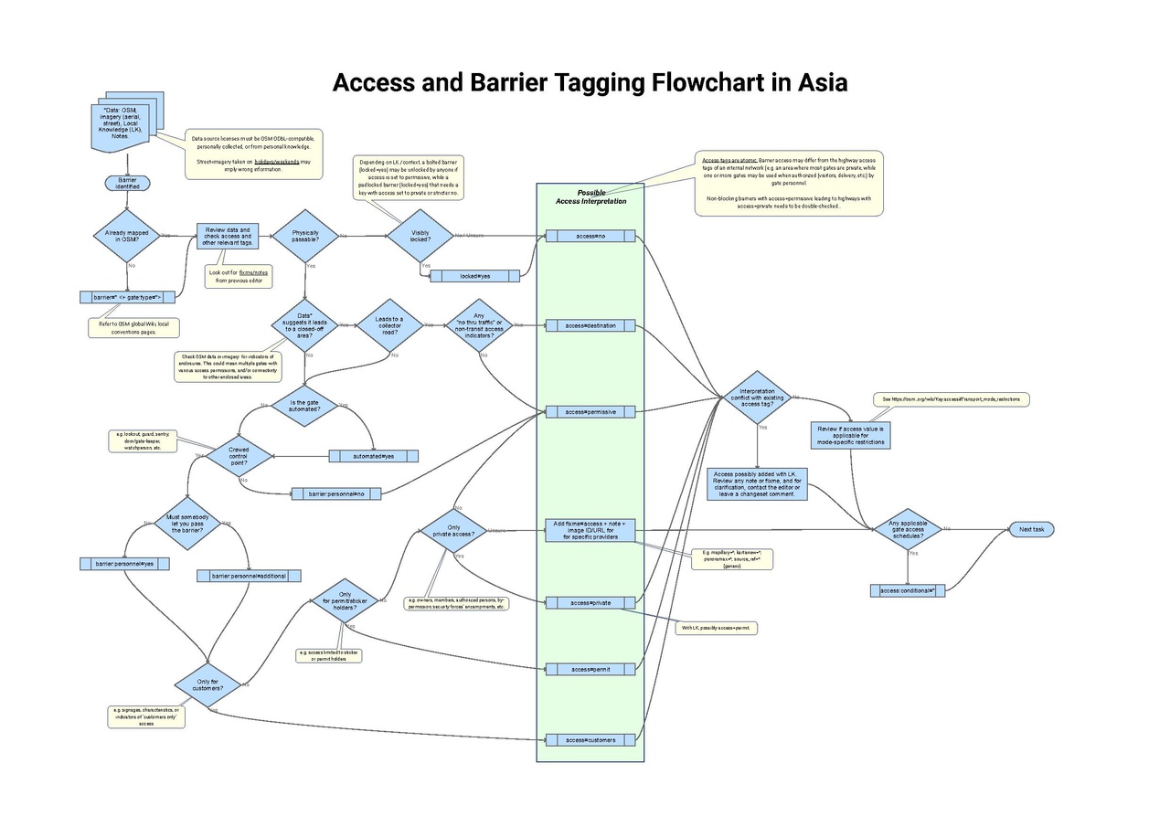
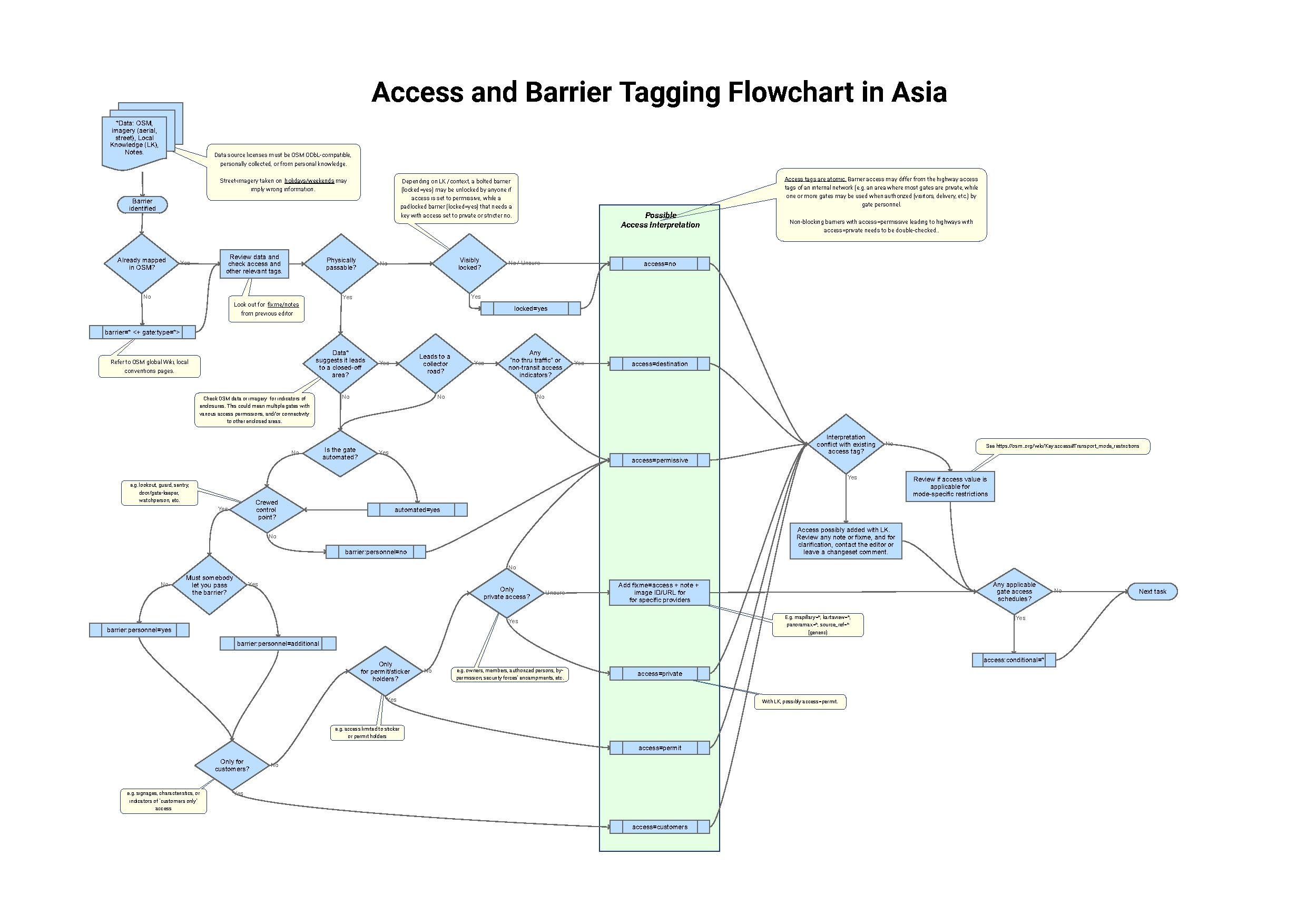
| Description | A flowchart that depicts barrier access tagging in Asia, based on feedback and inputs from OSM communities in PAK, PHL, IDN, MYS. |
|---|---|
| Author | Erwin Olario |
| Source | own work |
| Date | 2024-06-16 |
Licensing
![]()
![]()
This file is made available under the Creative Commons CC0 1.0 Universal Public Domain Dedication.
The person who associated a work with this deed has dedicated the work to the public domain by waiving all of his or her rights to the work worldwide under copyright law, including all related and neighboring rights, to the extent allowed by law. You can copy, modify, distribute and perform the work, even for commercial purposes, all without asking permission.
File history
Click on a date/time to view the file as it appeared at that time.
| Date/Time | Thumbnail | Dimensions | User | Comment | |
|---|---|---|---|---|---|
| current | 23:47, 20 June 2024 |  | 2,481 × 1,752 (49 KB) | GOwin (talk | contribs) | Minor readability improvements: increase font size of decision labels, reposition some shapes. |
| 06:28, 20 June 2024 |  | 2,481 × 1,752 (49 KB) | GOwin (talk | contribs) | Improve readability, increase font size, change resolution, and change paper to ISO A3. | |
| 01:26, 16 June 2024 | 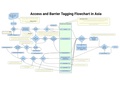 | 1,752 × 1,237 (536 KB) | GOwin (talk | contribs) | Update to higher resolution | |
| 01:13, 16 June 2024 | 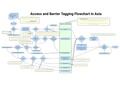 | 1,752 × 1,237 (125 KB) | GOwin (talk | contribs) | {{Information | description=A flowchart that depicts barrier access tagging in Asia, based on feedback and inputs from OSM communities in PAK, PHL, IDN, MYS. | source=own work | date=2024-06-16 | author=Erwin Olario | other_versions= }} |
You cannot overwrite this file.
File usage
The following 5 pages use this file: