File:Hierarchical Classification of the Metropolitan Road Network of Malaga (PMUS, 2021).jpg
Jump to navigation
Jump to search

Size of this preview: 800 × 417 pixels. Other resolutions: 320 × 167 pixels | 640 × 334 pixels | 1,024 × 534 pixels | 1,562 × 814 pixels.
Original file (1,562 × 814 pixels, file size: 1 MB, MIME type: image/jpeg)
Summary
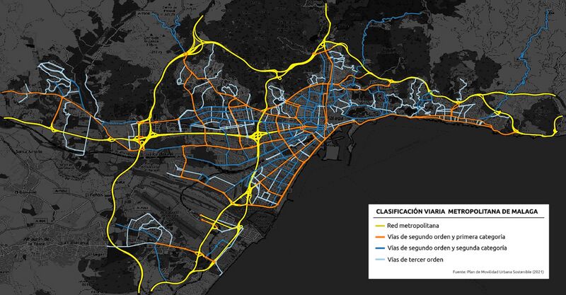
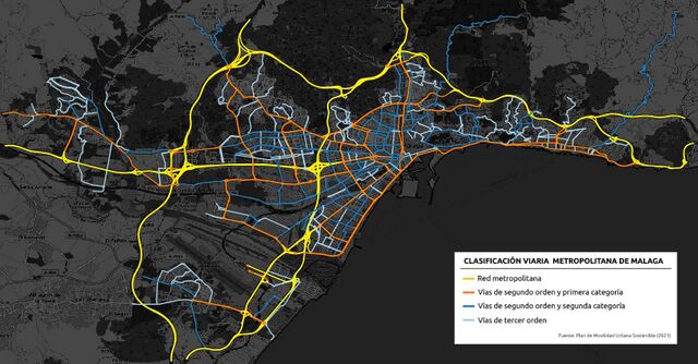
| Description | Clasificación jerárquica de la red viaria metropolitana de Málaga según el Plan de Movilidad Urbana Sostenible (2021). |
|---|---|
| Author | Daniel Capilla |
| Source | own work, OpenStreetMap Contributors |
| Date | 2024-03-26 |
Licensing
![]()
![]()
![]()
This work is licensed under the Creative Commons Attribution-ShareAlike 4.0 License.
Attribution: Daniel Capilla
Attribution: Daniel Capilla
| Contains map data © OpenStreetMap contributors, made available under the terms of the Open Database License (ODbL).
The ODbL does not require any particular license for maps produced from ODbL data, produced maps may be subject also to other licences. |
File history
Click on a date/time to view the file as it appeared at that time.
| Date/Time | Thumbnail | Dimensions | User | Comment | |
|---|---|---|---|---|---|
| current | 06:47, 14 April 2024 | | 1,562 × 814 (1 MB) | Dcapillae (talk | contribs) | Fix some wrong coloured areas |
| 08:48, 26 March 2024 |  | 1,562 × 814 (1,019 KB) | Dcapillae (talk | contribs) | {{Information | description=Clasificación jerárquica de la red viaria metropolitana de Málaga según el Plan de Movilidad Urbana Sostenible (2021). | source= {{own}}, OpenStreetMap Contributors | date= 2024-03-26 | author= Daniel Capilla | other_versions= }} Category:Images for illustration of wiki |
You cannot overwrite this file.
.jpg&oldid=2696132)