File:Staffanstorp 1.png
Jump to navigation
Jump to search


No higher resolution available.
Staffanstorp_1.png (768 × 460 pixels, file size: 169 KB, MIME type: image/png)
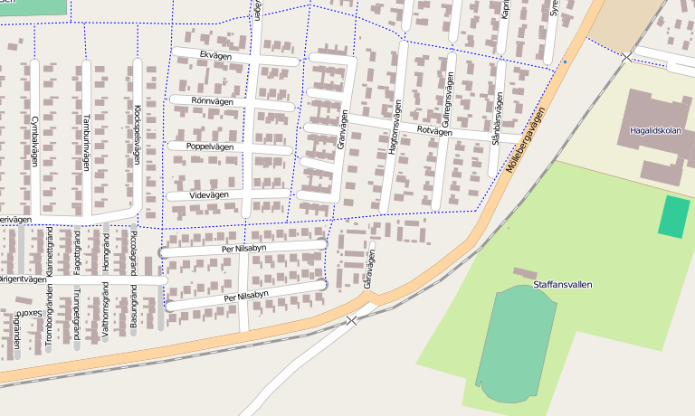
Building outlines in Staffanstorp courtesy of the town council GIS
This is a Featured image, which means that it has been identified as one of the best examples of OpenStreetMap mapping, or that it provides a useful illustration of the OpenStreetMap project. If you know another image of similar quality, you can nominate it on Featured image proposals.
Front-page image for week 37 of 2010 (13–19 Sep.).
- Image descriptions
- Deutsch : Gebäudeumrisse in Staffanstorp, Schweden, aus dem GIS der Stadtverwaltung.
- eesti : Rootsi linna Staffanstorpi hoonete piirjooned pärinevad linnavalitsuse GISist.
- English : Building outlines in Staffanstorp, Sweden courtesy of the town council GIS.
- français : Tracé des bâtiments de Staffanstorp, Suède, avec la permission du service GIS de la ville.
- italiano : Tracciatura dei contorni a Staffanstorp, Svezia, con gentile concessione del consiglio GIS della città.
- lietuvių : Pastatai mieste Staffanstorp, pagal miesto tarybos GIS.
- Nederlands : Gebouwen in Staffanstorp (Zweden) zijn ter beschikking gesteld door de GIS afdeling van de gemeente.
- polski : Obrysy budynków w szwedzkim Staffanstorp, dar władz miasta.
- português : Contorno de prédios em Staffanstorp, Suécia, cortesia do setor de GIS da Câmara Municipal.
- русский : Контуры домов в Стаффансторпе, Швеция любезно предоставлены ГИС городского совета
Licensing
![]()
![]()
![]()
This screenshot contains OpenStreetMap Carto rendering.
The OpenStreetMap Carto map style is made available under the Creative Commons CC-0 1.0 Universal Public Domain Dedication.
- Attribution to the map data:
![]()
Contains map data © OpenStreetMap contributors, made available under the terms of the Creative Commons Attribution-ShareAlike 2.0 (CC-BY-SA-2.0).
File history
Click on a date/time to view the file as it appeared at that time.
| Date/Time | Thumbnail | Dimensions | User | Comment | |
|---|---|---|---|---|---|
| current | 21:40, 27 April 2010 | | 768 × 460 (169 KB) | Wynndale (talk | contribs) | Building outlines in Staffanstorp courtesy of the town council GIS |
You cannot overwrite this file.