File:Sunderland-party-030509.jpg
Jump to navigation
Jump to search

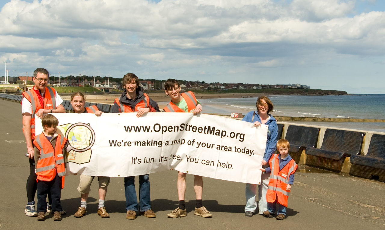
Size of this preview: 800 × 477 pixels. Other resolutions: 320 × 191 pixels | 640 × 382 pixels | 1,024 × 610 pixels | 1,280 × 763 pixels | 2,927 × 1,745 pixels.
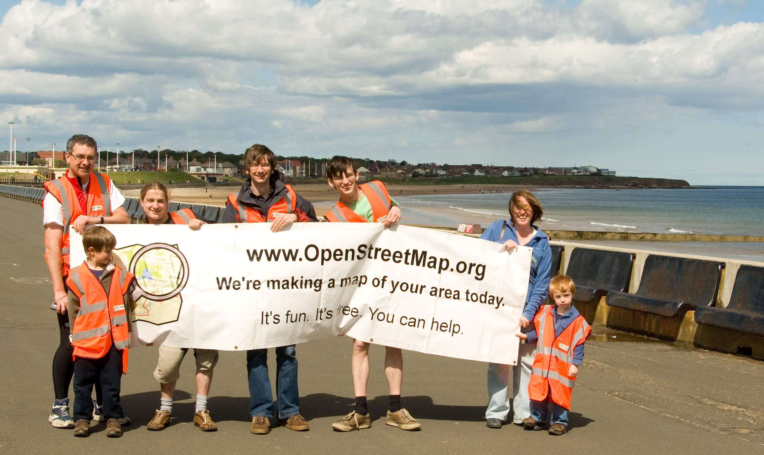
Original file (2,927 × 1,745 pixels, file size: 896 KB, MIME type: image/jpeg)
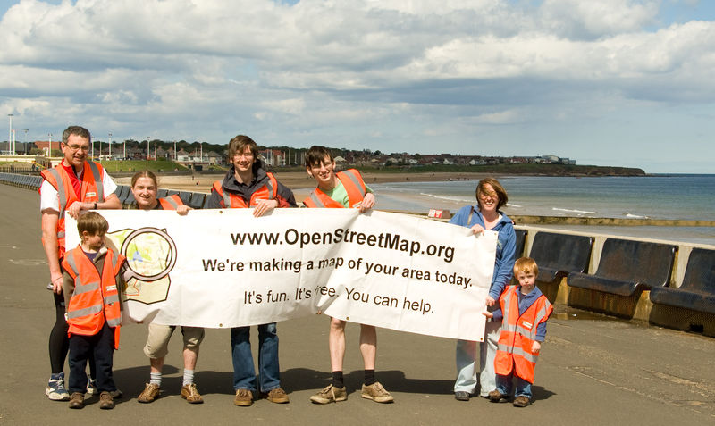
Sunderland Mapping Party - group photo. Some missing as they were out mapping!
- This media file was uploaded by author of the work and its copyright holder.
![]()
![]()
![]()
This work is licensed under the Creative Commons Attribution-ShareAlike 4.0 License.
Attribution: Ddixon
Attribution: Ddixon
This is a Featured image, which means that it has been identified as one of the best examples of OpenStreetMap mapping, or that it provides a useful illustration of the OpenStreetMap project. If you know another image of similar quality, you can nominate it on Featured image proposals.
Front-page image for week 23 of 2009 (1–7 Jun.).
- Image descriptions
- català : La Festa de mapes de Sunderland és un exemple de l'exitosa idea de les "Festes de mapes" (vegeu: Mapping Weekend Howto). Sunderland era a la llista de prioritats de mapes del Regne Unit .
- English : The Sunderland Mapping Party being an example of the successful Mapping parties idea. Sunderland was chosen from the UK Mapping Priorities list.
- italiano : Il Sunderland Mapping Party è un esempio riuscito dell'idea dei Mapping Party. Sunderland è stato scelto dalla lista delle priorità di mappatura del Regno Unito (en).
- magyar : A Sunderland Mapping Party a sikeres mapping party-k ötletének egy példája. Sunderlandot a UK Mapping Priorities listáról választották.
- português : A Mapping Party de Sunderland é um exemplo de Mapping Party bem-sucedida. Sunderland foi escolhida da lista de Prioridades de Mapeamento no Reino Unido.
File history
Click on a date/time to view the file as it appeared at that time.
| Date/Time | Thumbnail | Dimensions | User | Comment | |
|---|---|---|---|---|---|
| current | 19:43, 11 May 2009 | | 2,927 × 1,745 (896 KB) | Ddixon (talk | contribs) | Sunderland Mapping Party - group photo. Some missing as they were out mapping! |
You cannot overwrite this file.
File usage
The following 12 pages use this file:
- Featured images/Apr-Jun 2009
- List of featured images/2009
- Merchandise
- Sunderland Mapping Party 2009
- User:Cyrille37
- Template:Iotw image/2009-23
- DE:Featured images/Apr-Jun 2009
- FR:Featured images/Apr-Jun 2009
- ES:Chaleco de encuestadores OSM
- IT:Featured images/Apr-Jun 2009
- IT:Merchandise
- JA:Merchandise