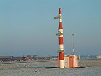
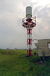
Tag:airmark=beacon
(Redirected from Key:airmark)
| Description |
|---|
| Base tag for beacons used in aerial radio navigation. |
| Group: aeroways |
| Used on these elements |
| Useful combination |
| Status: de facto |
| Tools for this tag |
Radio navigation beacons support the different radio aeronautical navigational systems that help pilots guide their aircraft during flight. These facilities are particularly useful during bad weather (like fog, or low cloud), and for flights operating under ![]() IFR.
IFR.
Those include:
- NDB Non-Directional Beacon
- ILS Instrument landing system
- VOR VHF Omnidirectional Radio Range
- DVOR Doppler VHF Omnidirectional Radio Range
- DME Distance Measuring Equipment
- TACAN Tactical Air Navigation
- RSBN Radiotechnic System for Inner Navigation (ru: Радиотехническая Система Ближней Навигации)
- VORTAC Often used for a combination (D)VOR and TACAN. VHF Omnidirectional Range Tactical Air Navigation
For visual navigation systems use aeroway=navigationaid.
How to map
Place a node at the location of the beacon, and tag with airmark=beacon.
Tagging
airmark=beaconbeacon:type=*- see § Examples section belowbeacon:code=*beacon:frequency=*- in MHzbeacon:channel=*localizer=yes,glideslope=yes- additional tags to mark subtype of ILS beacon
operator=*ele=*
Examples
| Photo | Tags | beacon:type |
Description |
|---|---|---|---|
 Glide path |
airmark=beaconbeacon:type=ILSbeacon:frequency=*glideslope=yes
|
ILS | |
 Localizer |
airmark=beaconbeacon:type=ILSbeacon:frequency=*localizer=yes
|
ILS | |
 Outer marker |
airmark=beaconbeacon:type=OMbeacon:frequency=*
|
OM | |
 Middle marker |
airmark=beaconbeacon:type=MMbeacon:frequency=*
|
MM | |
Inner marker |
airmark=beaconbeacon:type=IMbeacon:frequency=*
|
IM | |
 VHF Omni Directional Radio Range |
airmark=beaconbeacon:type=VORbeacon:code=*beacon:frequency=*
|
VOR | |
 D-VOR Antenna (circle with 50 antennas) |
airmark=beaconbeacon:type=DVORbeacon:code=*beacon:frequency=*
|
DVOR | |
 DVOR-DME |
airmark=beaconbeacon:type=DVOR/DMEbeacon:code=*beacon:frequency=*
|
DME | |
 Non-directional beacon |
airmark=beaconbeacon:type=NDBbeacon:code=*beacon:frequency=*
|
NDB | |
 Tactical Air Navigation System |
airmark=beaconbeacon:type=TACANbeacon:code=*beacon:channel=*
|
TACAN | |
 Radiotechnic System for Inner Navigation |
airmark=beaconbeacon:type=RSBN
|
RSBN |
See also
aeroway=navigationaid– for visual navigation aidsman_made=beacon– often used as a complementary tag to this tag

